Issue Date: Wednesday, August 2, 2017
Issue Time: 10:55AM MDT
Summary:
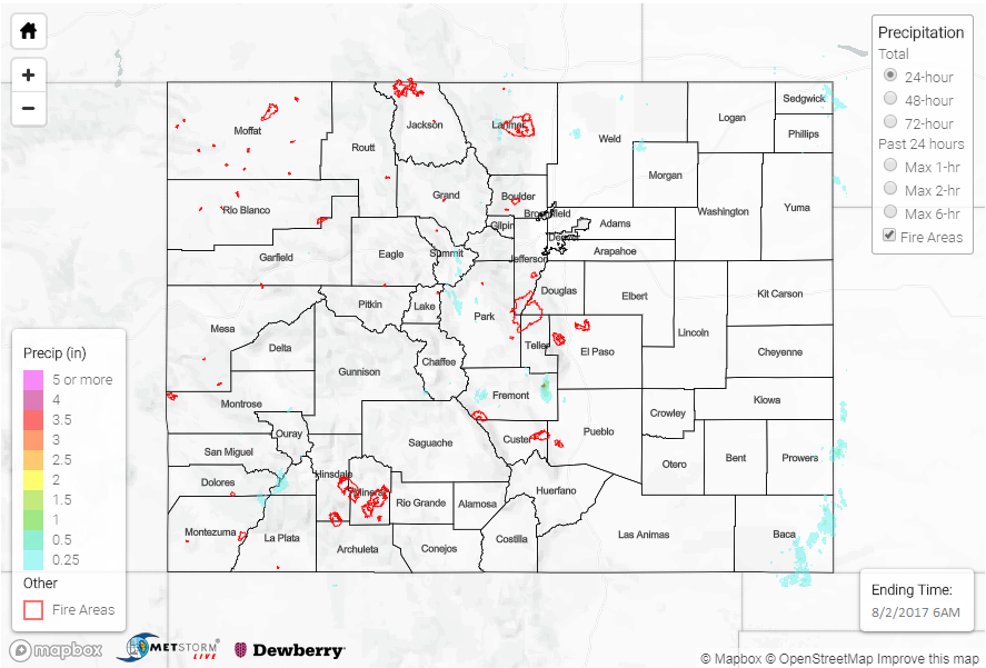
After the long string of heavy rainfall since mid-July, it was nice (at least for us!) to see a break in the activity. With drier west-northwesterly flow, storm coverage once again took a step down on Tuesday. However, isolated to scattered thunderstorms once again dotted areas east of the Continental Divide. Similar to Monday, coverage was highest in two separate area. First, along the foothills of the Rockies where several storms produced as much as 1 inch of rainfall in Park, Chaffee and Fremont counties. Second, farther east, storms produced 0.25 to 0.7 inches of rainfall in Sedgwick, Prowers and Baca counties. In general, rainfall rates were lower than Monday due to faster south-southeasterly steering winds.
To the west of the Continental Divide, isolated showers and weak storms were mostly limited to the southern faces of the San Juan peaks. Up to 0.25 inches of rainfall we observed by CoCoRaHS volunteers in San Miguel, Montezuma and La Plata counties.
Flooding was not reported on Tuesday. For rainfall estimates in your area, check out our State Precipitation Map below.