Issue Date: Thursday, July 26th, 2018
Issue Time: 9:30 AM MDT
Summary:
Moisture was plentiful yesterday, and Mother Nature did her best to use it to its fullest potential. Scattered showers/thunderstorms dotted the state, with the strongest storms bringing 35 mph to 70 mph wind gusts, hail up to 1 inch in diameter, and heavy rainfall. Flash flooding was observed in a couple locations yesterday:
-Eastbound C-470 was closed at Lucent this morning due to flooding (standing water) on the roadway
-1 mile NNE of Trimble (La Plata County): A 4-to-5 foot wall of debris flowed down Tripp Creek Gulch and spread out as it crossed CR 203 and ran across the yards of several homes along Tripp Creek Road
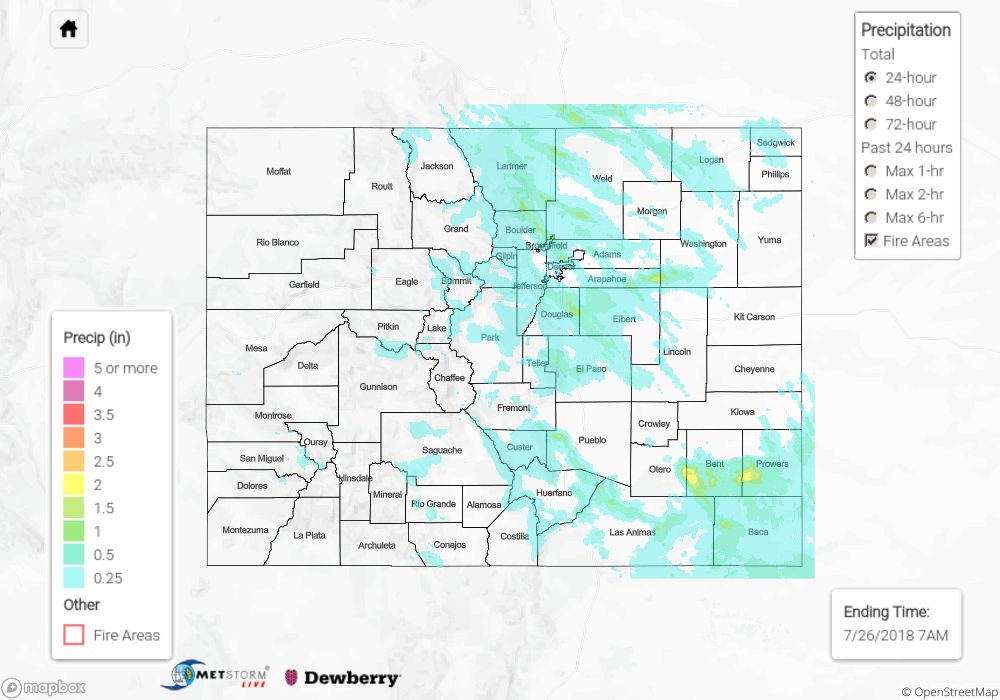
As far as rainfall observations go, here are the big winners from several counties according to CoCoRaHS:
1.56 inches: Boulder County
1.39 inches: Weld County
1.35 inches: Larimer County
1.26 inches: Logan County, Elbert County
1.25 inches: Adams County
1.22 inches: Douglas County
1.02 inches: Pueblo County
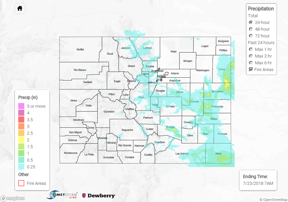
For a look at precipitation estimates in your area, please see our State Precipitation Map below.
Click Here For Map Overview
Note: We have identified a possible underestimation in QPE over the southwest part of the state. We are working to on this issue, and will provide an update as soon as possible.