Issue Date: Monday, July 23rd, 2018
Issue Time: 09:30 AM MDT
Summary:
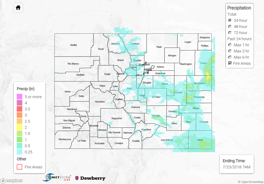
West and southwesterly winds aloft helped pull in mid-level moisture with the upper-level high over central New Mexico yesterday. This helped initiate some showers and thunderstorms over the high terrains yesterday mid-afternoon. The bulk of the activity was over the Front Range and Southeast Mountains with more limited coverage over the San Juan Mountains. Due to low-level moisture being scoured out to the west, storms were more outflow driven and produced gusty winds. A severe thunderstorm formed near Pueblo that produced 2.5 inches of rain. Multiple gusts of 65 mph were reported with this storm.
As the storms moved eastward, moisture increased with dew points in the mid-50Fs to mid-60Fs yesterday afternoon. They formed a complex of thunderstorms, which produced heavy rainfall, hail (1.5 inches) and gusty winds. CoCoRaHS stations in Kit Carson County recorded up to 1.89 inches. Over Baca County, a CoCoRaHS station recorded 1.4 inches. While the storms were moving fairly quickly, efficient rain rates caused some flooding issues. Flash flooding of the highway and county roads were reported in Yuma near Bonny Reservoir and Hale. There were several flood advisories and flood warnings over the eastern Colorado counties during the afternoon and evening.
Over the mountains, totals were in the 0.25 to 0.5 inch range. Two flood advisories were issued for the Spring Creek and 416 burn scars. Thankfully, no flooding or debris flows were reported as of this morning. The largest mountain rainfall observation for the day was the Loveland Basin SNOTEL station. It measured 0.8 inches over the 24-hour period.
To see how much precipitation fell in your neighborhood, scroll down to the State Precipitation Map below.
Click Here For Map Overview