SPM 08-06-2022: Debris Flow on Cameron Peak Burn Scar, Rain for Central Colorado

Issue Date: Saturday, August 6th, 2022
Issue Time: 10:30 AM MDT

Summary:

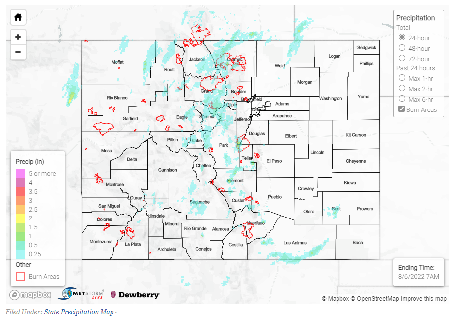
Yesterday brought a scattering of flood advisories across the state, mostly in the Front Range and Central Mountains. The Urban Corridor was mostly dry, with most storms staying contained to the mountains. Although there was a landspout near DIA briefly in the afternoon, that was the extent of activity for Denver and the surrounding areas to the east. The Eastern Plains were quite dry, with just a few scattered reports of trace or less than 0.1″. Similarly, the Western Slope saw very little rainfall as well. 45 mph winds accompanied a single flood advisory west of Steamboat Springs, but no flooding or damage was reported.

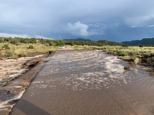
Moving east of the Northwest Slope, many flood advisories were issued for the Cameron Peak burn scar once again. Parts of the burn scar received up to 1.3” of rainfall over just a few hours, causing a debris flow in Buckhorn Creek and flooding in multiple locations across the area. Reports include:

-Flash flooding near Pingree Park and Buckhorn Mountain, where officials put up barricades in both locations to assist with water overflow

-Multiple reports of flooding and washouts along CR 44H, from Ballard Road to MM30, according to law enforcement. Reports noted a “2–3 foot surge” of water and debris in Buckhorn Creek.

See below for a photo and more information on the flow:

Other totals across the Front Range vary from 0”-0.2”, but some other notable precipitation totals across the mountains include:

-0.73” in Minturn
-1.05” southeast of Denver
-0.58” north of Kremmling
-0.69” southeast of Pueblo

If you observe flooding in your area, remember to use the “Report a Flood” page to make any flood reports when you can safely do so. For precipitation estimates in our area, check out the map below.
Click Here For Map Overview

The map below shows radar-estimated, rainfall gage-adjusted Quantitative Precipitation Estimates (QPE) across Colorado. The map is updated daily during the operational season (May 1 – Sep 30) by 11AM. The following six layers are currently available: 24-hour, 48-hour and 72-hour total precipitation, as well as maximum 1-hour, 2-hour and 6-hour precipitation over the past 24 hour period (to estimate where flash flooding may have occurred). The accumulation ending time is 7AM of the date shown in the bottom right corner. Also shown optionally are vulnerable fire burn areas (post 2012), which are updated throughout the season to include new, vulnerable burn areas. The home button in the top left corner resets the map to the original zoom.

SPM 08-05-2022: Another Round of Flash Floods for High Terrain

Issue Date: Friday, August 5th, 2022
Issue Time: 11:25 AM MDT

Summary:

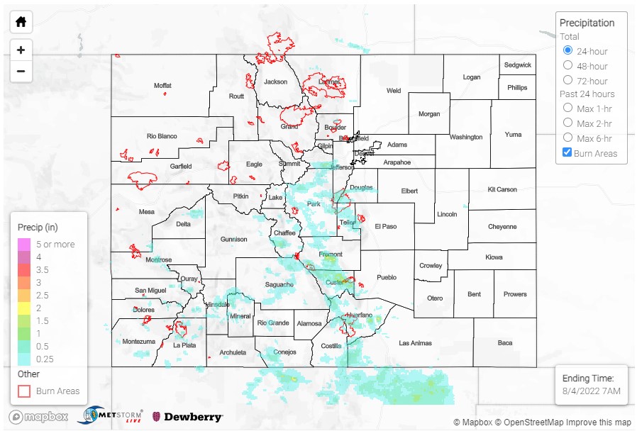
Yesterday was another low to moderate flood threat day across Southern Colorado, and heavy rain and flooding did not take long to materialize. In the late morning high-based, isolated thunderstorms began to fire up in the San Juan and Southeast Mountains, tapping into available monsoonal moisture and diurnal heating. Storms increased in coverage and intensity as the afternoon progressed, as well as development on the Raton Ridge and Southeast Plains. By evening, the most intense storms were along the Southern Front Range, west of Colorado Springs, and spilling onto the Urban Corridor and Palmer Ridge.

Now for the heavy rain and flood reports:

Severe thunderstorms and heavy rain resulted in a flash flood over Highway 24 east of Florrissant last night. A trained spotter in the area reported 2.65 inches of heavy rain and a nearby MesoWest gage in Divide reported 2.61 total. There could be some hail contamination with these precipitation totals, because there was enough pea-sized hail to accumulate and crush some patio furniture in Divide.

A bit further south, a severe thunderstorm near Cripple Creek produced up to 0.50 inch hail; a CoCoRaHS observer reported 1.05 inches of rain as well from this severe thunderstorm.

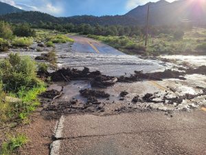
In Freemont County, flooding and debris flows were reported at multiple locations on County Road 28 (Copper Gulch Road). Over 6 feet of “water with mud and debris” was reported at several water crossings located between mile markers 10 and 14. Gauge observations in this area are sparse, and a MesoWest gage at Copper Gulch only reported 0.03 inches yesterday. However, QPE places up to 1.5 inches of rain in this area. Freemont County Emergency Management shared the following images on Facebook of water and debris across the roadway.

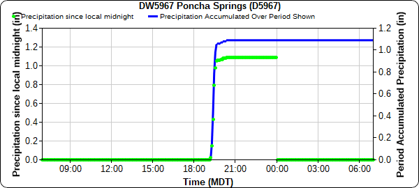
In Poncha Springs and Salida, law enforcement reported significant flooding north of Highway 50 between the two towns. There was also a public report of over 2 inches of rain and flood water entering the garage of their home. Based on the hyetograph below, most of the rain in this area fell in a very short time – this gauge picked up 1.09 inches in just over an hour. Poncha Pass also saw significant flooding with debris flow consisting of boulders on Highway 285. The Decker burn scar is near Poncha Springs/Salida and was included in the issued flash flood warnings, but it doesn’t appear that any of the floods occurred on the burn scar itself.


The Spring Creek burn scar was also issued a flash flood warning yesterday. Stations near La Veta reported between 0.33-0.41 inches of rain, and no flooding was reported on this scar.

On the Southwest Slope, a series of flood warnings were issued including Mesa Verde National Park. The Mesa Verde gauge picked up 0.83 inches of rain. Due to the rural nature of this area of the state, there are limited gages and flood reports elsewhere, but a Dolores gauge in one of the flood warnings picked 2.47 inches over the course of the evening and overnight hours. CDOT also reported rocks on Highway 145, it is unclear if this is heavy rain related, but the rocks were within one flash flood warning polygon.

A few other notable totals in Southern Colorado:
• 1.43 in Kim
• 1.20 in Boncarbo
• 1.13 in Cortez
• 1.05 in Peyton, along with a 0.88 inch hail report
• 0.68 in Gardner

If you observe flooding in your area, remember to use the “Report a Flood” page to make any flood reports when you can safely do so. For precipitation estimates in our area, check out the map below.
Click Here For Map Overview

The map below shows radar-estimated, rainfall gage-adjusted Quantitative Precipitation Estimates (QPE) across Colorado. The map is updated daily during the operational season (May 1 – Sep 30) by 11AM. The following six layers are currently available: 24-hour, 48-hour and 72-hour total precipitation, as well as maximum 1-hour, 2-hour and 6-hour precipitation over the past 24 hour period (to estimate where flash flooding may have occurred). The accumulation ending time is 7AM of the date shown in the bottom right corner. Also shown optionally are vulnerable fire burn areas (post 2012), which are updated throughout the season to include new, vulnerable burn areas. The home button in the top left corner resets the map to the original zoom.

SPM 08-04-2022: Flash Floods, Debris Flows for San Juan and Southeast Mountains

Issue Date: Thursday, August 4th, 2022
Issue Time: 11:10 AM MDT

Summary:

Yesterday saw slightly cooler temperatures for much of the state, which helped to limit some storm potential until later in the day – the exception being on the Eastern Plains and portions of the Grand Valley, which were still quite toasty. Even with cooler temperatures, there was plenty of monsoonal moisture present for widely-scattered storms to fire up along the high terrain of the San Juan, Central, and Southeast Mountains, as well as the Front Range by the afternoon. Generally slower steering flow kept the storms that did develop in place for longer, allowing for heavy localized rainfall. Showers and thunderstorms tapered off shortly after nightfall.

Several flash flood warnings and flood advisories were issued yesterday, particularly for Southern Colorado including the San Juan, Central, Southeast Mountains, Raton Ridge, and Southwest Slope. Several burn scars were also included in the warnings, including the Junkins, Hayden Pass, and Spring Creek burns.

A CoCoRaHS observer near the northern edge of the Spring Creek scar reported 0.60 inches of rain yesterday and left a remark of “street/meadow flooding on Pass Creek Road”. There was also a report of a flash flood in Coaldale with “water rushing over roadway” at the northern extent of the Hayden Pass burn scar. West of that burn, another CoCoRaHS observer in Lake George reported 0.84 inches of rain and “considerable erosion”. The Hayden Pass fire occurred in 2016, which shows how long these burn areas can remain sensitive, especially after several days of consistent rainfall.

Outside of burn areas, there was also a flash flood reported in Texas Creek, where Freemont County sheriff reported a “rock slide on Highway 50 at Mile Mark 261.” On the Mineral-Hinsdale county line, another flash flood and a debris flow were reported due to heavy rain, with “5 feet of standing water on the road…from blocked culvert, causing a vehicle to be trapped”. The debris flow occurred on Highway 149, blocking the northbound lane.

The towns of Poncha Springs and Walsenburg were also included in flash flood warnings. In Walsenburg, a CoCoRaHS observer reported 1.06 inches of rain yesterday, along with small hail.

Some other notable rainfall totals around the state include:

  • 1.51 inches in Hartsel
  • 0.74 inches in Westcliffe
  • 0.61 inches in Evergreen, which came down in just 20 minutes (between 5-10 year 30-minute ARI)

Northern and Southern Portions of Urban Corridor also saw evening showers, including totals up to 0.33 in Castle Rock and 0.39 in Loveland.

If you observe flooding in your area, remember to use the “Report a Flood” page to make any flood reports when you can safely do so. For precipitation estimates in our area, check out the map below.
Click Here For Map Overview

The map below shows radar-estimated, rainfall gage-adjusted Quantitative Precipitation Estimates (QPE) across Colorado. The map is updated daily during the operational season (May 1 – Sep 30) by 11AM. The following six layers are currently available: 24-hour, 48-hour and 72-hour total precipitation, as well as maximum 1-hour, 2-hour and 6-hour precipitation over the past 24 hour period (to estimate where flash flooding may have occurred). The accumulation ending time is 7AM of the date shown in the bottom right corner. Also shown optionally are vulnerable fire burn areas (post 2012), which are updated throughout the season to include new, vulnerable burn areas. The home button in the top left corner resets the map to the original zoom.

SPM 08-03-2022: Rain Over Southern San Juans & Along/North of I-70 Corridor; Grand Junction Radar Back Online

Issue Date: Wednesday, August 3rd, 2022
Issue Time: 11:15 AM MDT

Summary:

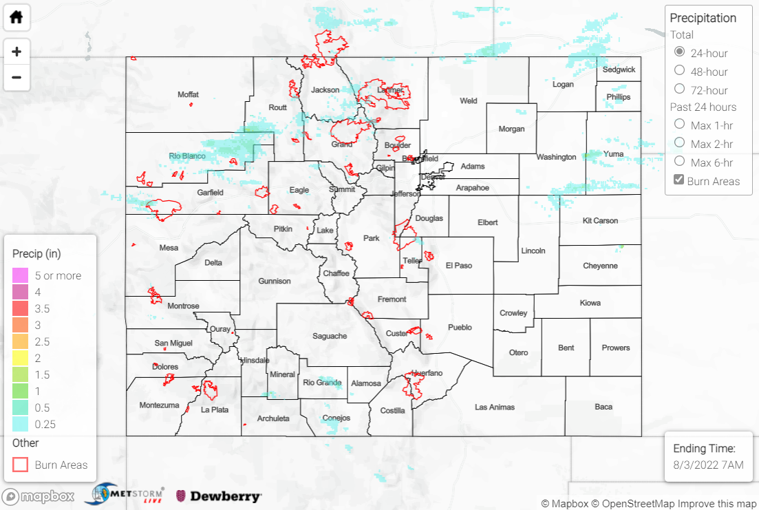
A shortwave trough moving across the region on Tuesday helped to produce showers and storms over portions of the high terrain and Northeast Plains, although limited instability precluded more widespread rainfall and severe weather.

The heaviest rain in the state fell across the southern San Juan Mountains where better moisture was available, with QPE data suggesting localized amounts of up to 2”. The Grand Junction radar went back online yesterday afternoon, so QPE totals appear reasonable after being underestimated over the past week. Rain gauge observations are sparse, but an automated station south of Bayfield measured 1.62”. A Flash Flood Warning was issued for west-central Archuleta County, with law enforcement reporting a mudslide/debris flow west-southwest of Pagosa Springs on Highway 160 at mile marker 130. Another mudslide/debris flow was reported west of Antonito near the intersection of Highway 17 and County Road D5.

Farther north, QPE data suggests 0.25-0.50” of rain fell across the northern Grand Valley, southeast Northwest Slope, and Northern Mountains, with localized amounts up to 1”. Flash Flood Warnings were issued for the Pine Gulch burn scar and southeast Moffat/west-central Routt Counties, but no flooding was reported. Flood Advisories, also with no flooding reported, were issued for central Rio Blanco County, as well as portions of the East Troublesome and Cameron Peak burn scars. Notable rain gauge observations include 0.62” at an automated station north of Glenwood Springs and 0.42” from a CoCoRaHS observer south of Steamboat Springs.

Across the Central Mountains, Front Range, and Urban Corridor, much lighter precipitation amounts of T-0.15” were generally observed. In the eastern Northeast Plains, QPE data suggests highly localized amounts of up to 1”, particularly across Washington and Yuma Counties.

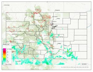
If you observe flooding in your area, remember to use the “Report a Flood” page to make any flood reports when you can safely do so. For precipitation estimates in our area, check out the map below.
Click Here For Map Overview

The map below shows radar-estimated, rainfall gage-adjusted Quantitative Precipitation Estimates (QPE) across Colorado. The map is updated daily during the operational season (May 1 – Sep 30) by 11AM. The following six layers are currently available: 24-hour, 48-hour and 72-hour total precipitation, as well as maximum 1-hour, 2-hour and 6-hour precipitation over the past 24 hour period (to estimate where flash flooding may have occurred). The accumulation ending time is 7AM of the date shown in the bottom right corner. Also shown optionally are vulnerable fire burn areas (post 2012), which are updated throughout the season to include new, vulnerable burn areas. The home button in the top left corner resets the map to the original zoom.