Issue Date: Saturday, June 22nd, 2019
Issue Time: 9:10 AM MDT
Summary:
Mother Nature brought some fireworks to celebrate the first day of Summer, with showers and thunderstorms rumbling over much of the state. Activity got started before Noon over the High Country, mainly north of I-70, then increasing in intensity and coverage through the afternoon and evening hours across Colorado, minus the San Juan Mountain, Southwest Slope, and San Luis Valley regions. It wasn’t until after 5 PM that a few showers began over the Southwest Slope and San Juan Mountains regions, though dry air prevented anything more than a few scattered sprinkles in those areas.
The main culprits behind yesterday’s widespread active weather were an upper-level disturbance and jet streak, combined with a surface cool front. To the east of the mountains and north of Highway 50, abundant moisture fueled the strongest storms of the day, with scattered strong-to-severe storms rumbling across the area. The following severe reports were submitted to the National Weather Service, including a thunderstorm wind damage report of parts of a house in Arapahoe being stripped to the concrete:
95 mph Thunderstorm Wind Gust: 8 miles S of Cheyenne Wells, 9 miles S of Cheyenne Wells
70 mph Thunderstorm Wind Gust: 4 miles S of Cheraw
63 mph Thunderstorm Wind Gust: 1 mile SW of Firstview
62 mph Thunderstorm Wind Gust: Cheyenne Wells, 4 miles SW of Arapahoe
61 mph Thunderstorm Wind Gust: 6 miles W of Elbert
60 mph Thunderstorm Wind Gust: 1 mile N of Fowler, 8 miles SE of Boone, Hugo, Cheyenne Wells
2.75 inch hail: 3 miles N of Matheson
2.00 inch hail: 1 mile N of Simla, 10 miles S of Limon
1.80 inch hail: 3 miles SE of Simla
1.75 inch hail: 5 miles ENE of Matheson, 1 mile W of Simla, 8 miles ENE of Fondis
1.30 inch hail: 9 miles NNW of Simla (additional report of 1.20 inch hail)
1.25 inch hail: 1 mile N of Kit Carson,
1.00 inch hail: 8 miles SE of Boone, 1 mile E of Ordway, 7 miles E of Kiowa, 5 miles SW of Arapahoe, 7 miles WSW of Firstview, 2 miles S of Cheyenne Wells, Cheyenne Wells
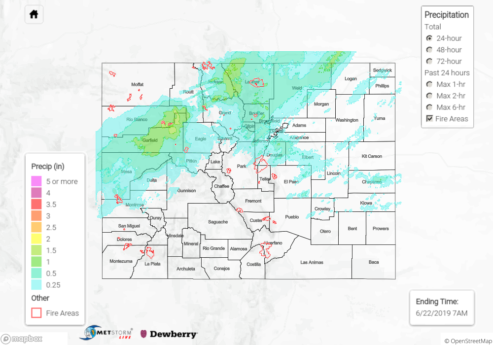
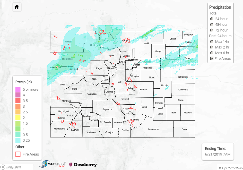
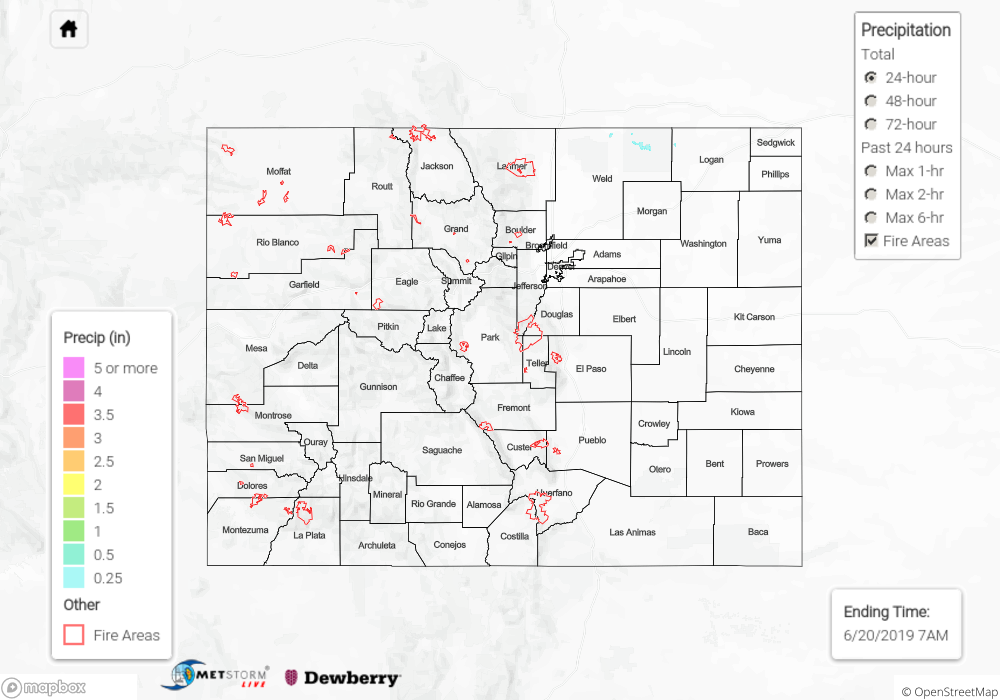
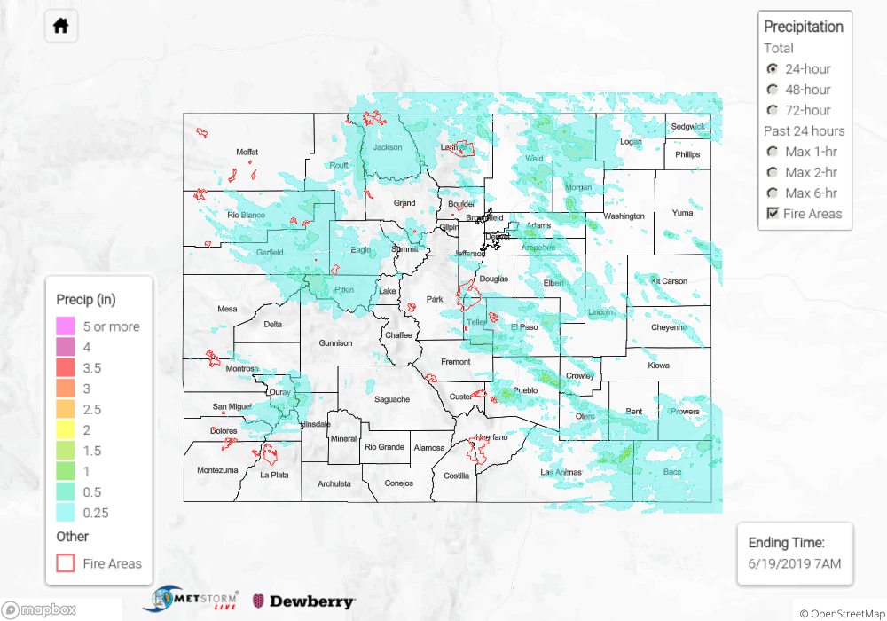
Rainfall and high elevation snow are ongoing across portions of the Front Range, Urban Corridor, Northeast Plains, Central Mountains, and Northern Mountains this morning, setting the stage for what will be a cool and wet day. No flash flooding was reported yesterday. For a look at precipitation estimates in your area, please see the State Precipitation Map below.
Click Here For Map Overview
The map below shows radar-estimated, rainfall gage-adjusted Quantitative Precipitation Estimates (QPE) across Colorado. The map is updated daily during the operational season (May 1 – Sep 30) by 11AM. The following six layers are currently available: 24-hour, 48-hour and 72-hour total precipitation, as well as maximum 1-hour, 2-hour and 6-hour precipitation over the past 24 hour period (to estimate where flash flooding may have occurred). The 24-hour, 48-hour and 72-hour total precipitation contain bias corrections that are not disaggregated into the hourly estimates, so there will likely be some differences. The accumulation ending time is 7AM of the date shown in the bottom right corner. Also shown optionally are vulnerable fire burn areas (post 2012), which are updated throughout the season to include new, vulnerable burn areas. The home button in the top left corner resets the map to the original zoom.