Issue Date: Wednesday, June 19th, 2019
Issue Time: 10:13AM MDT
Summary:
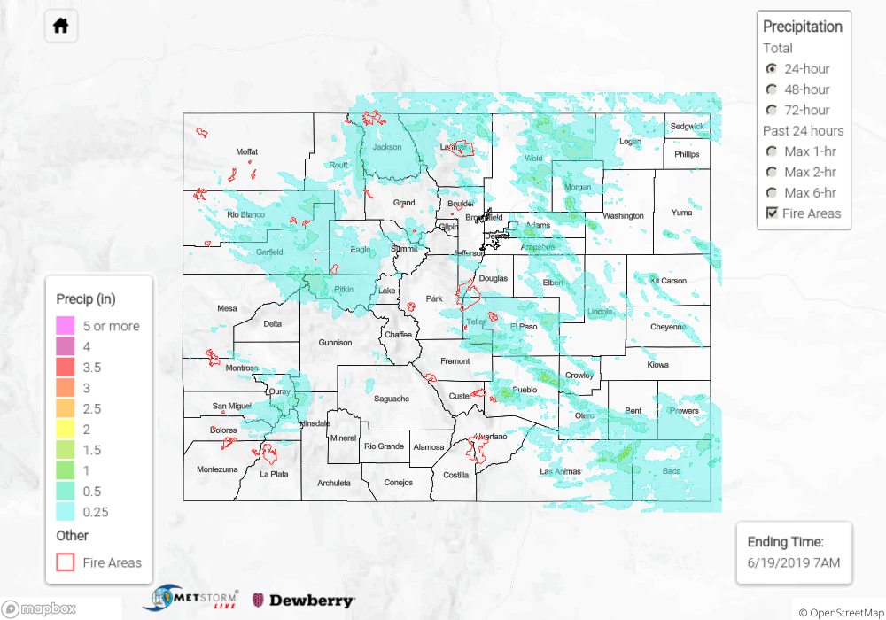
Another wet day throughout the state yesterday as another shortwave propagated over the state from Utah. Rain began over the Northwest Slope and Grand Valley around 7am yesterday as the disturbance first entered the state, providing additional lift and vorticity to the upper elevations. Heavy rain reports were provided to the NWS in southern Routt County near Toponas and in Garfield County near Glenwood Springs measuring 0.59 and 0.57 inches respectively. Small hail of 0.25 inches and heavy rainfall of 0.54 inches was reported north of Cedaredge in Delta County. Other than these isolated cases, precipitation was light in nature, with showers until 7am today in the northwest quadrant of the state. Over the San Juan Mountains precipitation began midday. The high pressure system to the south perturbed moisture in the lower elevations and kept precipitation to the high country. Heavy rain was reported to NWS in San Miguel County near Telluride and La Plata County near Rockwood measuring 0.57 and 0.54 inches respectively. Due to lack of moisture and insufficient forcing as the low pressure system moved over the Eastern Plains, precipitation ended by 9PM.
Convection began on the Continental Divide around 10:30 as the shortwave began to influence the area. Ample moisture from the Eastern Plains, combined with upslope flow allowing heavy rainfall over the Front Range, with CoCoRaHS reporting 1.35 inches in Larimer County. Convection then moved off of the mountains to the ESE. Precipitation was lighter in the Northeast Plains compared to its southern counterpart due to cool temperatures and morning cloud cover, which lead to weakened convective instability. Convection began around 11:30 on the Palmer Ridge providing light rain to the Metro area. Additional systems developed over the Wet Mountains and progresses to the ESE, spawning reports of hail over Otero and Crowly counties. CoCoRahs stations in Baca County reported 1.05 inches of rain. Rain ended around 10PM last night over the Southeast Plains.
Flood warnings remain in effect for Mineral and Rio Grande Counties, Conejos County along the San Antonio and Conejos Rivers, and the Saguache Creek in Saguache County. No new flooding was reported yesterday.
For a look at yesterday’s precipitation, please see our State Precipitation Map below.
Click Here For Map Overview