SPM 07-24-2019: Weak Showers over the High County, Severe Thunderstorm over Teller County

Issue Date: Wednesday, July 24, 2019
Issue Time: 10:45AM MDT

Summary:

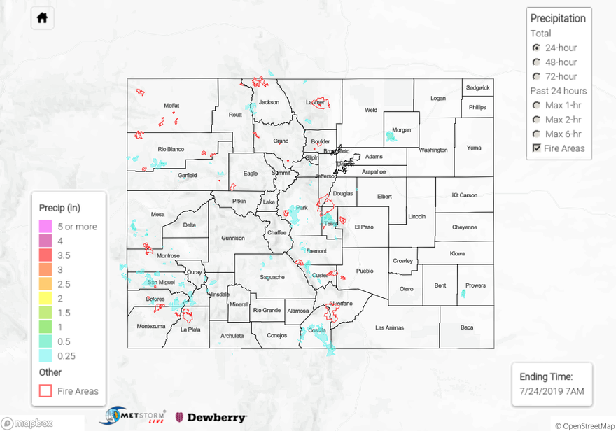
A calmer day yesterday compared to Monday, but there were still reports over severe thunderstorms and flash flooding near Colorado Springs. Storms over the area were driven primarily by upslope flow, peaking in intensity by 6PM. Reports to the NWS indicated 1 inch diameter hail over Teller Counter near Divide, with radar deriving from 1 to 2 inches of rain over the warned area between 5 and 6 PM. No flash flooding was reported in the area but CoCoRaHS stations reported up to 0.68 inches of rain.  Temperatures increased higher than expected over the eastern plains, causing rainfall rates to be weaker than forecast over the Southeast Mountains due to reduced moisture. A brief thunderstorm over Morgan County produced up to 0.75 inches of rain, but the environment was unable to sustain the storm for long.

Moderate to heavy rain was also reported over the San Juan Mountains and Southwest Slope as moisture increased from the southwest. A CoCoRaHS station in Montezuma County recorded 0.78 inches of rain yesterday, but the thunderstorms were unable to cross the ridge to reach the 416 burn area. Precipitation in La Plata County was limited to less than 0.2 inches. Alamosa County had multiple reports of rain over the San Luis Valley, with CoCoRaHS reporting up to 0.2 inches in the city of Alamosa.

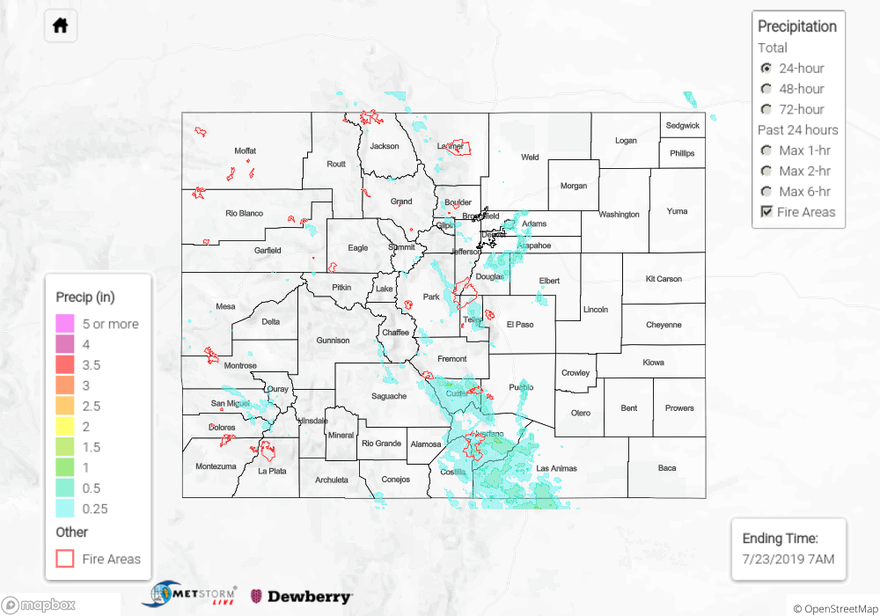
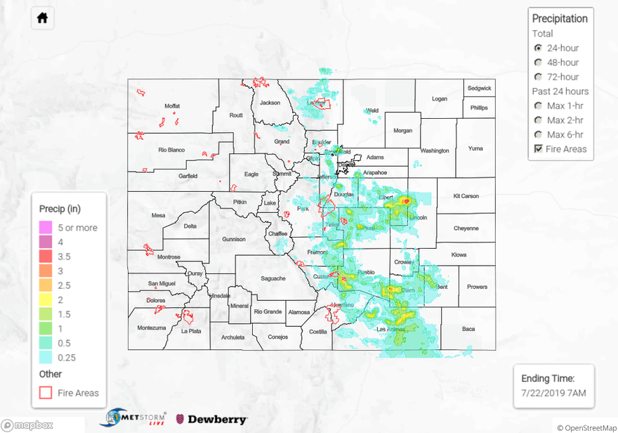
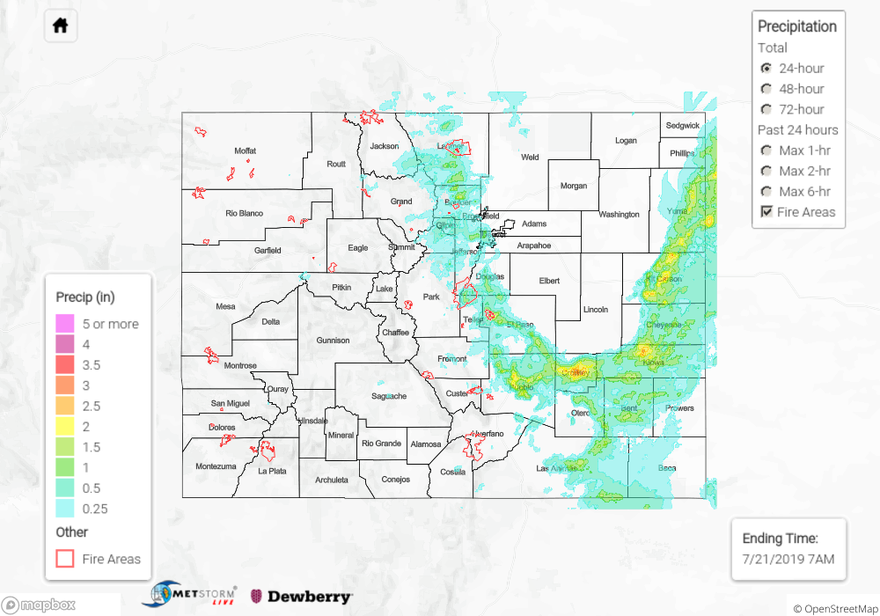
For a look at precipitation over your area, please visit the State Precipitation Map below.

Click Here For Map Overview

The map below shows radar-estimated, rainfall gage-adjusted Quantitative Precipitation Estimates (QPE) across Colorado. The map is updated daily during the operational season (May 1 – Sep 30) by 11AM. The following six layers are currently available: 24-hour, 48-hour and 72-hour total precipitation, as well as maximum 1-hour, 2-hour and 6-hour precipitation over the past 24 hour period (to estimate where flash flooding may have occurred). The 24-hour, 48-hour and 72-hour total precipitation contain bias corrections that are not disaggregated into the hourly estimates, so there will likely be some differences. The accumulation ending time is 7AM of the date shown in the bottom right corner. Also shown optionally are vulnerable fire burn areas (post 2012), which are updated throughout the season to include new, vulnerable burn areas. The home button in the top left corner resets the map to the original zoom.

SPM 07-23-2019: Flash Flooding Causes Road Closures in the Southeast Mountains

Issue Date: Tuesday, July 23rd, 2019
Issue Time: 9:50AM MDT

Summary:

The heavy rainfall threat moved south on Monday into the Southeast Mountains and Raton Ridge area. Moisture continue to stream in around the high and afternoon upslope flow kicked off thunderstorm activity around 1PM MDT over western CO. Best moisture was over the San Juan Mountains as the southern position of the high allowed a little more moisture to meander northwards. Rain totals over the area were estimated around 0.25 inches with a CoCoRaHS station 7 miles north of Durango reporting 0.17 inches. High bases on weak thunderstorms allowed for some gusty winds as well. There were 50-65 mph winds recorded over Garfield, Pitkin and Montrose Counties.

Storms initiated a couple hours later over the eastern mountains. Movement to the southeast was a bit quicker than the last couple of days, so not quite as high of accumulations. Storms moved into the adjacent plains in the late afternoon/early evening with a large cluster of storms outside the Denver Metro area. This weak bow echo produced between 0.8 to 1 inch of rainfall with 1 inch hail and an 80 mph gust (measured at DIA). Non-hail contaminated ALERT gages recorded between 0.2 and 0.75 inches with these storms.

There were several reports of flooding over Huerfano, Custer and Costilla Counties with Flash Flood Warnings and Advisories to go with them. There were several road closures due to the flooding and rock/mud slides. South Abeyta Creek overflowed its banks by 2 feet and Middle Creek flooded as well. There was possible damage to railroad tracks 3 miles WNW of La Veta from the flooding. A lot of these reports, not surprisingly, were over the recent burn areas (Junkins and Spring Creek). The Hayden Pass burn area likely helped contribute to the high runoff in the area. Totals over the Junkins burn area were estimated just under 1 inch, and 0.75 inches in an hour is known to cause flooding issues. Over the Spring Creek burn area, 1 inch was estimated. We have been using 0.4 inches in an hour as our threshold this season, so again, not surprised by these reports. A funnel was reported near Westcliffe, CO. The Custer County sheriff’s office reported power lines down and a possible propane leak from this tornado. This will likely be evaluated by the NWS sometime in the next couple of days. Thankfully, there were no reports of injuries from yesterday (as of this morning). Lastly, the eastern facing slopes of the Southeast Mountains (facing San Luis Valley) got in on the rainfall action, too. The Great Sand Dunes CoCoRaHS stations reported between 0.75 and 0.95 inches. That’s a large chunk of their expected June rainfall. All storms yesterday ended around 11:30PM MDT as they crossed into New Mexico.

To see estimated precipitation totals over your neighborhood on Monday, scroll down the State Precipitation Map below.

Click Here For Map Overview

The map below shows radar-estimated, rainfall gage-adjusted Quantitative Precipitation Estimates (QPE) across Colorado. The map is updated daily during the operational season (May 1 – Sep 30) by 11AM. The following six layers are currently available: 24-hour, 48-hour and 72-hour total precipitation, as well as maximum 1-hour, 2-hour and 6-hour precipitation over the past 24 hour period (to estimate where flash flooding may have occurred). The 24-hour, 48-hour and 72-hour total precipitation contain bias corrections that are not disaggregated into the hourly estimates, so there will likely be some differences. The accumulation ending time is 7AM of the date shown in the bottom right corner. Also shown optionally are vulnerable fire burn areas (post 2012), which are updated throughout the season to include new, vulnerable burn areas. The home button in the top left corner resets the map to the original zoom.

SPM 07-22-2019: Heavy Rainfall and Flooding Returns to the Urban Corridor and Southeast Plains.

Issue Date: Monday, July 22, 2019
Issue Time: 10:55AM MDT

Summary:

Another day of severe thunderstorms and flash flooding over the Urban Corridor and Southeast Plains. Upslope flow of moist, warm air from the northeast provided lift for severe thunderstorms over the areas last night. Mixing out of surface moisture throughout the afternoon prevented afternoon convection over most areas, which reduced rainfall totals from forecasted values. However, a resurgence of moisture to the west due to a low level vorticity maximum over the San Luis Valley, provided energy and lift for severe storms beginning around 7pm. Notable severe weather reports to the NWS include:

Monument (El Paso County): Flash flooding with an estimated 6 inches of water on roadways
4 miles northeast of Colorado Springs (El Paso County): 1.5 inches of rain in 30 minutes
Arapahoe Park (Arapahoe County): 1.75 inch diameter hail
Beulah (Pueblo County): 3.1 inches heavy rain

Little to no rain was measured to the east of the Continental Divide, with the highest report of the day measuring 0.56 inches over Chaffee County. CoCoRaHS stations in Pueblo and El Paso counties reported up to 3.07 inches and 2.03 inches respectively. The river gage at Fountain Creek rose briefly into Action stage yesterday, raising 5 feet over 45 minutes!

Click Here For Map Overview

The map below shows radar-estimated, rainfall gage-adjusted Quantitative Precipitation Estimates (QPE) across Colorado. The map is updated daily during the operational season (May 1 – Sep 30) by 11AM. The following six layers are currently available: 24-hour, 48-hour and 72-hour total precipitation, as well as maximum 1-hour, 2-hour and 6-hour precipitation over the past 24 hour period (to estimate where flash flooding may have occurred). The 24-hour, 48-hour and 72-hour total precipitation contain bias corrections that are not disaggregated into the hourly estimates, so there will likely be some differences. The accumulation ending time is 7AM of the date shown in the bottom right corner. Also shown optionally are vulnerable fire burn areas (post 2012), which are updated throughout the season to include new, vulnerable burn areas. The home button in the top left corner resets the map to the original zoom.

SPM 07-21-2019: Flash Flooding and Heavy Rain over the Foothills and Eastern Plains

Issue Date: Sunday, July 21, 2019
Issue Time: 10:45AM MDT

Summary:

Strong upslope flow and a passing shortwave created heavy rain and flash flooding over the Urban Corridor and Eastern Plains. Thunderstorms began to form over the foothills and Continental Divide by midday and moved over the adjacent plains by 2PM.  Storm continually formed over the high country throughout the afternoon and into the early evening. Flash flooding occurred over the major metro areas of Denver, Colorado Springs and Pueblo. Notable reports of flash flooding include:

2 miles southeast of Denver (Denver County): southbound I-25 south of 6th Avenue under multiple feet of water
West Colfax and 121st (Denver County): water rescue as flood waters poured into a stalled vehicle
3 miles north of Lakewood (Jefferson County): a few feet of water over the road at 12th and Miller
4 miles north of Manitou Springs (El Paso County): 8 inches of muddy water off of the Waldo Canyon burn area running over roads
4 miles northwest of Blende (Pueblo County): car completely submerged in water
Pueblo (Pueblo County): Flooding up to 8 inches over many roadways

Rain was very heavy over the eastern plains as well. Radar derived up to 3.5 inches in central Crowley County and up to 3 inches in Kiowa and Kit Carson Counties. High, non-tornadic wind gusts were also reported over the eastern plains, with reports to the NWS of 66 mph and 62 mph in Otero County near Cheraw and Prowers County near Lamar respectively. High winds in El Paso County caused downed live trees to fall over roadways southeast of Peterson. Rainfall was also measured west of the Continental Divide, with Eagle County CoCoRaHS stations reporting up to 0.39 inches. Most CoCoRaHS stations over the west reported less than 0.1 inches, but light rain was widespread over most of the area.

For a look at precipitation over your area, please see the State Precipitation Map below.

Click Here For Map Overview

The map below shows radar-estimated, rainfall gage-adjusted Quantitative Precipitation Estimates (QPE) across Colorado. The map is updated daily during the operational season (May 1 – Sep 30) by 11AM. The following six layers are currently available: 24-hour, 48-hour and 72-hour total precipitation, as well as maximum 1-hour, 2-hour and 6-hour precipitation over the past 24 hour period (to estimate where flash flooding may have occurred). The 24-hour, 48-hour and 72-hour total precipitation contain bias corrections that are not disaggregated into the hourly estimates, so there will likely be some differences. The accumulation ending time is 7AM of the date shown in the bottom right corner. Also shown optionally are vulnerable fire burn areas (post 2012), which are updated throughout the season to include new, vulnerable burn areas. The home button in the top left corner resets the map to the original zoom.