Issue Date: Tuesday, September 10th, 2019
Issue Time: 9:25AM MDT
Summary:
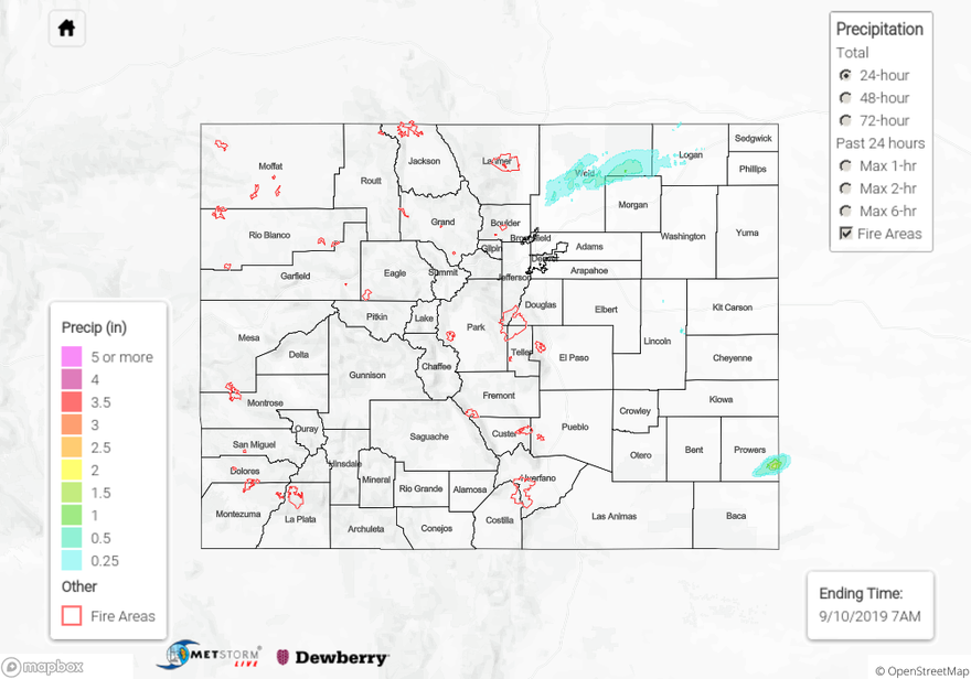
Drier air began to move in from the west yesterday, and with rising pressure over the state promoting subsidence, rainfall was somewhat absent across the state after a long weekend of heavy rain. The morning started with quite a bit of fog over the Northeast Plains and Urban Corridor. It burned off with a little daytime heating, which helped mix out the lower level moisture. Other than some fair weather cumulus over the mountains and some sprinkles over the Northern Mountains (near the Continental Divide) it was a gorgeous day. There were some stronger storms over Prowers County that formed along a dryline. Dew points in the area were around 55°F, so high enough for some decent accumulations. An Areal Flood Advisory was issued around 3:30PM for this storm, but as of this morning, no flooding was reported. Trailing/nearly stationary movement allowed up to 1.75 inches to fall with max 1-hour rain rates just under 1 inch.
Another set of storms formed over the northern Urban Corridor around midnight. This set of thunderstorms was associated with a jet streak passing overhead. Surface moisture had returned by the time the storms kicked off, so dew points were in the mid to upper 50°Fs. This allowed for more efficient rain rates, and MetStorm estimates up to 1 inch fell. A CoCoRaHS station near Greeley (Galeton) recorded up to 0.88 inches. Higher amounts of accumulation were avoided due to the fairly quick storm movement and dry mid/upper layers of the atmosphere. Storms moved to the northeast and eventually exited into Nebraska early this morning. There was a report of 1 inch hail over Logan County, so a Severe Thunderstorm was issued last night.
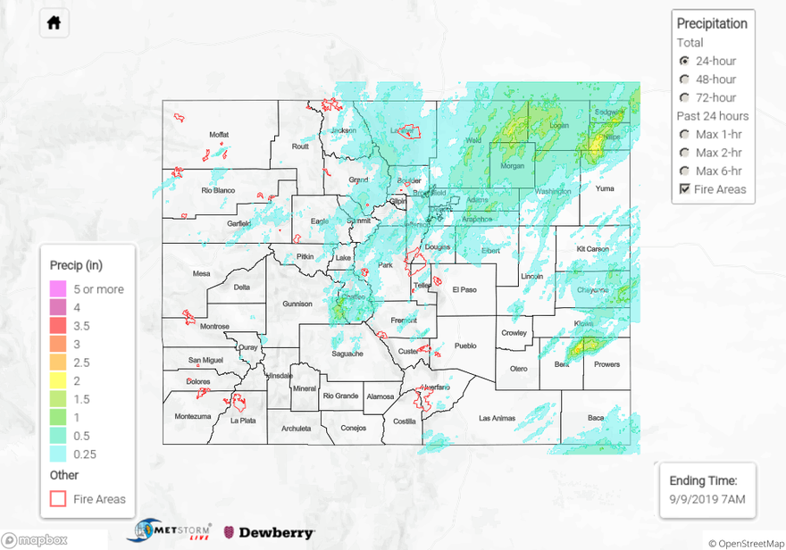
To see estimated precipitation totals over your neighborhood on Monday, scroll down to the State Precipitation Map below.
Click Here For Map Overview