Issue Date: Sunday, September 8th, 2019
Issue Time: 10:20AM MDT
Summary:
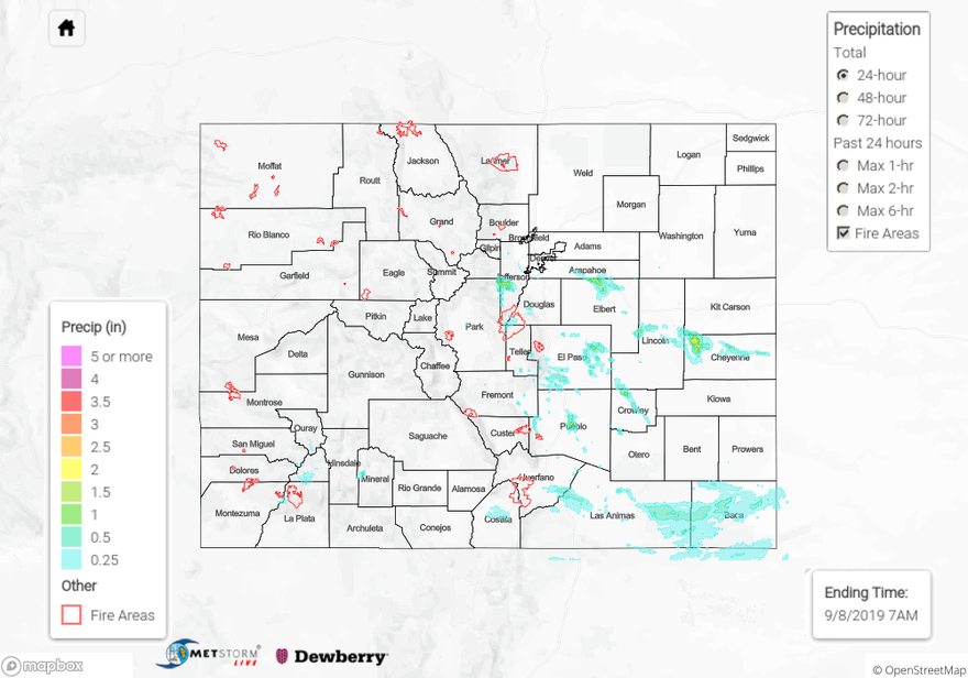
The active pattern continued with the next shortwave trough helping spark more widespread coverage of thunderstorms and rainfall over southern Colorado yesterday. Drier air limited the rainfall potential over the Northeast Plains and northern western slope, so these areas mostly remained dry. Storms favored the southern Urban Corridor/Southeast Mountains and Raton Ridge area were better moisture was in place and cloud cover was able to break up and provide some instability for growth. With the cloud cover taking longer to break apart, the heavy rainfall was not widespread in nature yesterday. Additional storms formed along a boundary over the Southeast Plains. Finally, a second round of scattered storms formed around 10PM over the Palmer Ridge/southern Northeast Plains. An isolated total up to 2.5 inches was estimated by MetStorm over Cheyenne County associated with a nearly stationary storm.
With storm motion slow, totals up 1 inch were realized just north of Bailey, CO. There is a CoCoRaHS in the area that recorded 1.46 inches, but not thinking this is correct with the other observations around it. Over the adjacent plains, max 1-hour rain rates up to 1.5 inches were reached with the late night storms. A storm near Pueblo during the afternoon produced just under 1.5 inches with a CoCoRaHS station recording 1.23 inches just east of town. The NWS San Luis Valley gage recorded 0.25 inches, which was very much welcomed as the area is experiencing much below average rainfall this summer. An Areal Flood Advisory was issued east of Colorado Springs for those late night storms, but flooding was not reported as of this morning.
To see estimated precipitation totals over your neighborhood the last 48-hours, scroll down to the State Precipitation Map below.
Click Here For Map Overview