Issue Date: Sunday, September 22nd, 2019
Issue Time: 8:55AM MDT
Summary:
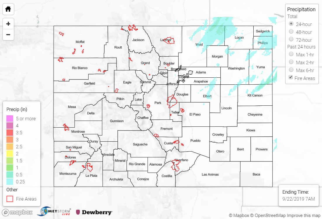
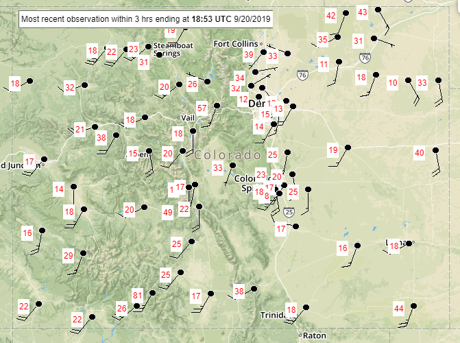
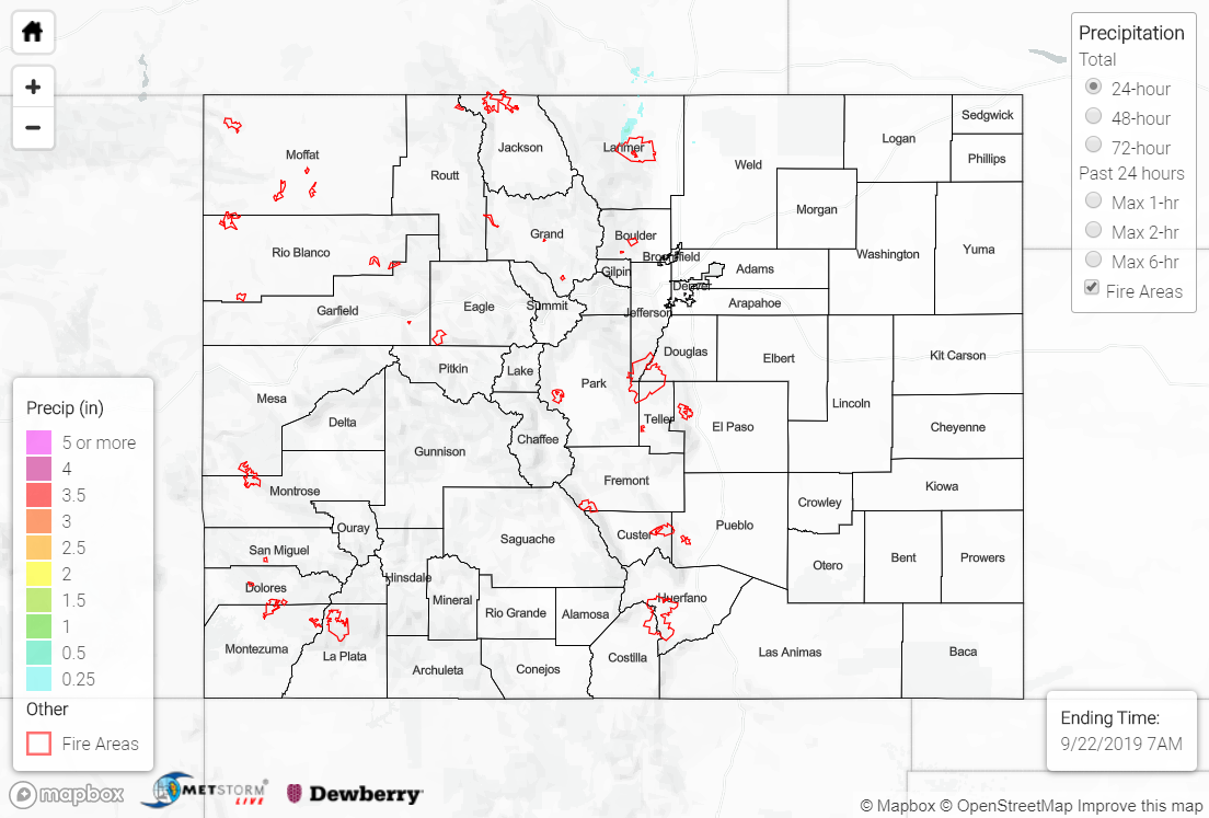
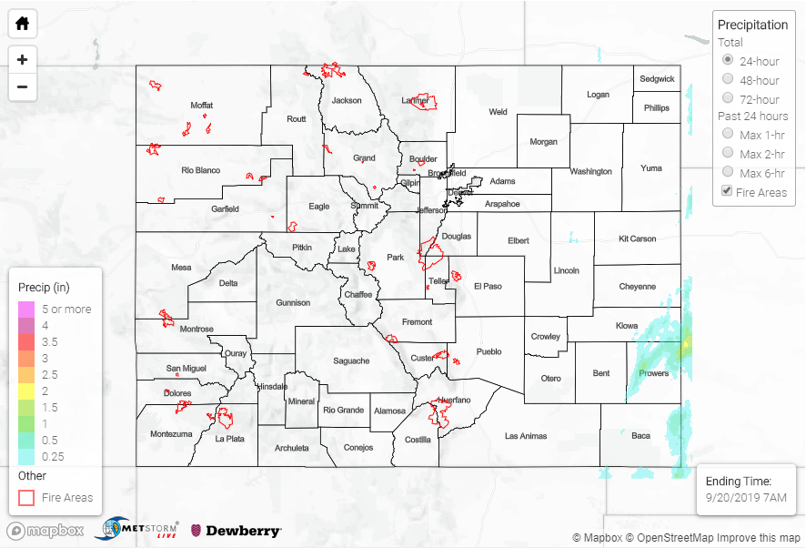
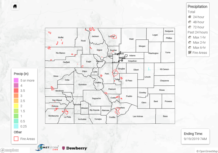
Evening and overnight rainfall for the northeast corner of the state as a cold front dipped south behind a trough. Storms began to fire just after 5PM with mostly light to moderate rainfall, which included the Front Range. A couple thunderstorms were able to form over Kit Carson, Yuma and Lincoln Counties around 9PM. With higher moisture, a little instability and extra dynamics along the front, these storms produced the most rainfall. A RAWS station between Burlington and Wray, Colorado recorded 0.64 inches. MetStorm estimates up to 1 inch of rainfall. Further to the north and west, a NWS ASOS recorded 0.35 inches in Grover. Rainfall mostly ended early this morning with some light sprinkles reported over the Northeast Plains through 7AM MDT. Elsewhere was dry minus a few possible sprinkles over the highest elevations of the San Juan Mountains (Hinsdale County). As you may have guessed, flooding was not reported.
To see estimated precipitation totals over your area the last 48 to 72-hours, scroll down to the State Precipitation Map below.
Click Here For Map Overview
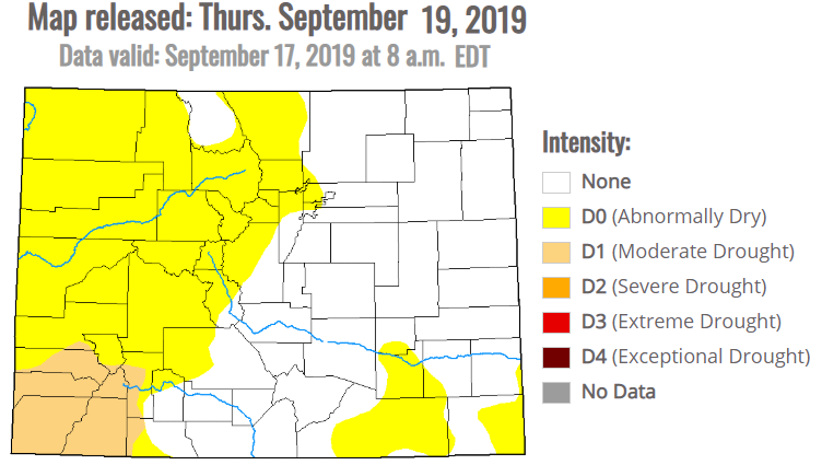
Note: The 24-hour, 48-hour and 72-hour total precipitation do not contain bias corrections today due to errors in the CoCoRaHS data. This means there may be underestimations in QPE over the southwest and southeast corners of the state.