Issue Date: Thursday, September 19th, 2019
Issue Time: 9:25AM MDT
Summary:
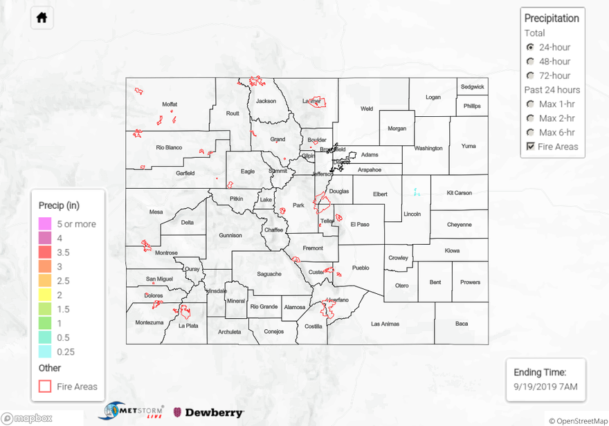
Not much rainfall yesterday with a dry air mass in place over the state. A couple weak afternoon showers were able to form over the Front Range and push into the adjacent plains with the residual moisture in the atmosphere. Totals up to 0.15 inches were realized along and over the Continental Divide. A CoCoRaHS site in northwest Douglas County recorded 0.25 inches. Additional light rainfall occurred over the far Northeast Plains. Isolated totals just under 0.25 inches were estimated by MetStorm with more widespread values under 0.05 inches. Gusty winds over western Colorado with mostly clear conditions during the afternoon and evening. Two non-thunderstorm related gusts around 50mph were recorded at Douglas Pass and Montrose due to the tightening surface gradient. Flooding was not reported.
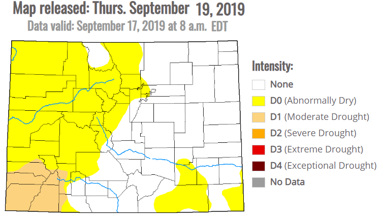
Below is the latest drought map released this morning, which is valid through Sept 17 (created by Eric Luebehusen, Dept. of Agriculture). With the last couple of systems providing rainfall to western Colorado, there has been no change to the map since last week.
To see estimated precipitation totals over your neighborhood the last 72-hours, scroll down to the State Precipitation Map below.
Click Here For Map Overview