Issue Date: Saturday, September 21st, 2019
Issue Time: 9:20AM MDT
Summary:
Critical and elevated fire danger across the state yesterday as the jet moved overhead with a passing trough. Not much moisture over the state, but some weak showers and cloud cover were able to form along the Continental Divide. The heaviest rainfall was over the over northern Larimer County where MetStrom indicates up to 0.5 inches fell. SNOTEL in the area had up to 0.1 inches. Storms did not fully materialize over the eastern plains along the dryline, although there were some weak showers over the far northeast corner and in Kiowa County.
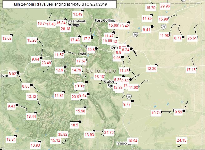
Below is a plot of relative humidity (RH) values from 11AM to 1PM with the lowest RH values for the 24-hour period below that. Just wanted to show how quickly the low levels dried out with the dry air mass that was advected into the state. Paired with gusts 45 to 65 mph range over western Colorado, quite a high fire risk situation. A fire was started in Clear Creek Canyon around 3PM and was 25 acres as of last night. Currently, no structures are being threatened, although residents received notices to prepare for possible evacuation.
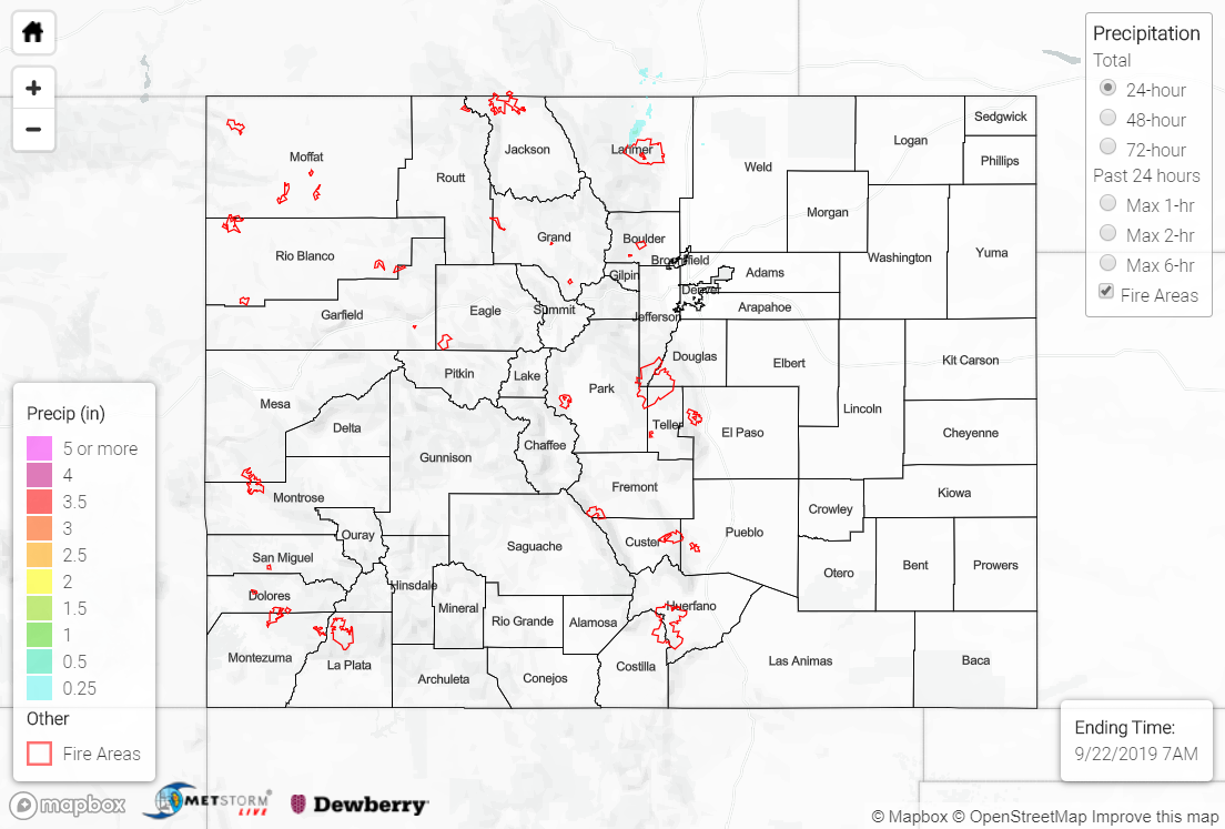
To see estimated precipitation totals over your area the last 48 to 72-hours, scroll down to the State Precipitation Map below.
Click Here For Map Overview
Note: The 24-hour, 48-hour and 72-hour total precipitation do not contain bias corrections today due to errors in the CoCoRaHS data. This means there may be underestimations in QPE over the southwest and southeast corners of the state.