Issue Date: Thursday, September 26th, 2019
Issue Time: 9:45AM MDT
Summary:
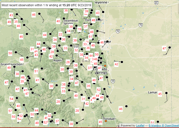
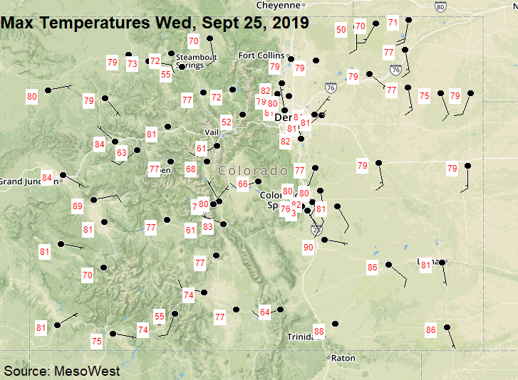
Once again, another gorgeous fall day with some very impressive high temperatures for late September. Below are the 24-hour maximum high temperatures across the state from the NWS ASOS network (source: MesoWest). The only place that recorded rainfall was El Paso County. Very light rainfall fell between 10 and 11PM last night with totals around or under 0.05 inches. Otherwise it was a rain-free day across the state.
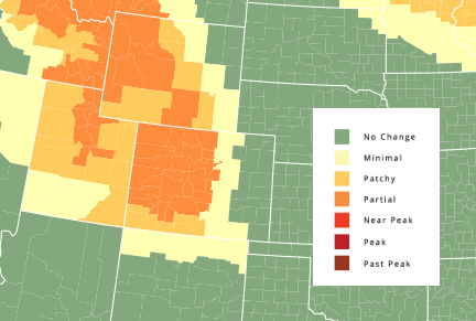
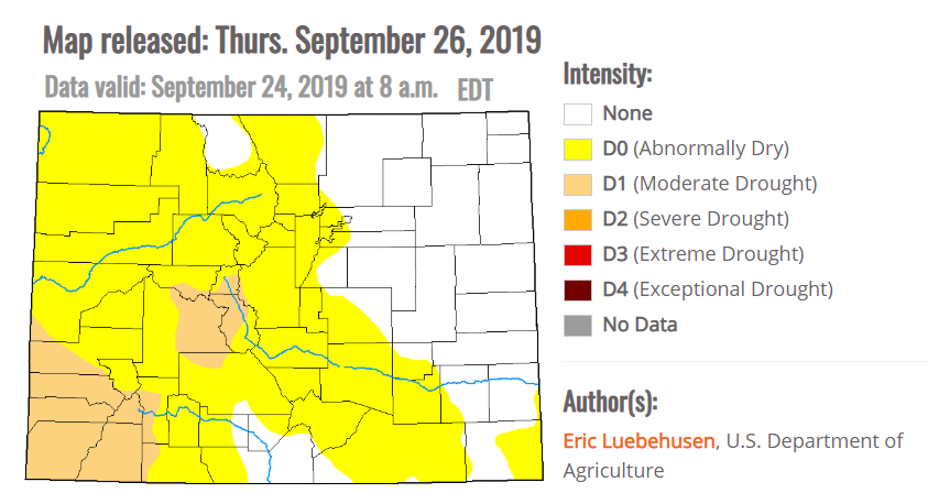
The newest drought map was released this morning. Quite the change from the last map with an increase in drought area (D0-D4) of 16%. The D1 category increased about 4% and is now just shy of 11% of the cumulative area of Colorado. Eastern Gunnison, Chaffee, Pitkin, and Lake County are also included in the D1 category now with the D1 category drifting further north over the western border (into Montrose and Mesa County).
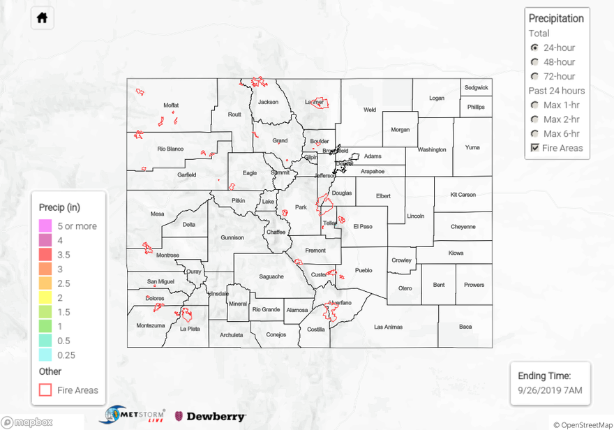
To see estimated precipitation totals over your neighborhood the last 72-hours, scroll down to the State Precipitation Map below.
Click Here For Map Overview