Issue Date: Wednesday, September 25th, 2019
Issue Time: 9:25AM MDT
Summary:
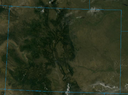
Another beautiful day on Tuesday with the dry air mass overhead keeping the rain threat away. There was some very light rainfall reported over the Southeast Plains for the 24-hour period, but totals were under 0.05 inches (from yesterday morning). Below is a visible satellite imagery from 3PM MDT yesterday. Outside of a couple high cloud over the NE/CO/WY border and far Southeast Plains, only a couple fair weather cumulus were present over the southern mountains. Everywhere else expected a severe clear day with temperatures in the 90°Fs over the eastern plains, 80°Fs over the Urban Corridors, and 70°Fs in the mountain valleys. Temperatures dipped into the mid-40°Fs over the eastern plains overnight, so quite the diurnal temperature swing (High – Low > 40°F+). These large swings are not uncommon for this time of year.
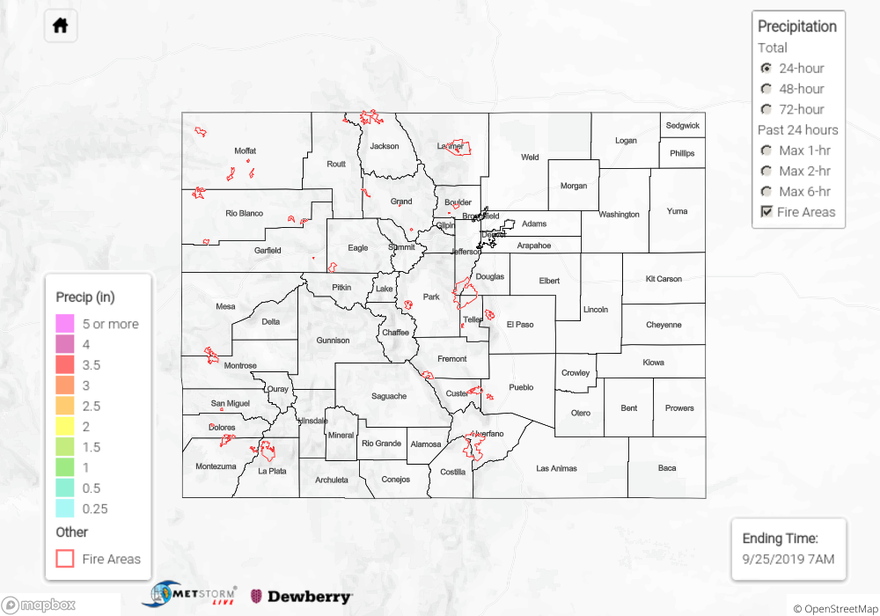
To see estimated precipitation totals over your area the last couple of days, scroll down to the State Precipitation Map below.
Click Here For Map Overview