Issue Date: Thursday, June 9th, 2022
Issue Time: 3PM MDT
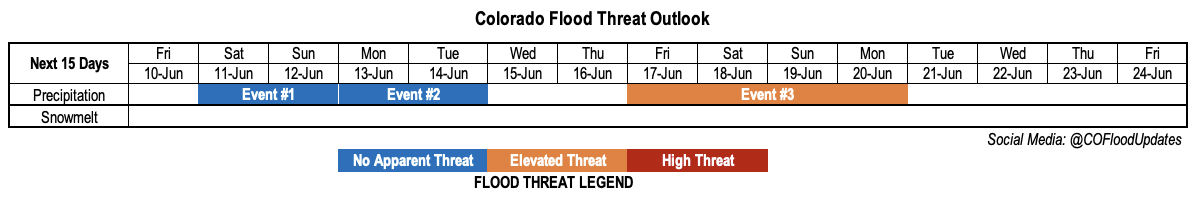
Valid Dates: 6/10-6/24
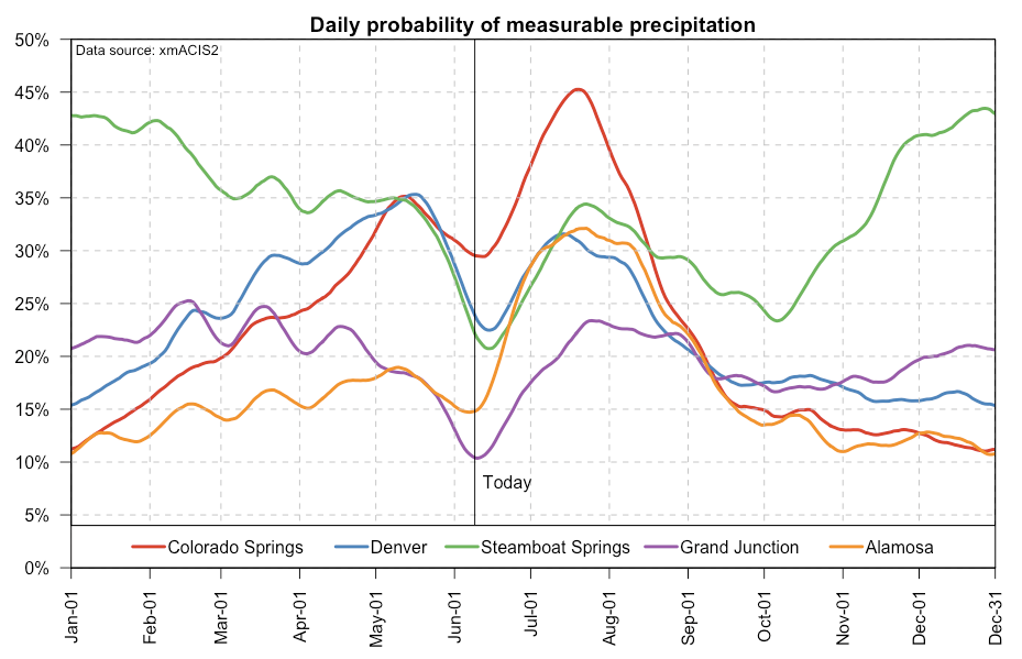
The middle part of June marks an interesting milestone in Colorado’s summer, which given our semi-arid climate, one that can be too subtle for even long-time residents to fully perceive. As shown below, over the next 10 days or so, we will see the summertime minimum in climatological precipitation chances across essentially the entire state. For example, Grand Junction’s climatological chance of precipitation is about 11% over the next few days, but will quickly jump up to 23% over the next month. Stark swings are seen at basically every long-term station that you can find. The back of the envelope explanation for this is the transition from mainly jet-stream driven springtime dynamics to slower, subtler monsoonal dynamics.
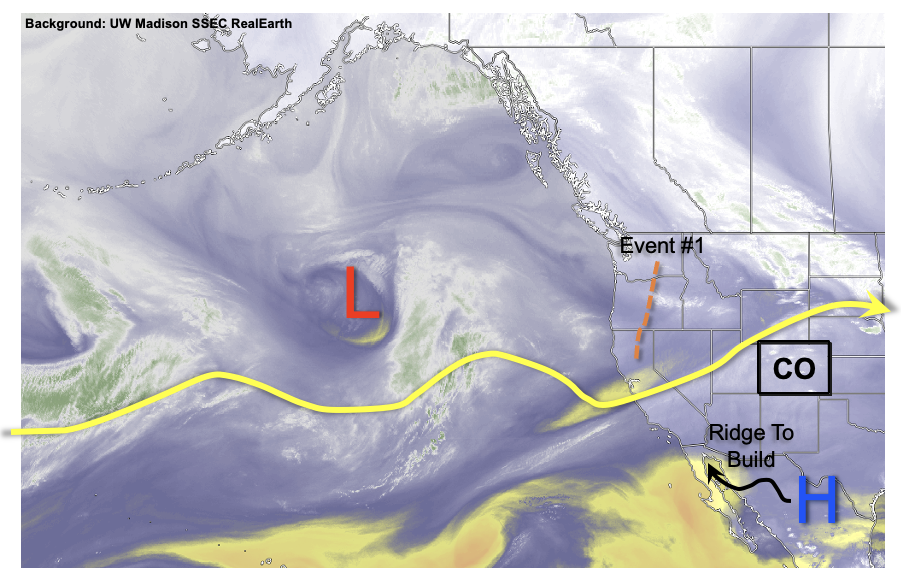
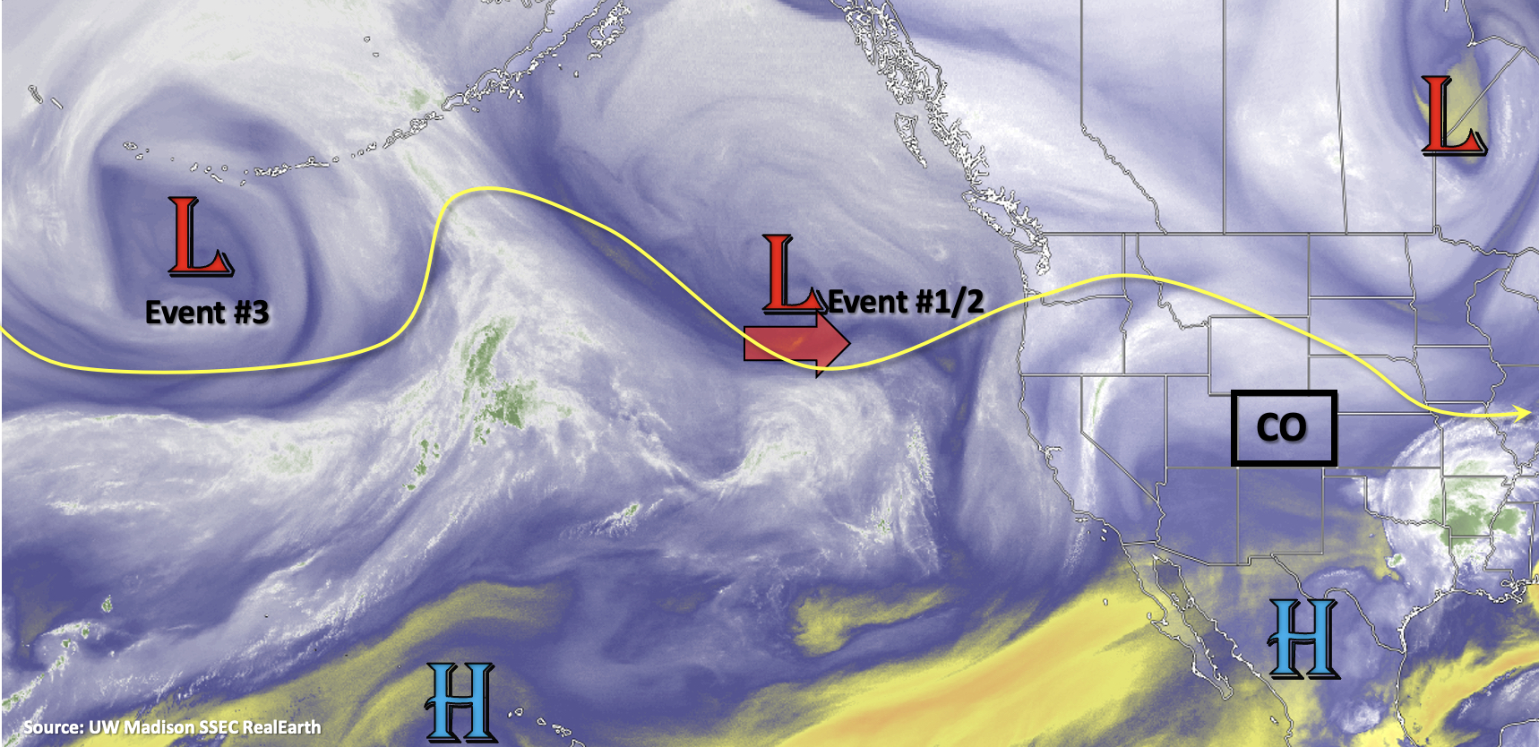
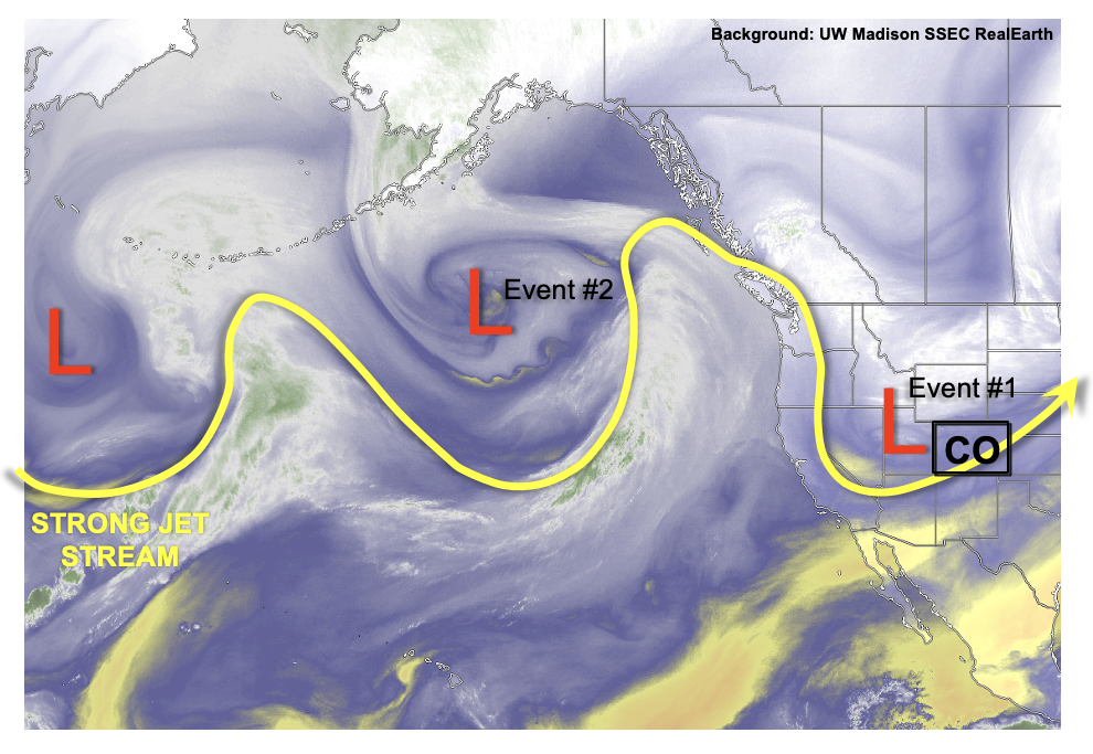
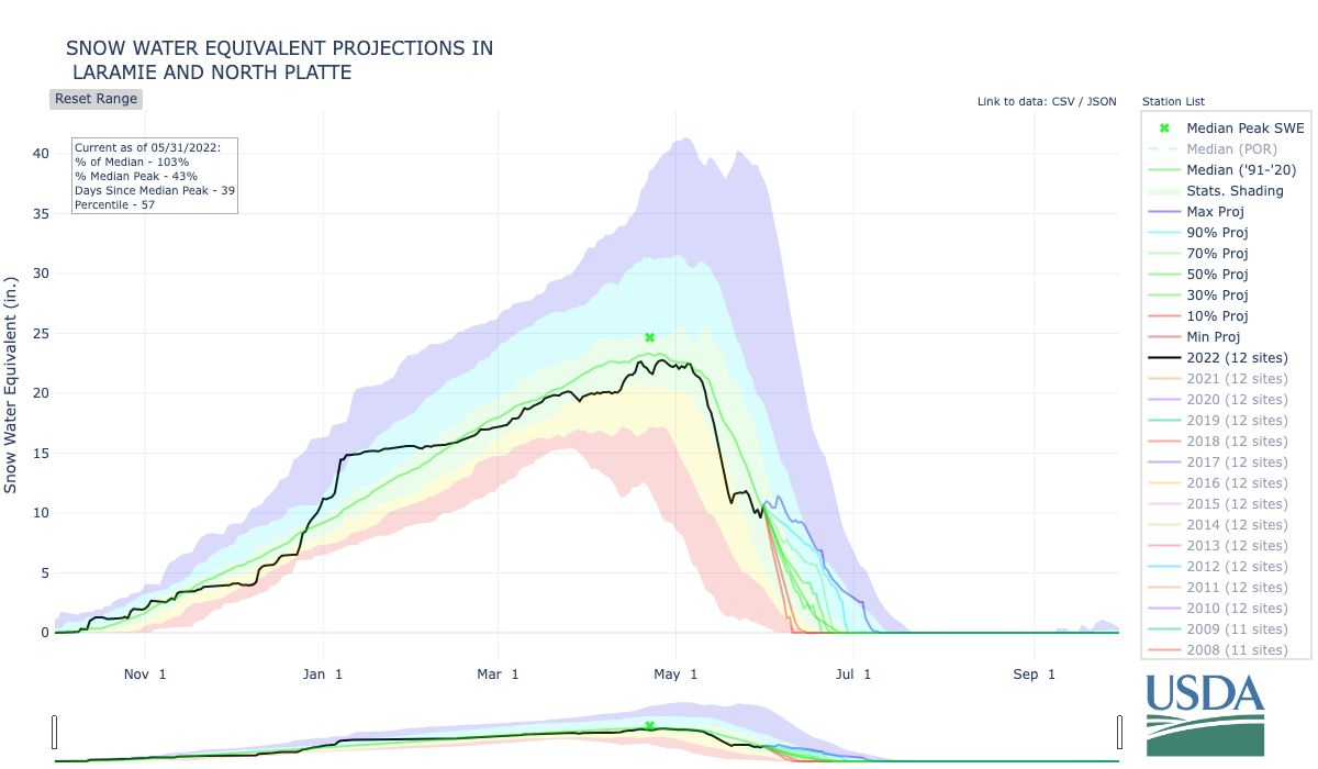
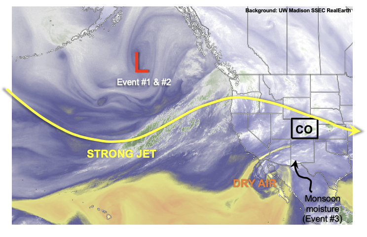
Interestingly enough, such a transition from jet-stream dominated flow to monsoonal is exactly what we are likely to see over the course of this Outlook. As shown in this afternoon’s water vapor imagery, below, another elongated jet is seen across the central and eastern Pacific Ocean. In association, a deep trough is positioned over the Gulf of Alaska. Over the next 3-5 days, several disturbances (Event #1 and Event #2) will detach from this parent trough and race eastwards towards Colorado. However, due to the combination of gradual drying, limited instability and fast storm motion, only isolated to widely scattered showers and thunderstorms are expected with limited rainfall (less than 0.5 inches at this time). Instead, the big story over the next week will be the building heat, first to the west of the Continental Divide, but then mainly over central and eastern Colorado. Temperatures up to 15F above normal will yield afternoon heat exceeding 100F over the state’s lower elevations. Over this time period, most of the remaining snowpack is expected to melt, with generally little fanfare although a few full smaller streams can be expected within the Elk River basin north of Steamboat Springs.
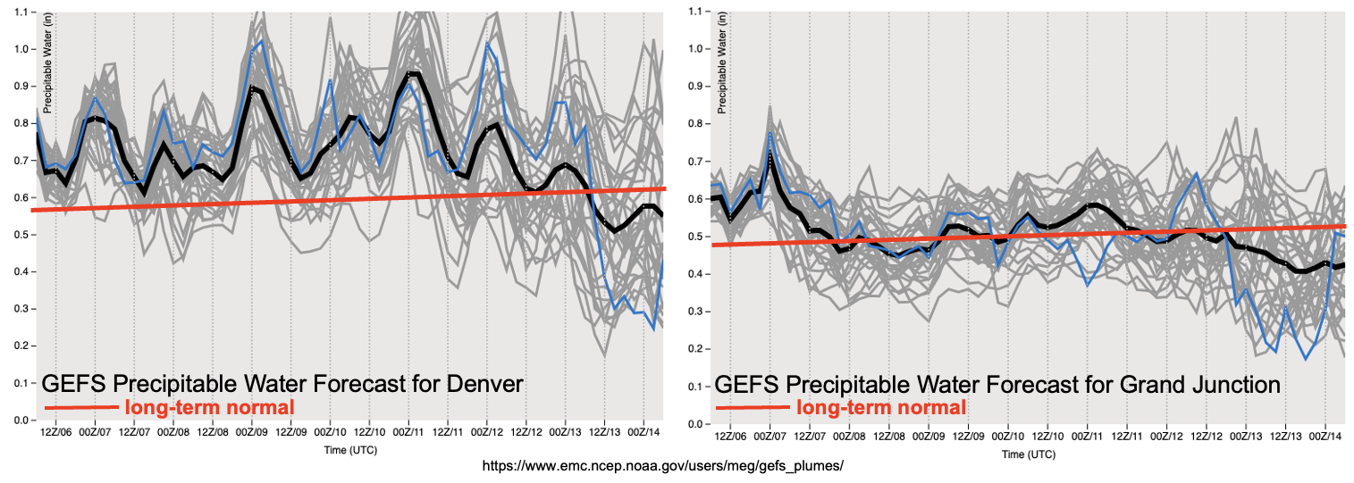
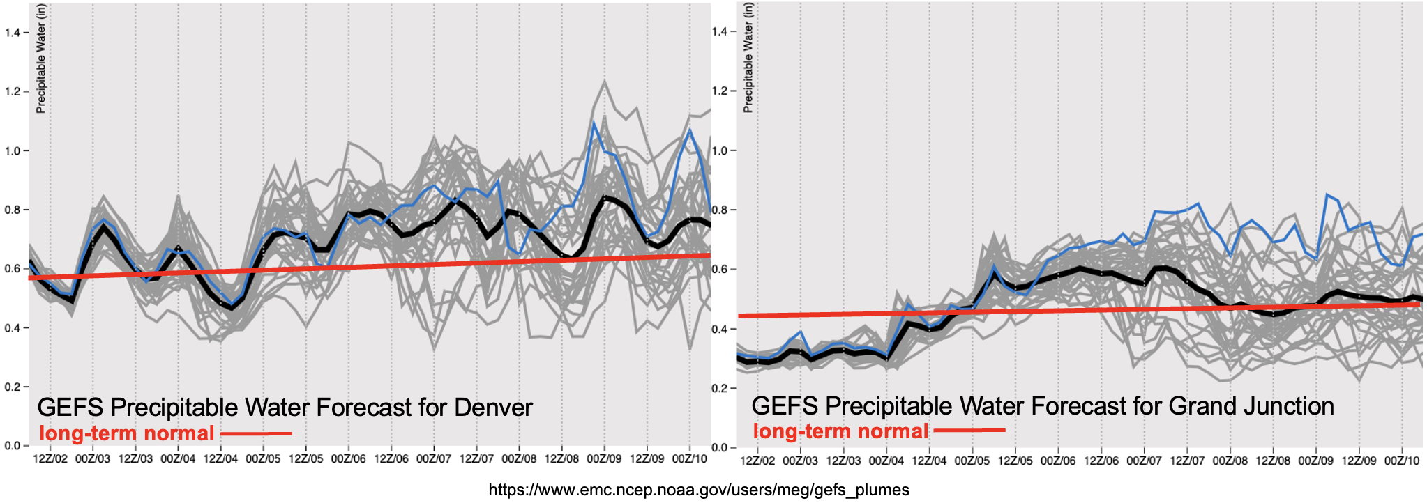
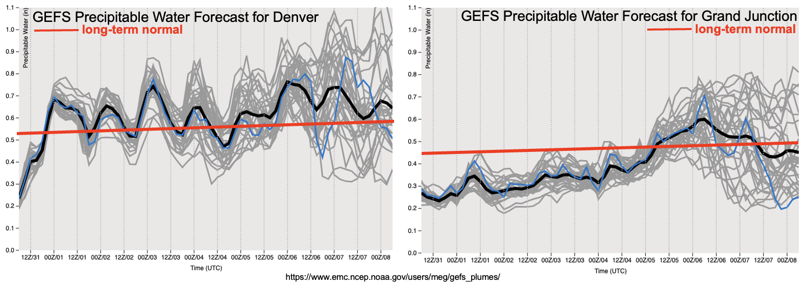
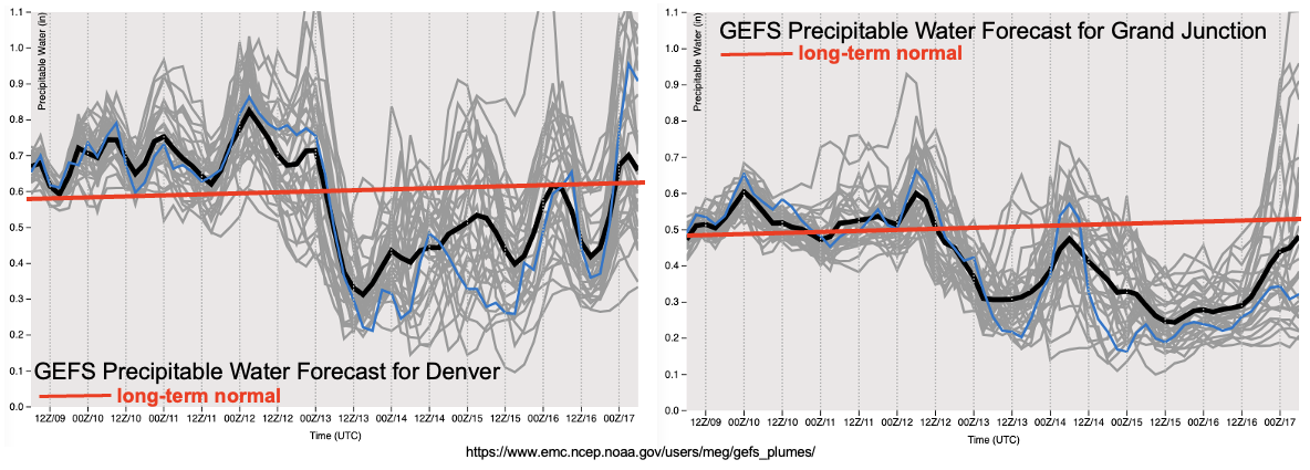
A strong cool front will swing across the state on Tuesday of next week. After a few days of quiet weather, that is when things become interesting. A strongly amplified pattern is expected to develop across North America with a strong ridge over the Northern Plains expected to support a multi-day early summer heat wave across the eastern two-thirds of our country. Associated with this ridge will be a strong southerly flow across the intermountain west, one that will open the gates to the season’s first pulse of monsoonal moisture as shown in the forecast GEFS PW plumes below. A multi-day period of active weather is expected mainly over western Colorado, however, it is typical to see at least some “spillover” of storms to the east of the Continental Divide. An Elevated Flood Threat is expected through the course of this monsoonal pulse as plenty of moisture will support at least isolated heavy rainfall.
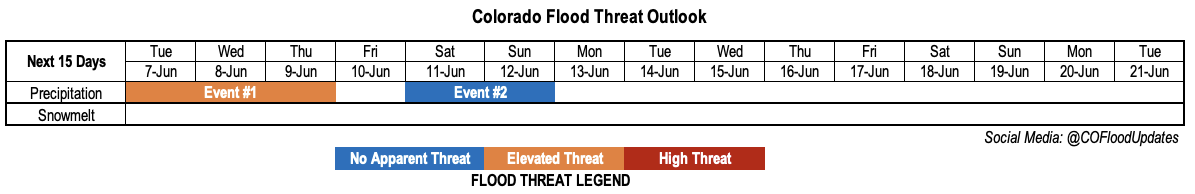
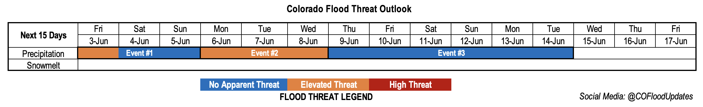
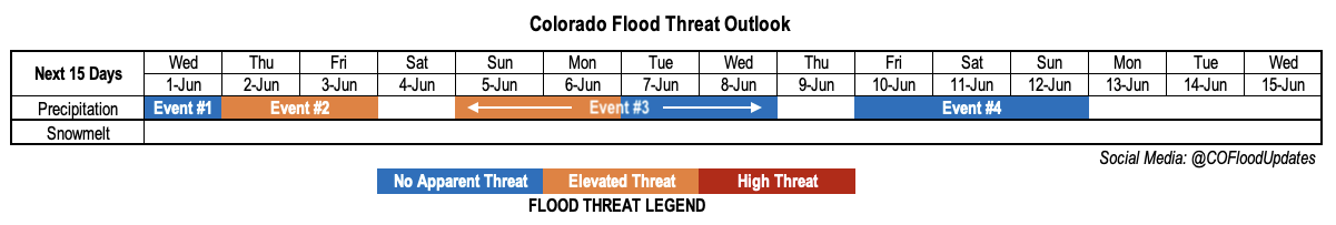
The identified precipitation events are described in more detail below.
Event #1: Saturday – Sunday (June 11 – June 12)
Isolated Showers And Storms Expected Across The State But No Apparent Flood Threat
Isolated to widely scattered afternoon showers and storms are expected over mainly the higher terrain of Colorado, though rainfall is expected to stay below 0.5 inches.
Event #2: Monday – Tuesday (June 13 – June 14)
Showers And A Few Storms To Graze State Borders, But No Apparent Flood Threat
The approach of the aforementioned cool front will lead to a slight increase in rainfall chances, though dry air aloft and quick storm motion is expected to limit point rainfall. The best chances of rainfall appear to be over northwest Colorado on Monday, and then over northeast Colorado on Tuesday. At this time, precipitation looks to be limited to 0.5 inches or less. However, any increase the moisture along the NE/KS borders could introduce a low-end flood threat over the eastern Plains. Stay tuned to the next Outlook for updates.
Event #3: Friday – Monday (June 17 – June 20)
Monsoon Surge To Fuel Scattered Storms For A Multi-Day Stretch; Elevated Flood Threat But Spatial Extent Uncertain
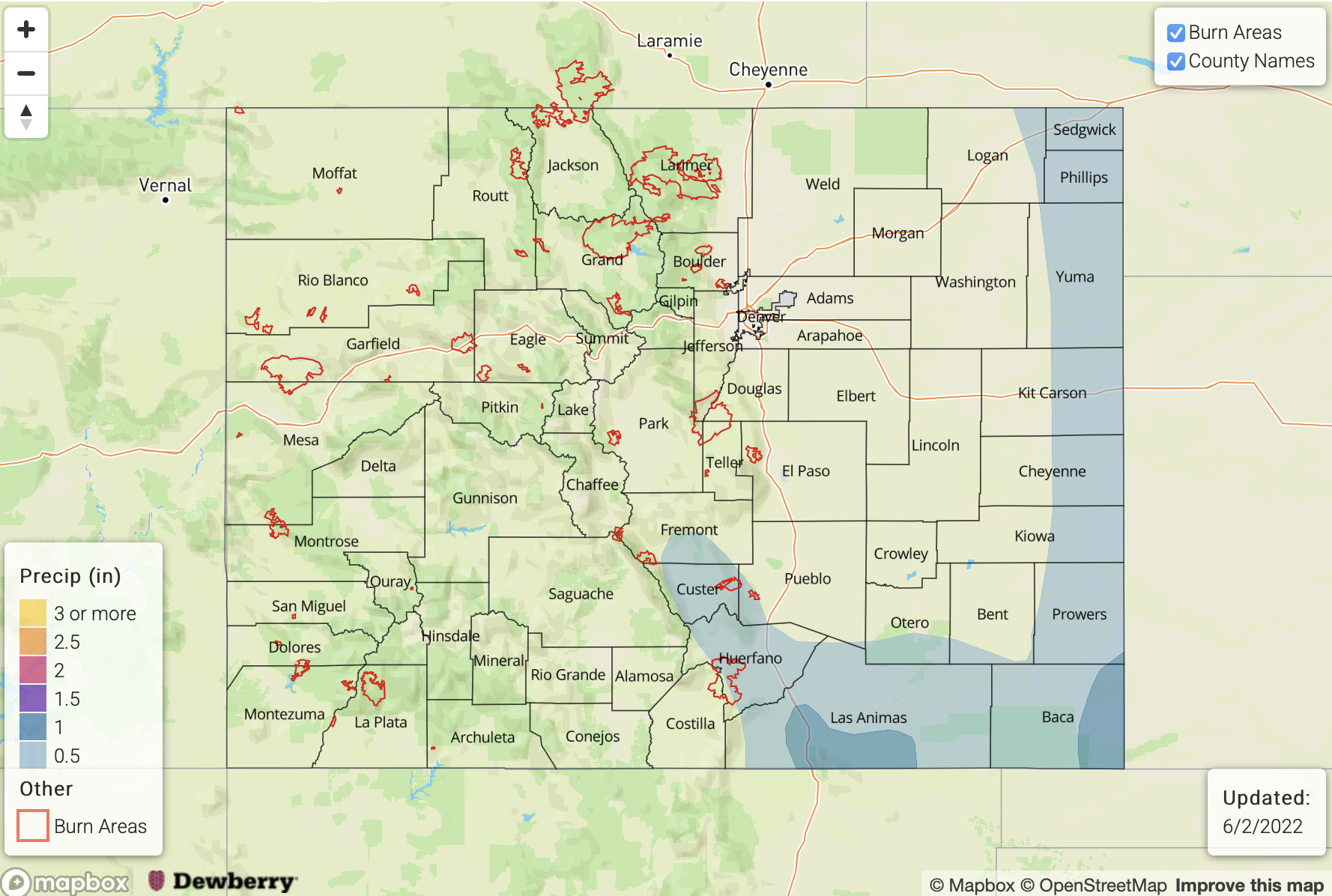
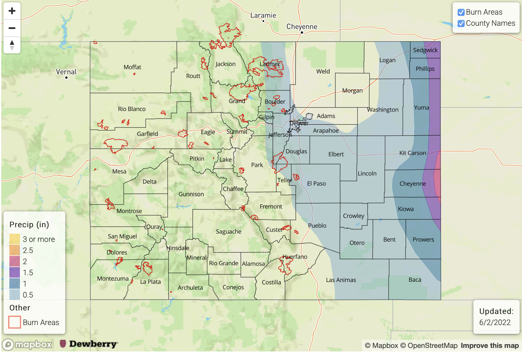
Monsoonal moisture looks to enter the state in full by Friday, with scattered to possibly numerous storms expected at least for the preferred southwest part of the state. The degree of moisture availability will determine the northward and eastward spread of rainfall chances by Saturday and especially Sunday/Monday. At this time, each day of this 4-day period looks to have the possibility of 1.0 per hour or greater rainfall rates, which warrants an Elevated Flood Threat for mainly the western portion of the state. Should this materialize, it will be great news for the area given the early snow meltout and serious concerns about an active wildfire season.