Issue Date: Tuesday, May 31st, 2022
Issue Time: 3PM MDT
Valid Dates: 6/1 – 6/15
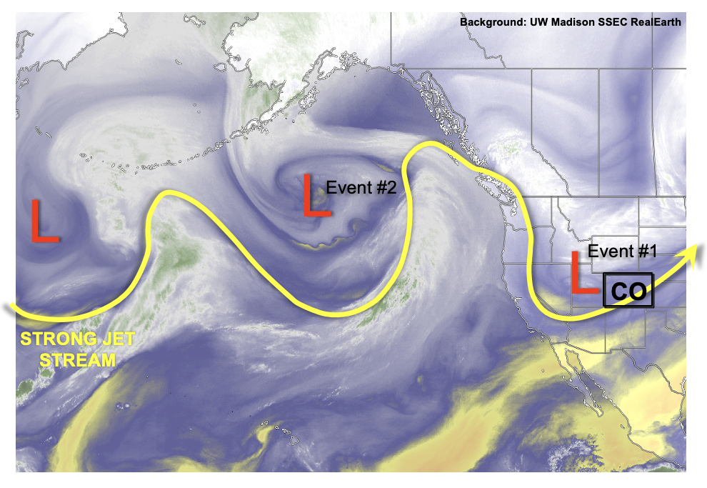
The atmosphere is technically a fluid, and in today’s water vapor image, below, that is certainly on display. Much like waves in the ocean, a pronounced wavy pattern is seen in the middle and upper atmosphere over the eastern Pacific Ocean. The strong elongated Pacific jet has briefly become dormant, but will reappear in the next 3-5 days. The overall result will be to keep sending disturbances and moisture into our state, which is a welcome change from the alarmingly dry conditions that most of the state endured during April.
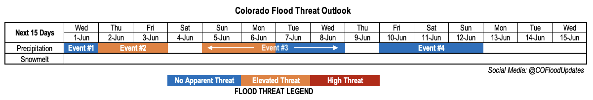
In this Outlook, we have identified a rare four separate precipitation events, all of which will mainly affect areas east of the Continental Divide. Event #1 will be a minor event on Wednesday for mainly the Northeast Plains (tail end of today’s widespread precipitation). Event #2 will arise from a couple of small disturbances that look to break off from a large-scale trough over the Gulf of Alaska. However, with plenty of solar insolation, isolated to scattered storms are possible mainly over the Southeast Plains. Isolated heavy rainfall will be likely both Thursday and Friday, though coverage will likely be higher on Thursday. In addition, there will likely be a severe weather threat with the stronger storms. After brief and subtle drying, a strong, moist Pacific cold front will usher in much above normal moisture and rainfall potential (Event #3). This event looks to be the most notable of the four, both from the perspective of heavy rainfall potential as well as overall precipitation totals. Fortunately, the relatively dry eastern Plains look to experience some widespread moderate to heavy rainfall right in time for their growing season to really begin. An Elevated Flood Threat is currently warranted, but hopefully rainfall will be spread out enough in time to curb significant (i.e. riverine) flooding concerns. Finally, after another very brief break, above normal moisture looks to keep precipitation chances elevated heading into next weekend (Event #4), though details on location are still highly uncertain.
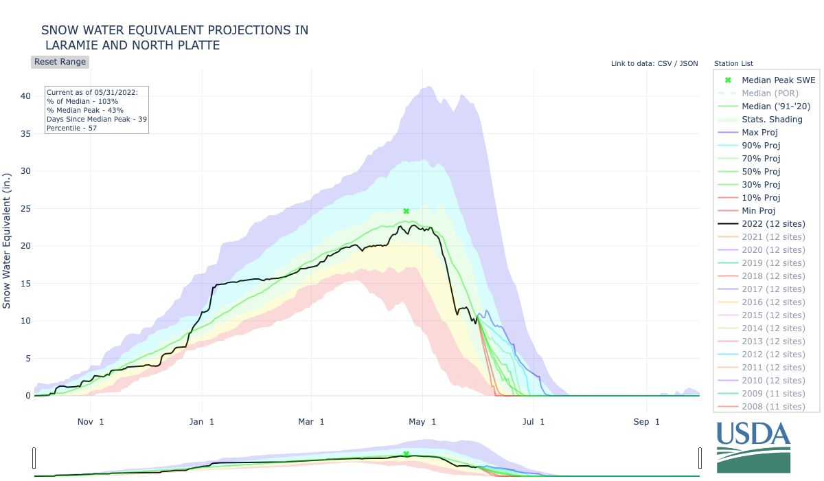
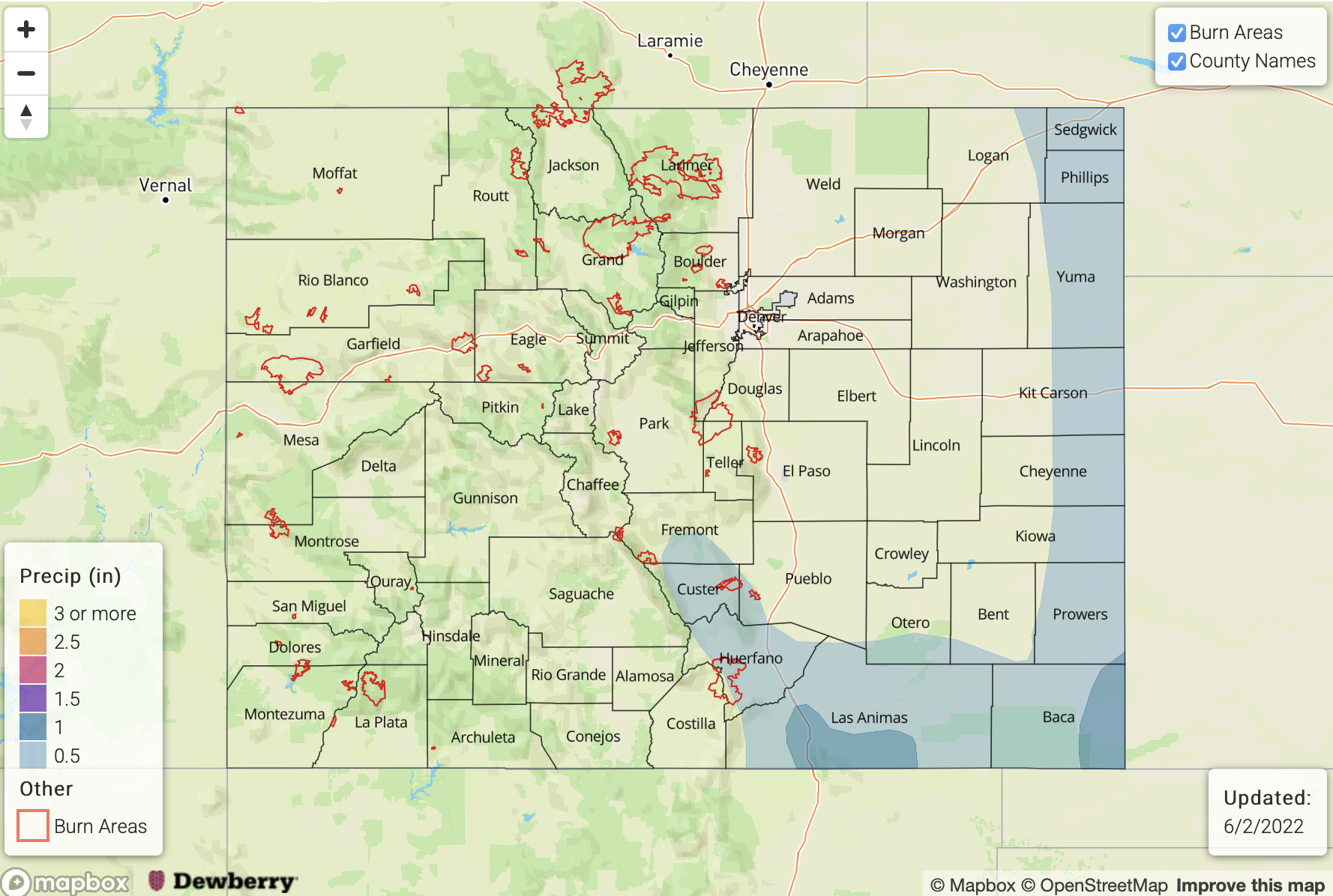
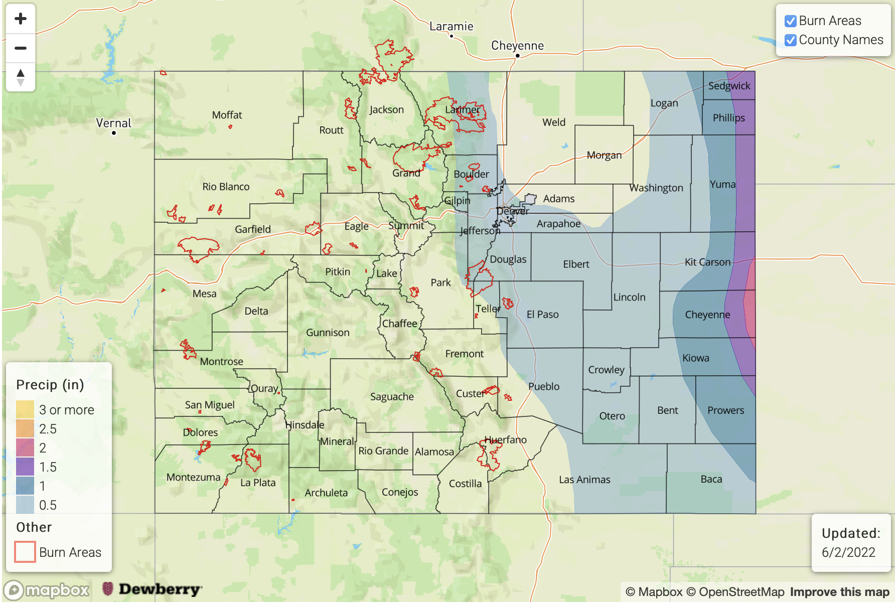
To close out today’s discussion, let’s take a look at the snowpack conditions across the state. Snowmelt is its waning stages over most of southern and south-central Colorado. But with below normal temperatures and some precipitation, the snowpack has held up very well over remaining northern and central areas. As suggested in the previous Outlook (5/26), the average SWE over the North Platte/Laramie and South Platte basins has actually gone back up above its normal value for the end of May. The North Platte/Laramie average SWE trace is shown below, along with a range of projections that encompass the future change in SWE from the last ~40 years of data. With the cool and wet/snowy conditions outlined in this Outlook, it is quite possible that a week from today, the snowpack will actually grow in the North Platte/Laramie and South Platte basins! Looking at historical percentiles, this will begin to place us in the 70th percentile if not higher. Little to no significant melt is expected over at least the next week. Thereafter, we will certainly have to keep a close eye on temperatures as the chances of high runoff can rapidly increase with even slightly above average June heat.
The identified precipitation events are described in more detail below.
Event #1: Wednesday (June 1)
Light To Moderate Precipitation Ending Over The Northeast Plains; No Apparent Flood Threat
Very cool temperatures will be accompanied by light to moderate rainfall through at least mid-day Wednesday mainly over the Northeast Plains. Max 1-hour rain rates up to 0.3 inches are possible and up to 0.5 inches of rainfall could occur over isolated parts of the region, but flooding is not expected.
Event #2: Thursday – Friday (June 2 – June 3)
Residual Moisture To Fuel Isolated/Scattered Storms; Low-End Elevated Flood Threat
Although upper-level ridging and subsidence will be present on Thursday and Friday, residual boundary layer moisture will support instability up to 1,200 J/kg and fuel isolated to widely scattered thunderstorms over the Southeast Mountains, Raton Ridge and Southeast Plains. Max 1-hour rain rates up to 1.25 inches are possible, as well as severe weather in the form of large hail and gusty winds. A low-end Elevated flood threat looks warranted especially for the Raton Ridge area where flash flood guidance is closer to 1.0 inch per hour over the steeper terrain.
On Friday, isolated heavy-rainfall producing storms (possibly severe) could additionally graze the far northeast portion of the Northeast Plains. A flood threat appears unlikely at this time, as the heavy rainfall should stay just east of our border.
Event #3: Sunday – Wednesday (June 5 – June 8)
Early Elevated Threat Over the Northeast/Southeast Plains, Then Cooler
Isolated to scattered storms are first expected on Sunday towards the KS border, with max 1-hour rain rates up to 1.6 inches possible. By Monday, a strong cold front will move south into Colorado. Pre-frontal convection could support a 3-6 hour period of heavy rainfall over mainly the eastern parts of the Northeast and Southeast Plains. The heavy rainfall threat further west appears limited, at least for now, though at least some light to moderate precipitation is expected west of I-25 and perhaps even west of the Continental Divide.
At this time, max 1-hour rain rates up to 2.0 inches look possible over eastern areas, though the bigger threat appears to be the 3 hour totals of up to 3.3 inches. Over parts of that terrain, these expected intensities are just above flash flood guidance so an Elevated flood threat is warranted.
By Tuesday and possibly continuing into Wednesday, cooler weather will overtake all of the state along with more stratiform precipitation of up to 1.0 inches possible over eastern Colorado. There is currently No Apparent flood threat by Tuesday and into Wednesday.
Event #4: Friday – Sunday (June 11 – June 13)
Moisture And Precipitation Chances Return, But Where Is The Big Question; No Apparent Flood Threat
Above normal PW values look to return quickly after Event #3, though the atmospheric circulation is uncertain at this time. Isolated to widely scattered showers and thunderstorms look most favorable over the eastern Plains for now. The next Outlook should provide more details on this.