Issue Date: Thursday, June 15th, 2017
Issue Time: 2:50PM MDT
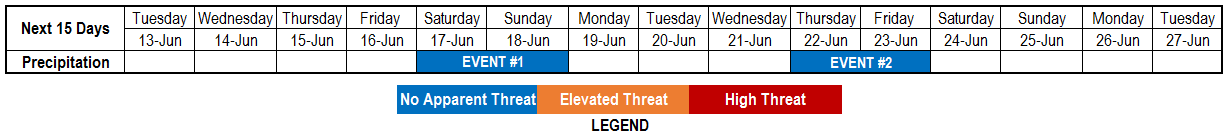
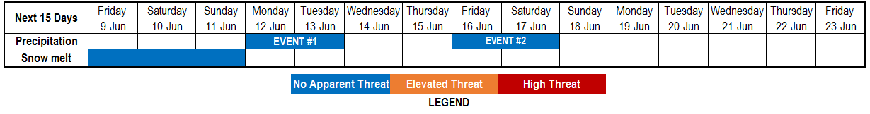
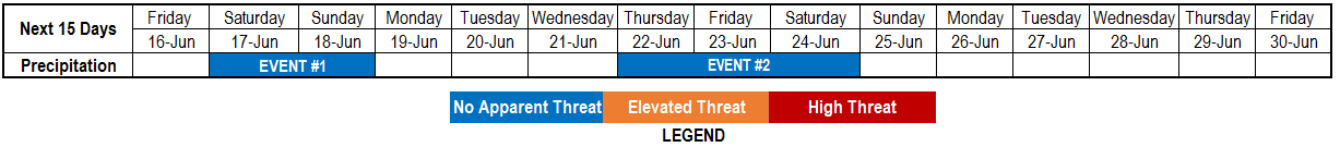
Valid Dates: 6/16 – 6/30
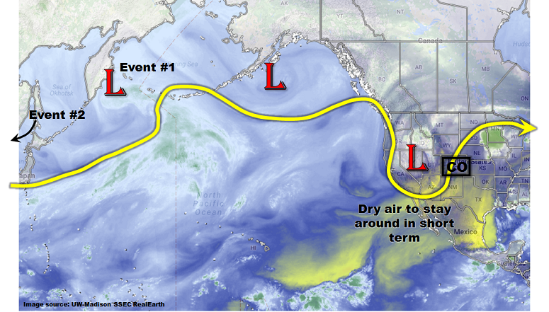
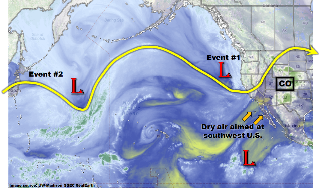
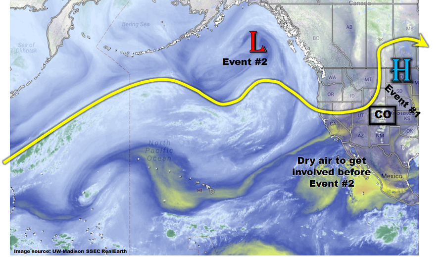
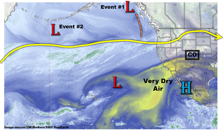
This afternoon’s North Pacific Ocean water vapor imagery, below, continues to show a zonally oriented, strong jet stream extending nearly to the North American coastline. While there has been a lot of variability in weather across the northwest U.S., our weather in Colorado has been quieter, in large part due to the substantial amount of dry air that has been entrained from the southwest. This large reservoir of dry air is easily seen west of the Gulf of California and will continue to affect our state over the next 7-10 day period. However, areas west of the Continental Divide will be disproportionately impacted, because eastern areas will see episodes of moister air drawn in from the Gulf of Mexico.
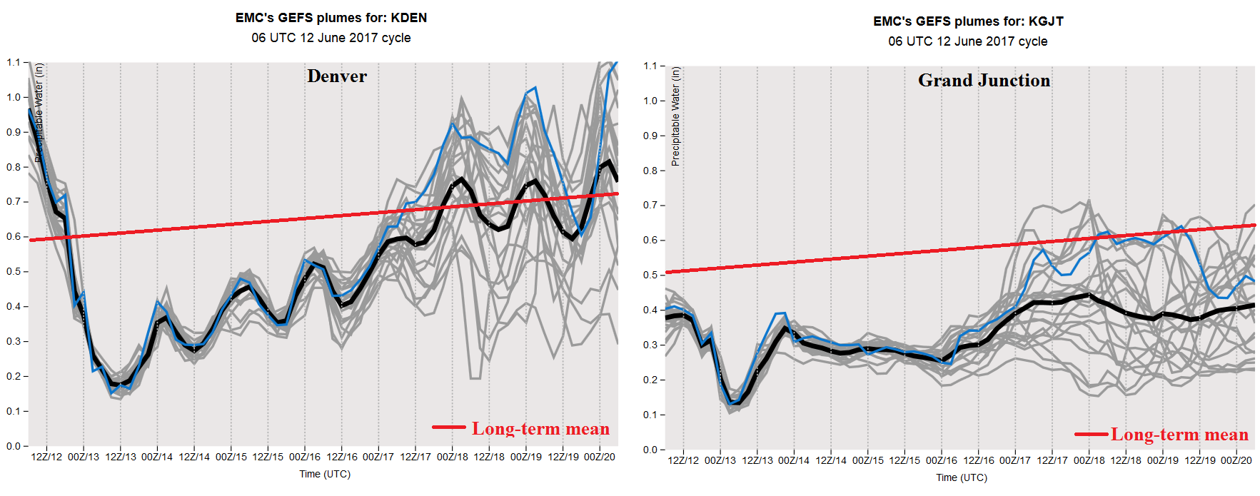
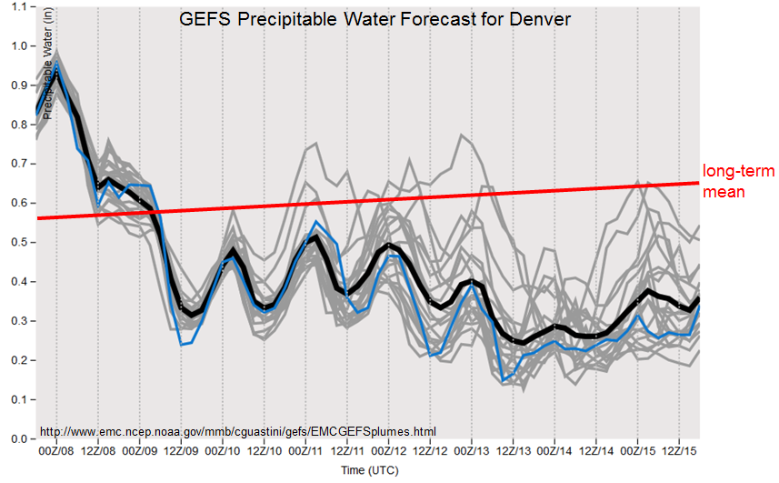
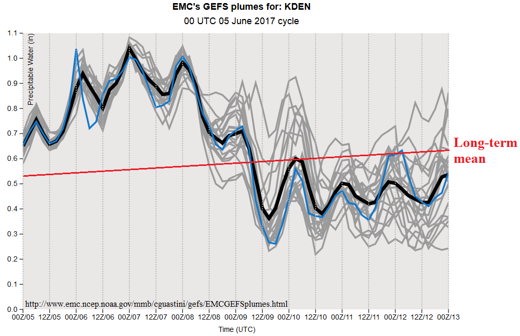
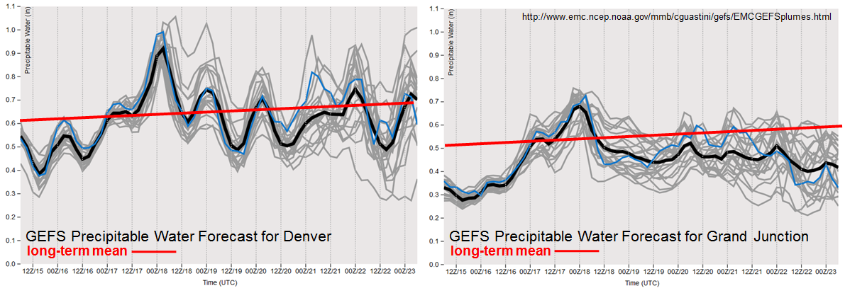
While we have identified two precipitation events for this 15-day Flood Threat Outlook, it is becoming more likely that hot and dry weather will continue to dominate headlines, especially for western Colorado. A look at the precipitable water (PW) plumes from the GFS ensembles highlights this story. Note at Denver, PW is expected to briefly peak just under 1 inch and then retreat back to its seasonal normal range. On the contrary, at Grand Junction, after a brief spike to 0.7 inches (though this will be dominated by mid-level moisture that will carry little odds of precipitation), values retreat to below seasonal normal level through 6/23, and even thereafter. In all, due to the combination of above normal temperatures, below normal precipitation over the past 2 weeks and little to no precipitation over the next 10-15 days, it is likely that short-term drought conditions will develop west of the Continental Divide.
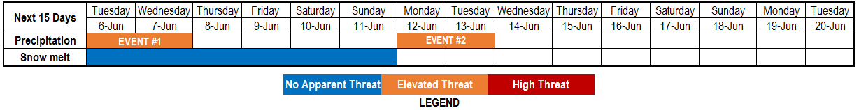
Below we describe each of the two identified precipitation events in more detail.
Event #1: Saturday (6/17) and Sunday (6/18)
Isolated, short-term heavy rainfall possible but No Anticipated Flood Threat
A Pacific-origin cool front will come in from the north, being supported by a shortwave feature embedded within a seasonably strong jet stream. For Colorado, the main chance of precipitation will arise due to the low-level forcing as aloft, a weak ridge will remain the status quo. A modest amount of moisture will be available for isolated to scattered shower and storm activity both days. Using climatology as guidance, the highest chances for precipitation will be in the foothills above 6,000 feet east of the Continental Divide. Additionally, some storms may develop along the frontal feature towards the Kansas border. However, we do not expect widespread precipitation exceeding 1.0 inch, and thus, a flood threat is currently not warranted. Stay tuned to daily Flood Threat Bulletins for a more detailed assessment each morning.

Event #2: Thursday (6/22) and Saturday (6/24)
Isolated, short-term heavy rainfall but No Anticipated Flood Threat as subsidence from ridge aloft negates low-level moisture
There will not be much change in the atmospheric pattern from Event #1 to #2 as a strong jet will continue to stay north of Colorado, with a subtropical jet continuing the feed of dry air from the southwest. A ripple in the jet stream is expected to send a cool front and weak upper-level dynamics across eastern Colorado starting Thursday and Friday, with residual moisture supporting more activity on Saturday. The nature of the activity will be similar to Event #1. On Thursday and Friday, expect isolated to scattered showers and weak thunderstorms mainly in northeast Colorado as well as the higher elevations of south-central Colorado. On Saturday, expect more isolated shower and storm activity mainly in the Southeast Mountains and Southeast Plains. In all, we do not foresee widespread amounts above 1 inch. While there will likely be short-term heavy rainfall, it will be too brief and limited in coverage to warrant a flood threat.