Issue Date: Monday, June 5th, 2017
Issue Time: 3:00PM MDT
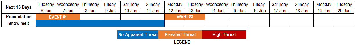
Valid Dates: 6/6 – 6/20
This afternoon’s water vapor imagery, shown below, continues to place an elongated and strong Pacific jet stream that stretches almost to the west coast of North America. At the far eastern end of the jet, the flow becomes more amplified as can be seen by a strong low in the Gulf of Alaska and modestly strong ridge currently centered over the Great Plains. These two features will be the main players impacting Colorado’s weather in this edition of the 15-day Flood Threat Outlook.
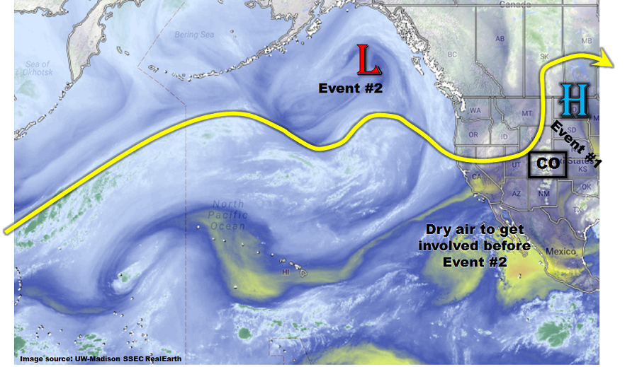
The first precipitation event will be provided courtesy of the return flow being brought into Colorado by the high-pressure ridge. This is well depicted by the Precipitable Water (PW) forecast for Denver from the Global Forecast System Ensembles, shown below. The long-term mean value for central Colorado is about 0.55 to 0.65 inches (rising slowly through the period). Note that the next 72 to 84 hours will have substantially above normal PW, approaching or exceeding 1.0 inch. PW is a good predictor of heavy rainfall likelihood in Colorado (not true elsewhere, especially in the eastern United States), warranting an Elevated flood threat for Event #1 for isolated flash flooding.
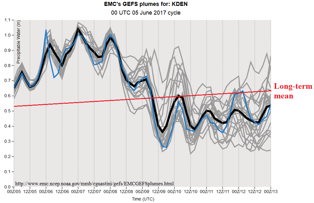
The PW forecast chart also shows a large drop in moisture level in anticipation of Event #2 as it approaches the state by Sunday 6/11. This will occur due to west-southwesterly flow advecting dry air from the subtropical eastern Pacific Ocean. Thus, although the disturbance accompanying Event #2 will bring strong dynamics, it will be handicapped by a lack of moisture, at least initially. Instead, a 24-48 hour period of elevated fire risk will likely result due to the combination of hot temperatures, gusty winds and low relative humidity. As the disturbance rotates across Colorado, it will begin to draw more moisture from the Gulf of Mexico and at least 1 day of heavy rainfall will be possible, warranting an Elevated flood threat.
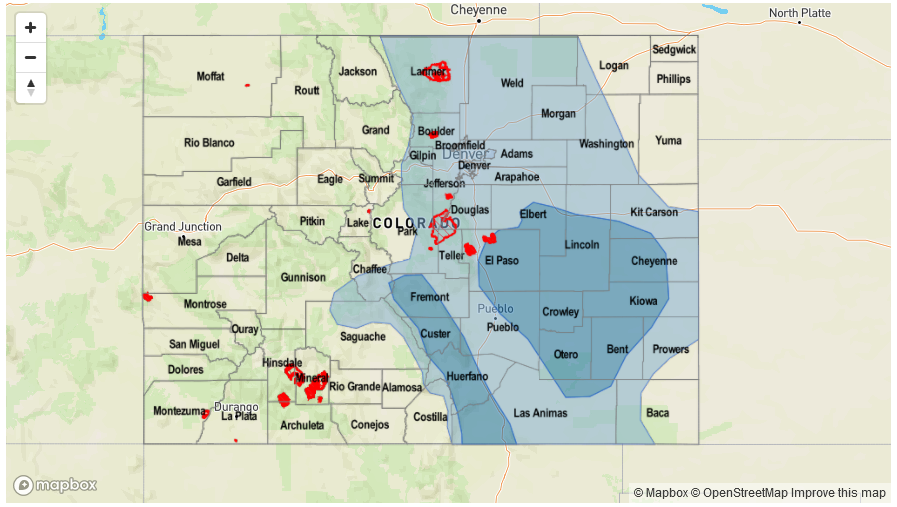
Finally, we are closely monitoring the state’s snow pack. With a multi-day period of warm to hot weather, we expect that snow melt will slowly come to an end by the end of this week. At this time, no flood-related impacts are anticipated statewide.
Below we describe each of the two identified precipitation events in more detail.
Event #1: Tuesday (6/6) and Wednesday (6/8)
Elevated Flood Threat as isolated heavy rainfall is likely due to high moisture content
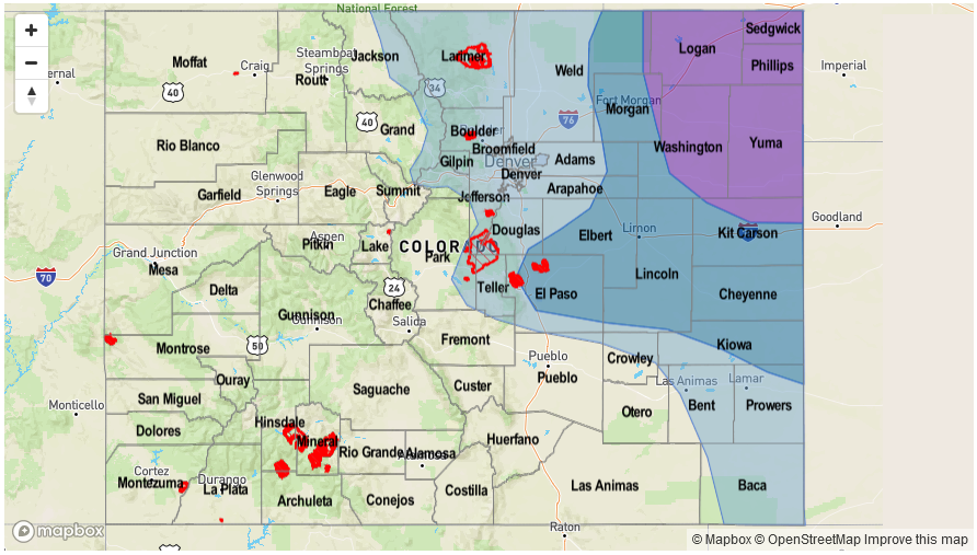
Even though a ridge of high pressure will be overhead, plenty of residual moisture will continue to fuel daily rounds of showers and thunderstorms east of the Continental Divide. The vast majority of the rainfall will be of light to moderate intensity, in the 0.25 to 0.5 inch range. However, in parts of southeastern Colorado, the combination of plenty of instability and slow storm motion will result in isolated pockets of rainfall approaching 1.5 inches per hour. Isolated flash flooding will be possible, especially in the foothills of the Southeast Mountains and Raton Ridge, where 1 inch or less of rainfall per hour is enough to cause runoff capable of flooding. It is possible that this threat will continue into Thursday, though the storm coverage looks to be to minimal to include in the threat presently.

Event #2: Monday (6/12) and Tuesday (6/13)
Elevated Flood Threat especially in eastern areas as moisture returns after a dry period; severe weather is a possibility
As mentioned earlier in the discussion, the dynamics responsible for Event #2 are expected to move overhead by Sunday, 6/11. However, moisture levels will be too low to support a flood threat (or even precipitation chances). By Monday, return moisture is expected to make it into far eastern Colorado, which supports the chance of isolated heavy rainfall exceeding 1.5 inches per hour. Severe weather, including large hail and possibly tornadoes is a possibility with this system. By Tuesday, higher moisture should find its way farther west and support another afternoon of heavy rainfall in the Front Range, Palmer Divide and areas to the north and east. Heavy rainfall approaching 1 inch per hour appears possible, and severe weather may accompany the strongest cells. Collectively, however, the disturbance should move quickly enough to limit anything beyond isolated flash flooding.