Issue Date: Monday, September 21, 2017
Issue Time: 1PM MDT
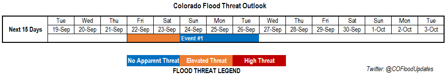
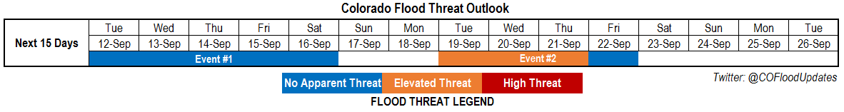
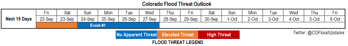
Valid Dates: 9/22 – 10/6
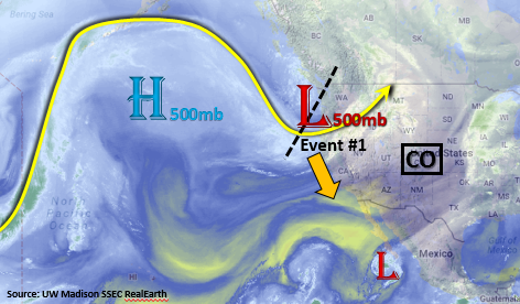
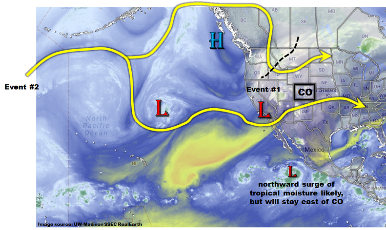
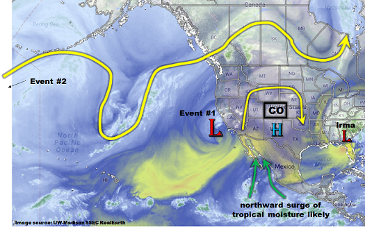
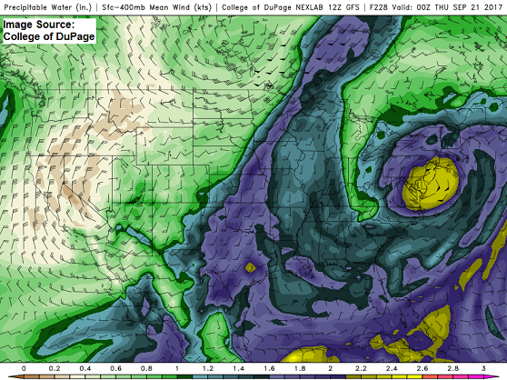
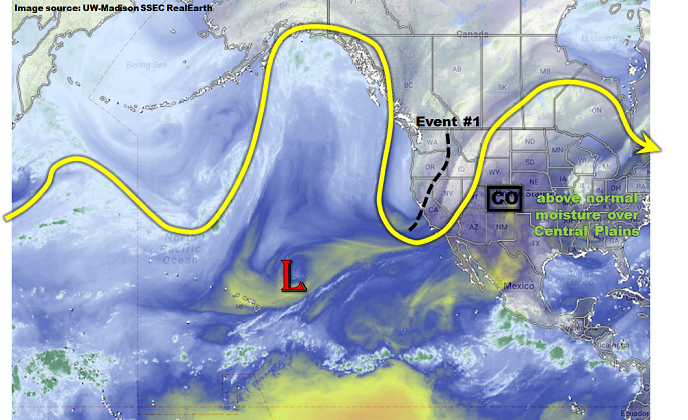
This afternoon’s water vapor image of the eastern Pacific and western North America shows a high amplitude pattern over and to the west of Colorado. A high amplitude pattern sometimes implies that disturbances will be slow to move eastward, and such is the case today. The strong trough that has now entered the western US coast will very slowly trek eastward and provide a long duration precipitation event (Event #1) for most of Colorado. In addition, a particularly moist airmass has developed over the US Central Plains. Precipitable Water (PW) values up to 2 inches will stream northward into OK, KS and NE. While we certainly do not expect these kind of values to make it into Colorado (which would be record highs even during the summer), some of this moisture will be available to draw from.
Thus, we expect a very active period over the next 5 days or so. Initially, there will be an elevated fire danger across central CO due to high winds and low relative humidity. By Saturday, colder air will slowly over take the state from the northwest. Friday and Saturday (and possibly Sunday) will feature elevated chances of severe weather across the far eastern Plains, and possibly as far west as the Palmer Ridge. By Sunday, much cooler/colder air will overtake most of the state, changing the dominant precipitation to stratiform, as opposed to convective, rain and snow showers.
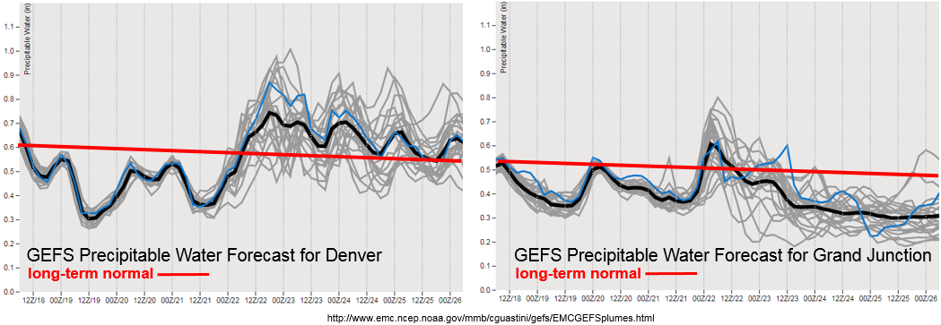
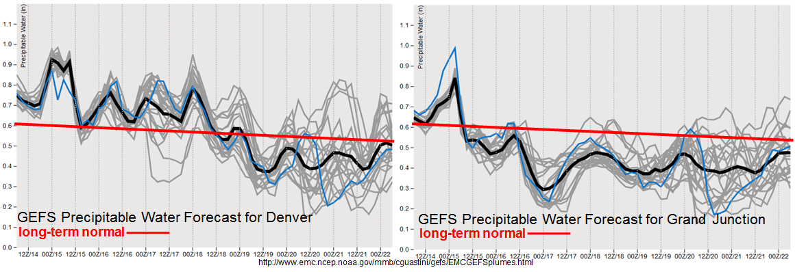
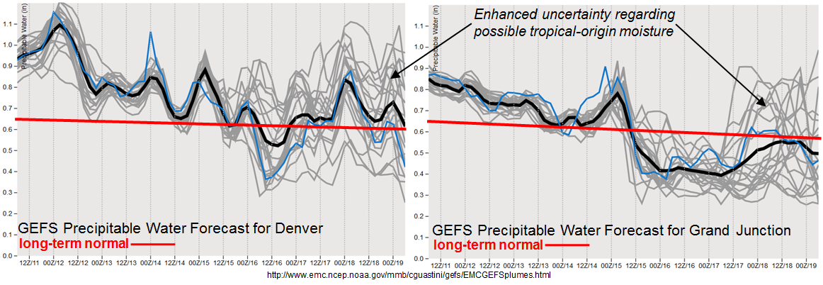
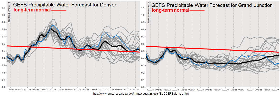
In terms of the flood threat, the forecasted PW plumes at Denver and Grand Junction, below, show a very large moisture gradient developing by this weekend. For example, by late Saturday, Denver’s PW could be as high as 0.9 inches while Grand Junction is expected to remain below 0.6 inches.
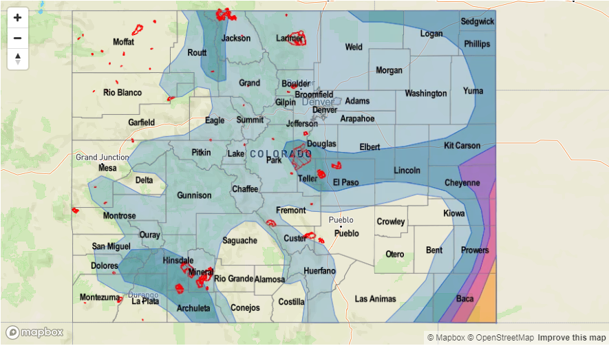
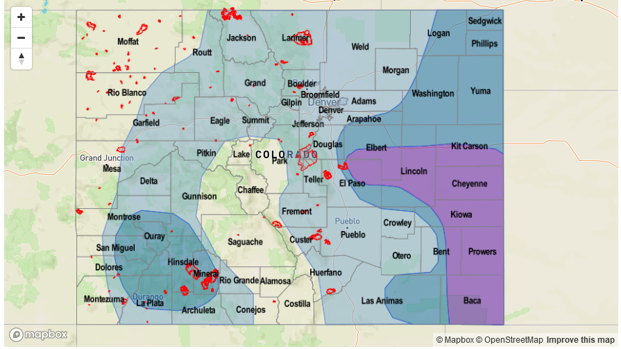
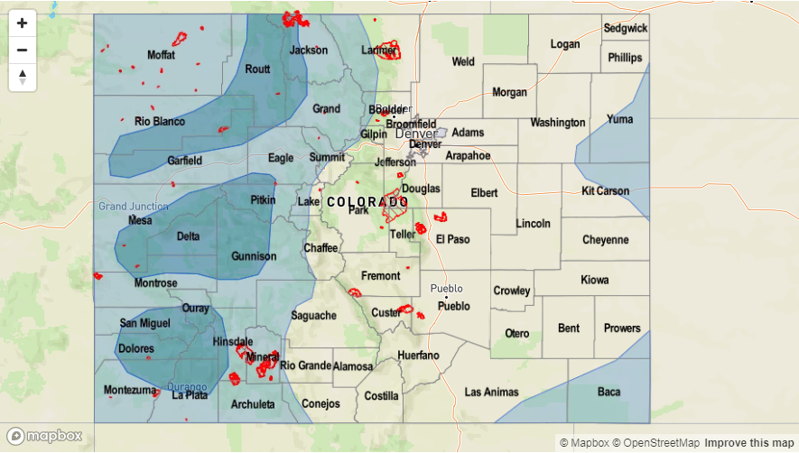
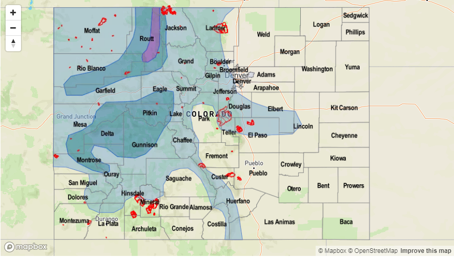
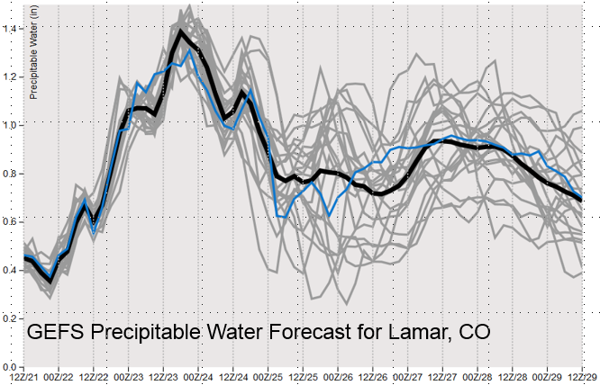
In fact, just these two sites do not tell the entire story. The forecasted PW at Lamar (below) shows values as high as 1.4 inches. While there is no long-term record of PW here, data from Goodland, KS (which is almost always moister than Lamar) shows that during late September, the 90th percentile of PW is about 1.1 inches. Thus, it is safe to say that the forecast values are well above average and likely close to record values. In addition, due to the slow movement of the trough, we expect a high potential of thunderstorm training. Although the higher flood threat remains just to the east of CO into KS and OK, an elevated flood threat will exist for southeast CO on Friday, Saturday and possibly Sunday for isolated flash flooding in southeast Colorado. Check back for our daily Flood Threat Bulletins for the most updated information.
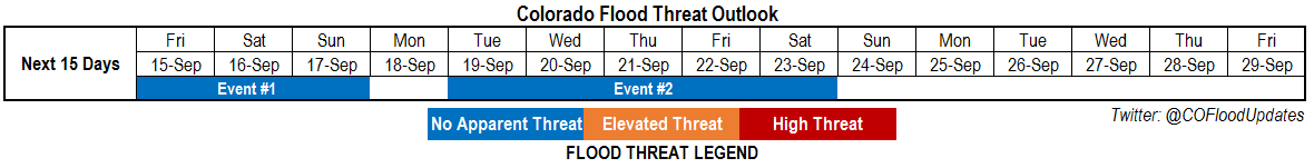
Below we describe the identified precipitation event in more detail.
Event #1: Friday (9/22) through Wednesday (9/27)
Early Elevated Flood Threat for Southeast Plains transitioning to scattered rain and snow later in the event
A prolonged period of active weather is expected across Colorado starting on Friday. Multiple rounds of severe thunderstorms are expected in the Southeast Plains (and possibly Palmer Ridge) on Friday and Saturday, with decreasing chances by Sunday. Gusty straight-line winds and large hail (up to 2.5 inches) are expected to be the main threat. Isolated heavy rainfall will be likely in mainly far southeast Colorado on Friday and Saturday. Max 1-hour rain rates up to 2.5 inches will be possible, with max 3-hour amounts up to 4 inches. Training of storm cells could lead to a prolonged threat of heavy rain. Isolated field and road flooding appears likely, with isolated flash flooding also possible though only localized impacts are expected. Riverine flooding on the Arkansas River basin is NOT currently expected, but will be likely farther east in OK and KS.
By Sunday, cooler air will overtake most of the state leading to a sharp reduction in precipitation rates. Mountain snow levels will drop to valley floors especially north of I-70. Several inches of snow accumulation is expected, mainly north of I-70. Scattered rain and snow showers are expected to continue through Wednesday as the upper-level disturbance sticks around the state.