Issue Date: Monday, June 8th, 2020
Issue Time: 2:45PM MDT
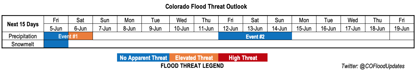
Valid Dates: 6/9 – 6/23
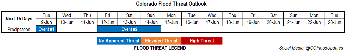
Event #1 is already underway, and the forecast details can be found in today’s FTB. Tomorrow morning, ongoing showers and snowfall will start to move from the Front Range/Urban Corridor into the eastern plains. Rain rates should be gradual enough that flooding is not anticipated at this time, and precipitation should exit the eastern border by late afternoon into the early evening. Behind the front there will be some respite from the heat with northerly surface winds. Highs tomorrow afternoon are expected to be in the 70Fs over the valleys/plains, high 60Fs over the Urban Corridor and 50Fs over the mountains with skies gradually clearing. There’s a break in rainfall from Wednesday to Thursday as the ridge begins to rebuild northward and the Low strengthens over the Gulf of Alaska. There will also be an increase in high temperatures each afternoon with highs 10-15F warmer by Friday.
Event #2 begins on Friday as the Low moves into the Pacific Northwest and shifts the ridge eastward. This will allow some moisture to creep northward from the Gulf of Mexico, and resume diurnally driven thunderstorms over the southern high terrains. Additionally, a lee trough sets up over the eastern plains on Saturday and Sunday, so a couple severe storms may be possible over the Southeast Plains in this time frame. Of course, this will only be possible if the dry line sets up over Colorado and not to the east over Kansas.
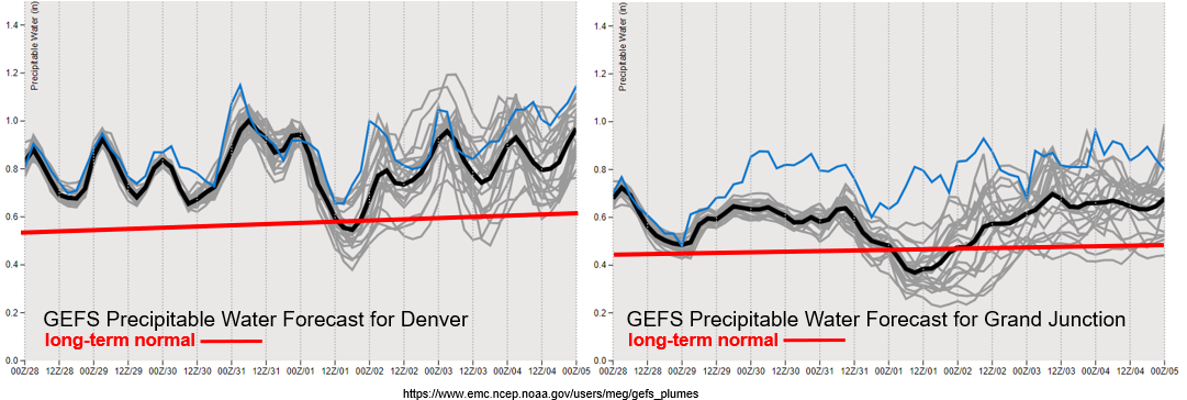
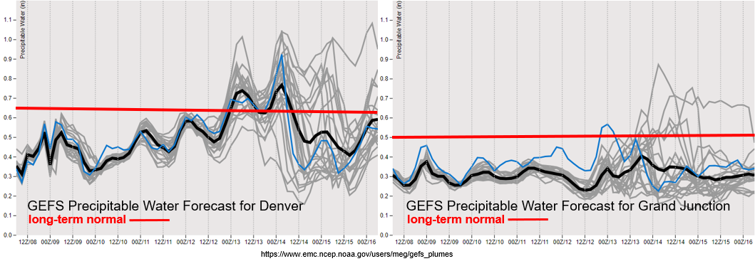
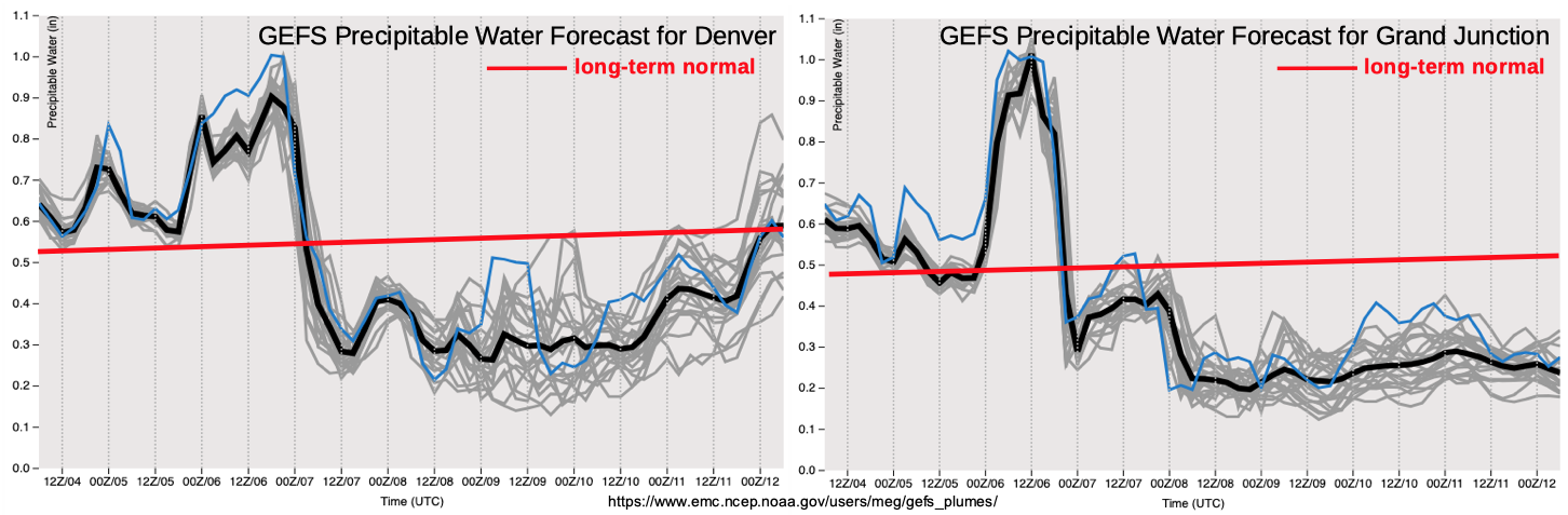
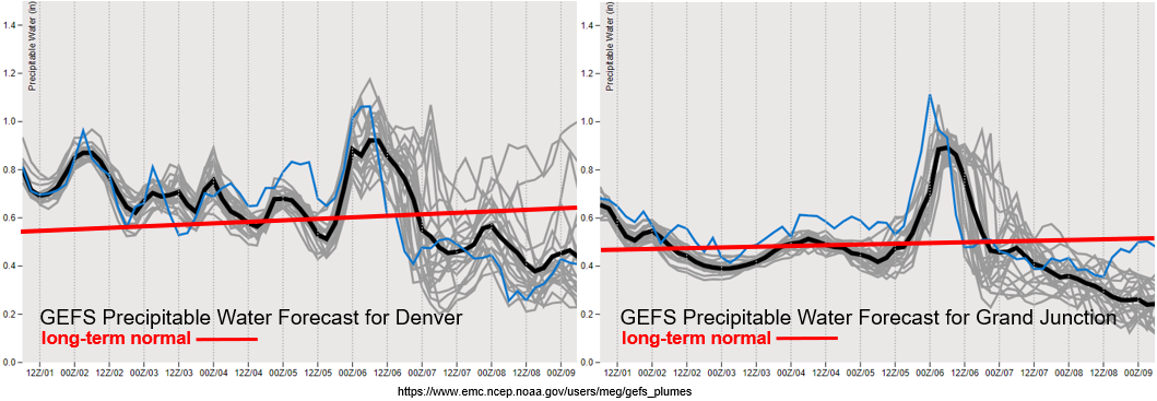
You can see that nice moisture creep northward from the Gulf of Mexico for Event #2 in the Denver PW forecast (left). There’s quite a bit of uncertainty over western Colorado as to how much and how far north the moisture will travel. We’ll likely only see an uptick in moisture over the eastern San Juan Mountains with the highest rainfall totals along and near the Continental Divide.
Another noticeable feature in the images below are the below average PW values both east and west to start this week. With the base of the trough moving through the state tomorrow, high surface winds are anticipated once again. This will likely create Red Flag Warning conditions across southern Colorado (back west), so be sure to tune into the FTB and your local NWS offices for more details. A High Wind Watch is also in place over the eastern plains on Tuesday. Less wind is forecast for Wednesday and Thursday under the building ridge, so critical fire weather is not anticipated at this time.
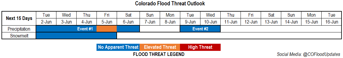
Event #1: Tuesday (6/9)
No Apparent Threat as the base of the trough and associated rainfall moves eastward.
Not thinking very much instability will be able to build tomorrow. That means ongoing showers will only slightly increase in rain rate efficiency during the afternoon, and flooding should be avoided. Overall, it will be a nice wetting rain for the eastern plains with the most widespread rainfall over the Northeast Plains. Areas over the Southeast Plains will likely receive between 0.25 and 0.50 inches of rainfall with isolated pockets up to 0.75 inches. Totals further north are expected to be slightly higher. Also, prepare for severe surface winds over the eastern plains tomorrow afternoon. Northerly gusts up to 65 mph will be possible and surface winds are forecast to be in the 35 to 45 mph range.
Event #2: Friday – Sunday (6/12 – 6/14)
No Apparent Threat as next trough passes through Colorado, dislodging the ridge eastward.
This will be another system that moves through the state this weekend. Enough moisture should make its way northward for storms to return to the southern mountains each afternoon. Steering flow will likely push the storms into the adjacent plains. Best chance for wetting rains will be on Saturday, and a couple severe storms may be possible over the eastern plains associated with a developing surface low (lee trough). We will continue to watch and update the forecast in Thursday’s FTO. At this time, there is No Apparent flood threat from the rainfall due to limited moisture and fast steering flow. With the jet once again overhead, critical fire weather will likely return for northwest Colorado.
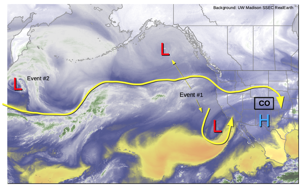
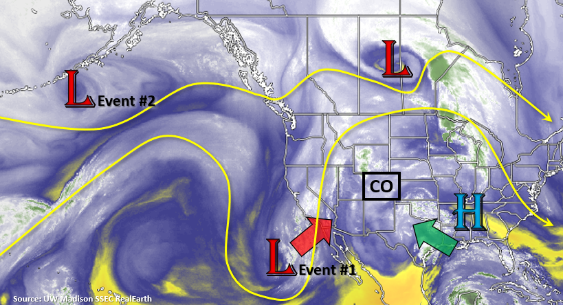
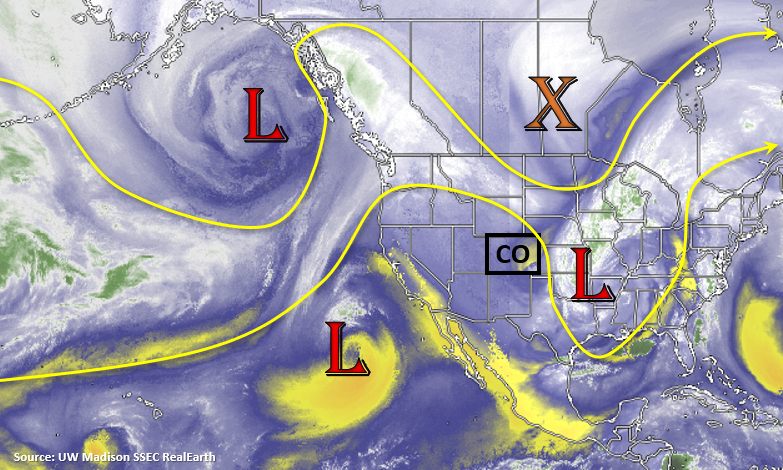
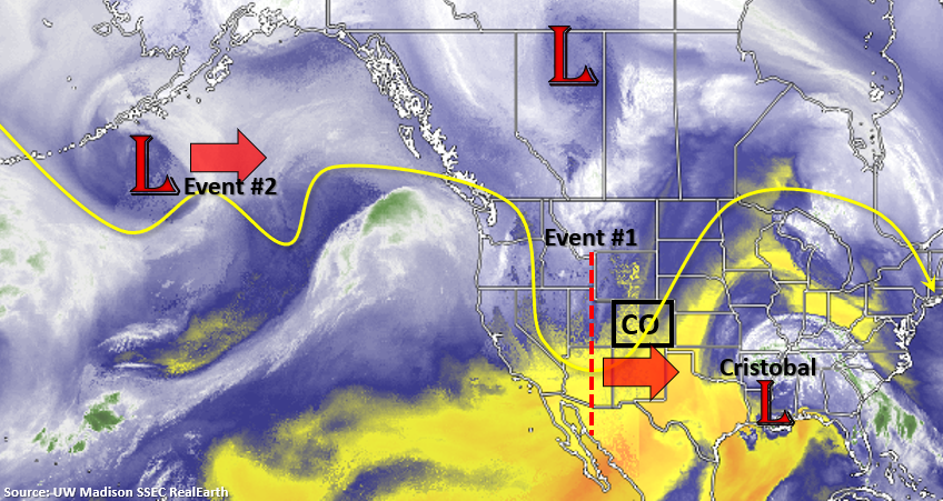
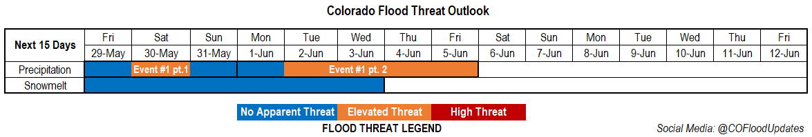 We’re currently in the semi-omega pattern discussed in Monday’s FTO. A persistent low continues to hold on over the Midwest, which has provided northerly flow across the state. Starting tomorrow, this low begins to merge with the vorticity max to the north of the border. Paired with the incoming low off the coast of CA, the omega pattern continues to hold on and places Colorado under a highly amplified ridge for Event #1 (part 1). The low to our west begins to move towards the Pacific Northwest later this weekend and another vorticity max shoots south off the backside of the low, and lands off the coast of CA. This will keep the ridge intact over the state for Event #1 (part 2); however, Colorado will be on the west side of the ridge, so more southwest flow is forecast aloft.