Issue Date: Thursday, May 28th, 2020
Issue Time: 2:35PM MDT
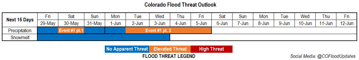
Valid Dates: 5/29 – 6/12
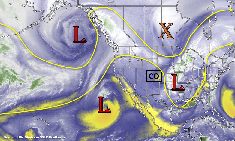
 We’re currently in the semi-omega pattern discussed in Monday’s FTO. A persistent low continues to hold on over the Midwest, which has provided northerly flow across the state. Starting tomorrow, this low begins to merge with the vorticity max to the north of the border. Paired with the incoming low off the coast of CA, the omega pattern continues to hold on and places Colorado under a highly amplified ridge for Event #1 (part 1). The low to our west begins to move towards the Pacific Northwest later this weekend and another vorticity max shoots south off the backside of the low, and lands off the coast of CA. This will keep the ridge intact over the state for Event #1 (part 2); however, Colorado will be on the west side of the ridge, so more southwest flow is forecast aloft.
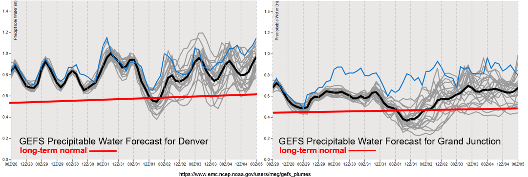
Timing of moisture surges and strength is a little different between models, but it looks like moisture is maintained over the state through the end of next week as indicated by the average PW (black line) compared to climatological PW (red line). For Event #1 part 1, Saturday looks to have the heaviest rainfall potential due to higher PW values, the vorticity maximum ejecting northward to our west, and slow steering winds aloft. Thus, the Elevated flood threat.
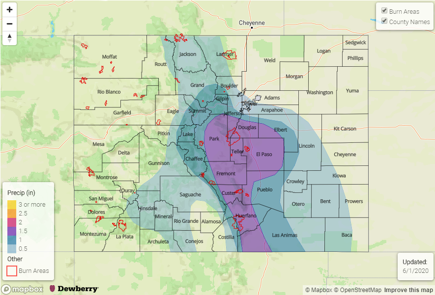
There is a slight dip in available moisture on Monday due to the location of the ridge axis, but by Tuesday, PW increases statewide. It’s a bit difficult to tell how much and where moisture under the ridge will pool next week as indicated by the spread in PW values (gray lines). However, the above climatology values and pattern suggest rainfall each day. Slow storm motion, on and off shortwaves, lee troughing, and saturated soils by the week’s end all point to an Elevated flood risk for this event. This is especially true if storms track over recent burn areas for multiple days. Additionally, bankfull conditions over smaller streams and rivers are anticipated after this weekend’s warm up over northern and central Colorado. Any heavy and widespread rainfall may cause minor low-land flooding issues for these areas by the end of next week. This will be watched closely over the next week and the threat will be added to the daily Flood Threat Bulletin if it’s needed.
Event #1: Friday – Sunday (5/29-5/31)
Elevated Threat as moisture and dynamics peak on Saturday.
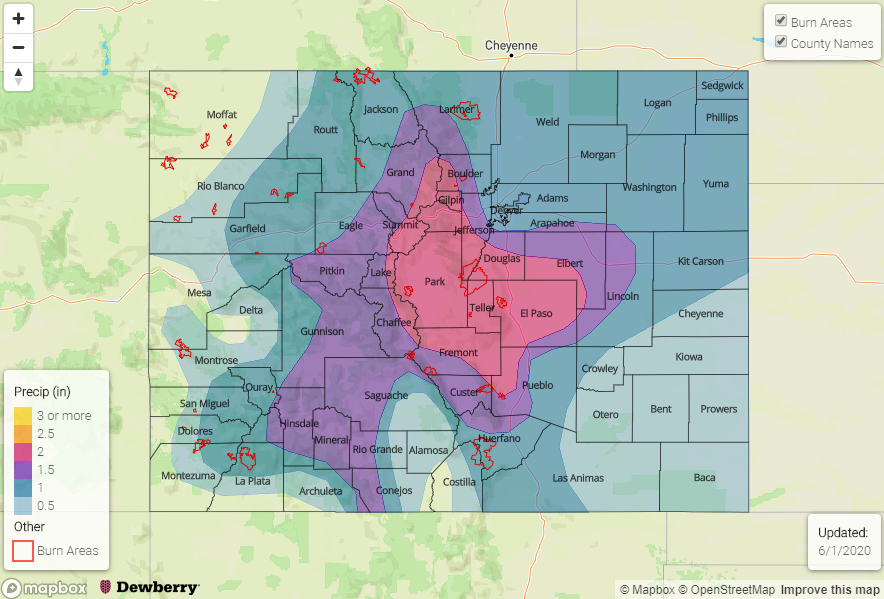
For the most part, this event looks like a mountain event with some activity spreading into the immediate, adjacent eastern plains. With storm motion more from the north, best accumulations over the eastern plains will most likely be along and south of the Palmer Ridge. More scattered storms with wind gusts are anticipated on Friday and Sunday. Saturday, there could be some small hail under the stronger storms, but the main threats from storms will be local, heavy rainfall and gusty outflow winds. Burn scars over the southern half of Colorado will be watched closely on Saturday. This includes the 416 burn area, although it is likely the higher moisture will be along and east of the Divide in the San Juan Mountains.
Event #2: Monday – Friday (6/1-6/5)
Elevated Threat as the amplified ridge continues to hold over the state and shortwaves move through the southwest flow.
It’s a bit difficult to tell which days will be the higher flood threat days this far out. However, dynamics (shortwaves, lee troughing, etc) could align equally on each of the four Elevated flood threat days. Right now, I’m not expecting to issue a threat each day, I just wanted to capture the potential time frame of the heavy rainfall threat. With rainfall anticipated over the mountain multiple days in a row, saturated soils also become a concern if enough subtropical moisture makes its way north. This is especially true over recent burn areas and areas experiencing peak runoff (north and central Colorado). The good news is this event will likely bring rainfall back into western Colorado and southern Colorado, which is currently in a D3 drought. If the southwest flow is stronger (ridge axis slightly east of the state), storms will likely move into the adjacent plains. This could bring another round of beneficial moisture to crops and drought areas as well as some severe weather. Be sure to tune back in on Monday as models will likely come back into better agreement, which will allow the details of the event to be better defined.