Issue Date: Thursday, June 4th, 2020
Issue Time: 11:15AM MDT
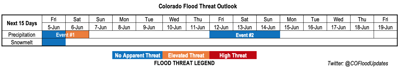
Valid Dates: 6/5-6/19
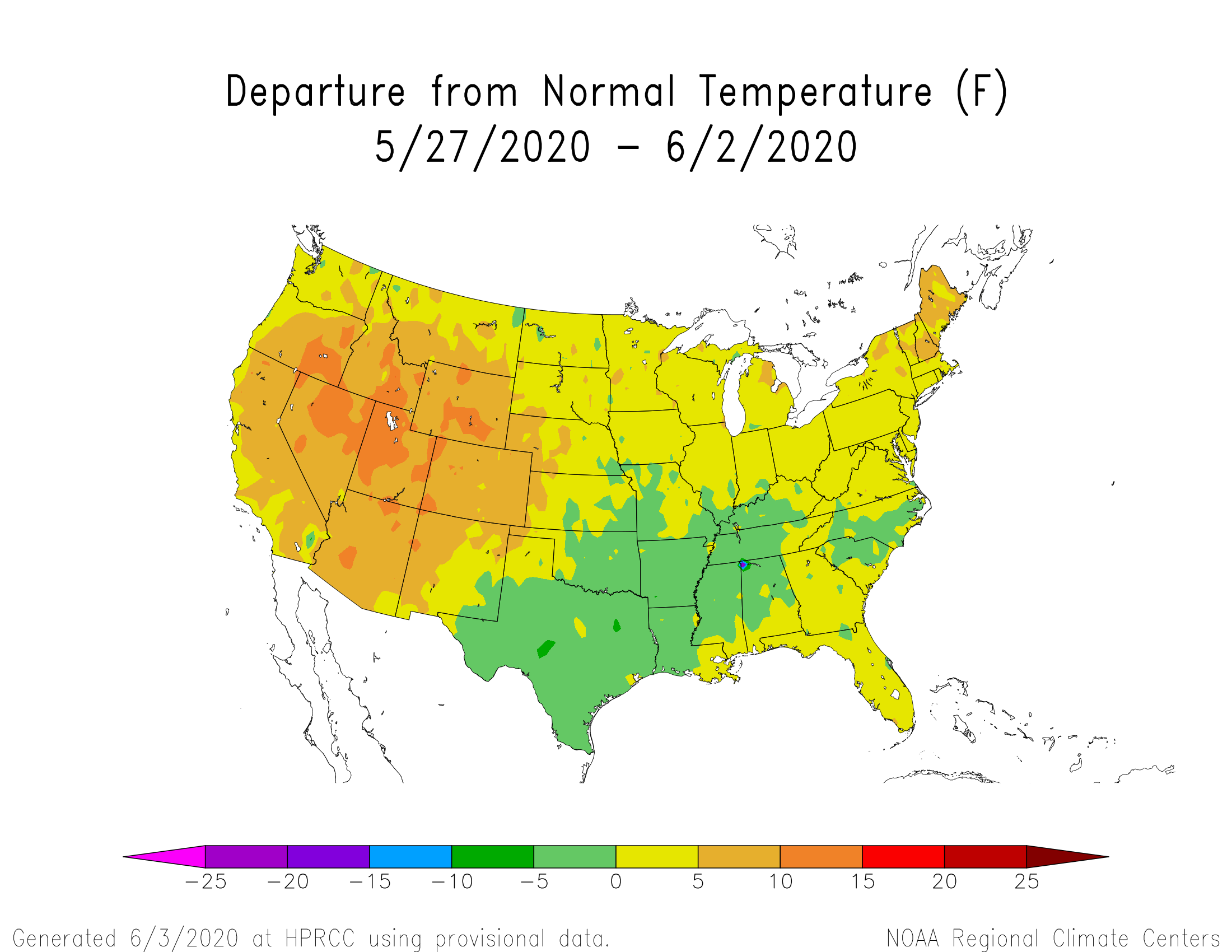
June has started where May left off: very hot with limited precipitation, despite above normal moisture in the air. The 7-day temperature departures from normal, provided by the High Plains Regional Climate Center, shows all of Colorado at least 5 degrees F above normal. Small portions of western Colorado are over 10 degrees F above normal!
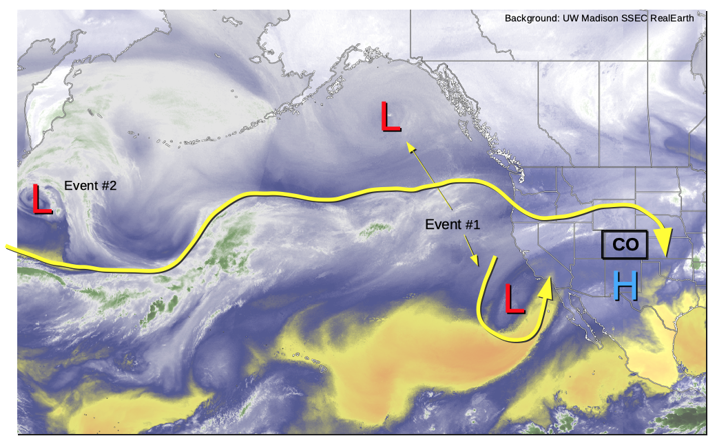
Fortunately, as shown in this morning’s water vapor image, below, substantial change is on the way. A surprisingly persistent cutoff low has been stalled off the southwest US coast for days. As a large trough digs into western North America, it will finally force the cut-off low to move rapidly northeastward beginning Friday. The result will be Event #1: a 24-36 hour period of strong dynamical lift, along with a plume of well above normal moisture content and atmospheric instability. Much welcomed widespread precipitation will cover central and western Colorado, though only briefly. Following this event will be drastically cooler weather statewide, more reminiscent of early May.
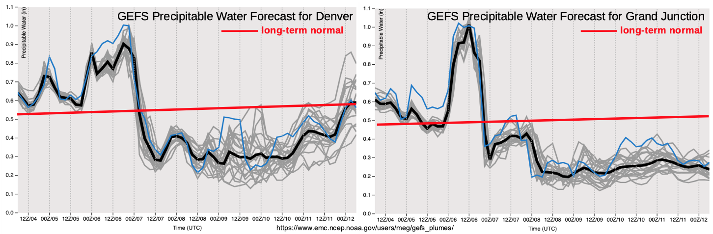
As shown in the forecast Precipitable Water (PW) plumes, below, values of up to 1.0 inch are expected across most of central and western Colorado during the brief Event #1. This is about double the normal value at Grand Junction for this time of year. In fact, the record value for early June is right around 1.0 inch, so certainly an unusual amount of moisture. However, there are two main factors that will act to limit the rain rates, and thus, the flood threat. First, the storm motions are expected to be extremely fast, above 30mph due to a strong pressure gradient aloft. This, coupled with limited instability of perhaps up to 700 J/kg, implies brief heavy rainfall will be likely, but its duration will not be long enough to support flooding. Second, quite simply, climatology. It is very unusual for western Colorado to get heavy rain before the monsoon season due to a poor juxtaposition of required factors (such as limited instability, fast storm motion, insufficient moisture fetch, etc). Nonetheless, there will be an increased flood threat for burn areas as detailed in the specific discussion below.
Following Event #1, there will be a 3-5 day period of below normal temperatures and low moisture with limited, if any, rainfall statewide. Thereafter, another large-scale trough is expected to approach the western US coast. However, the amount of moisture it has to work with is uncertain, and while we have enough confidence to identify an Event #2, there is No Apparent flood threat at this time.
Below we describe each of the two identified precipitation events in more detail.
Event #1: Friday (6/5) through Saturday (6/6)
Elevated Threat on Saturday especially for the 416 and Lake Christine burn scars
A surge of moisture accompanied by strong atmospheric dynamics will result in scattered to widespread showers and thunderstorms beginning Friday afternoon and lasting into Saturday. Friday’s precipitation is expected to be benign, as the dynamical support will still be too far away. Up to 0.25 inches of rainfall will be possible across the western higher elevations.
On Saturday, expect widespread showers and weak thunderstorms mainly west of the Continental Divide. Max 1-hr rainfall up to 0.6 inches will be possible with isolated 24-hr totals of up to 1.25 possible across the San Juans and Central Mountains. There will likely be at least a Low flood threat needed for the 416 and Lake Christine burn scars on Saturday. However, at this time, it appears that other areas will avoid flooding. Check back to the daily Flood Threat Bulletins for more updates. In addition to the rainfall, there will be very gusty winds up to 65mph in favored higher elevation wind “tunnels” as well as with the strongest thunderstorms.
East of the Continental Divide, especially over southeast Colorado, expect very hot and windy weather. It is possible that Red Flag warnings may be needed, especially downwind of the Sangre de Cristo Mountains.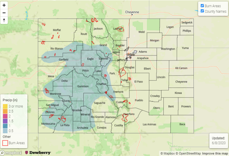
Event #2: Friday (6/12) through Sunday (6/14)
No Apparent Threat as dynamics present, but moisture return uncertain
After a prolonged stretch of cooler and drier weather, another large-scale disturbance will approach Colorado from the northwest. It will take time to advect high moisture into the state but scattered showers and storms look increasingly likely beginning Friday, 6/12. However, moisture content is uncertain and it does not appear this system will be able to tap into deeper moisture from the Gulf of Mexico. Thus, at this time, rainfall looks to stay below 0.5 inches and there is No Apparent flood threat.