Issue Date: Thursday, August 19th, 2021
Issue Time: 1:30PM MDT
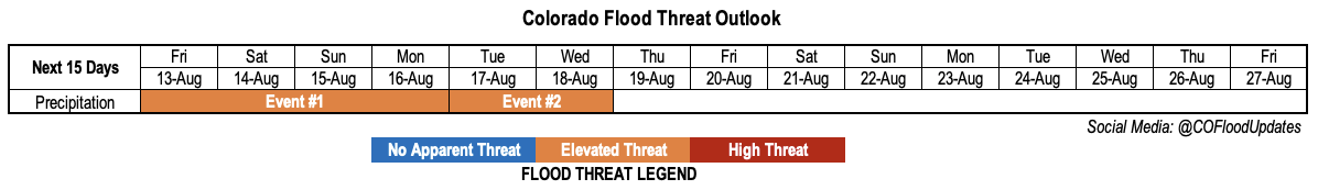
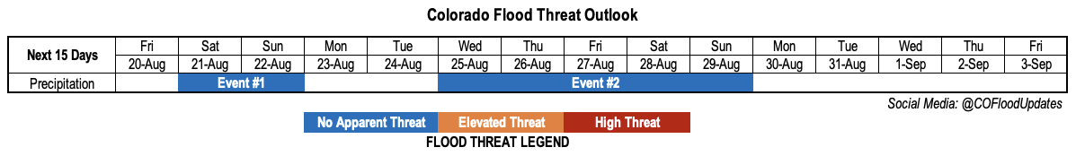
Valid Dates: 8/20-9/3
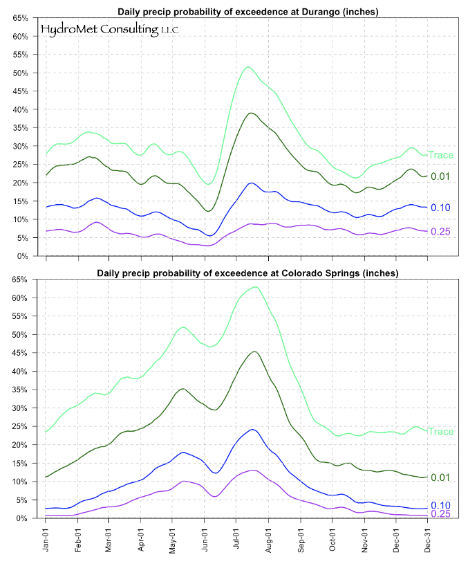
With the calendar progressing into late August, it is common knowledge that the monsoon season begins to quiet down. But what is less well known is how quickly this transition occurs. The charts below show average probability of precipitation in Colorado Springs (which surprisingly to many lies in an area that experiences one of the most pronounced monsoon spikes in the state), as well as Durango, which lies near Colorado’s monsoon hotspot of the San Juan Mountains. Although both locations are at a relatively low elevation of ~6,000 feet and miss out on more frequent higher-elevation summer rainfall events, both data records are superb in their length (100+ years) and quality. The thin green line shows that peak daily precipitation probabilities occur in mid-July, and reach the 60-65% range at Colorado Springs (very impressive by Colorado standards) and just above 50% at Durango. However, by early September, precipitation probabilities drop to below 40% on their eventual decline into the 25-30% range by the fall dry season. The reason why this data is relevant today is that hereafter, the probability of widespread monsoon-related rain, as is occurring today, drops off rapidly so savor it!
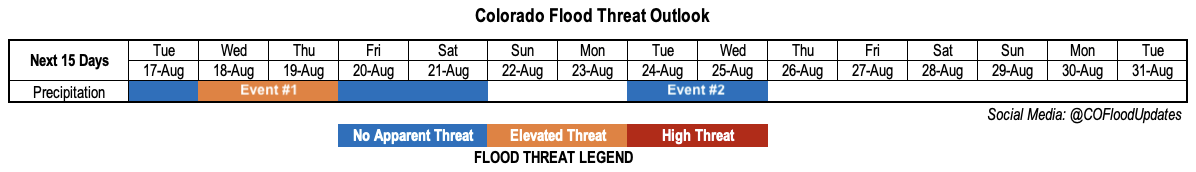
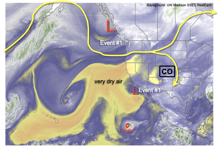
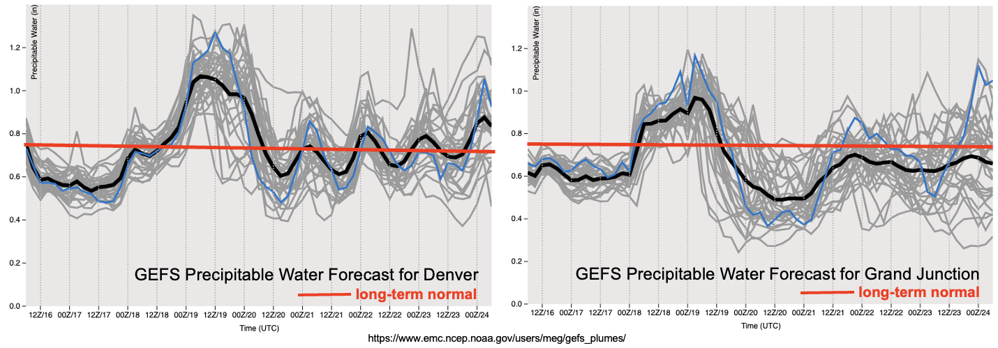
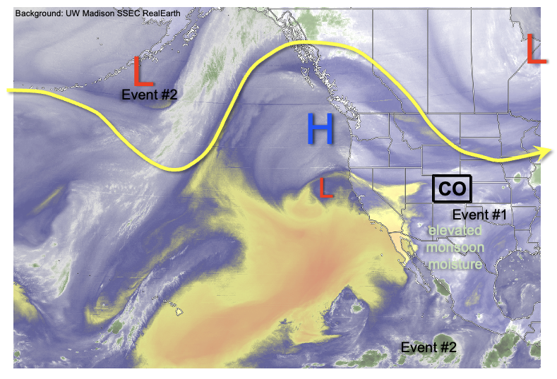
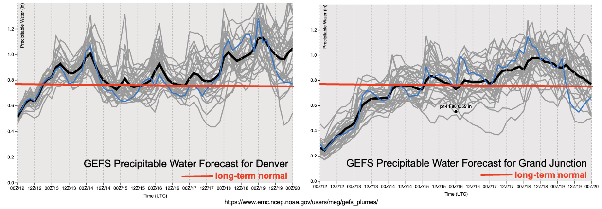
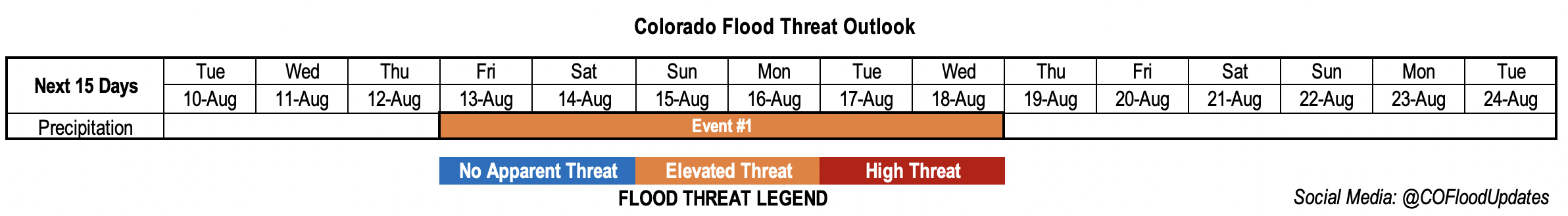
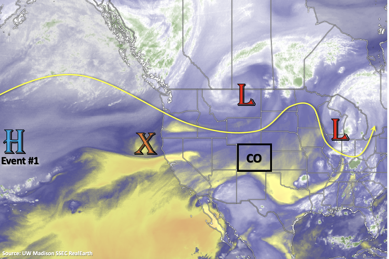
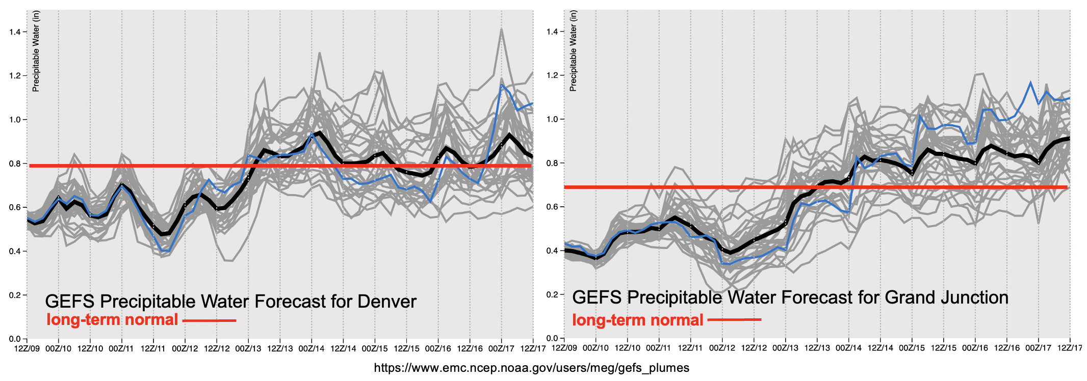
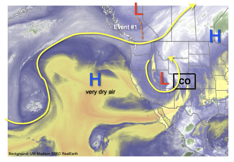
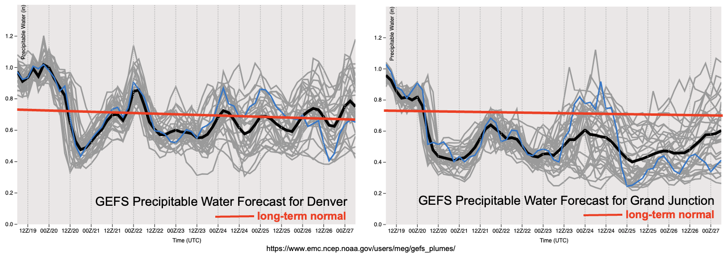
Looking at this afternoon’s water vapor imagery, below, we see that the overhead vigorous disturbance is actually the last remaining semblance of significant moisture over the southwest United States. A growing reservoir of dry air has overtaken the eastern Pacific Ocean and although relatively far from Colorado, it will be a tough obstacle to overcome over the foreseeable future. This leads to an Outlook where No Apparent Flood Threat is anticipated over the next 15 days. Fortunately, precipitation chances will not disappear entirely. A trough over southwest Canada is expected to merge with the briefly cut-off disturbance currently over Colorado, and provide isolated to widely scattered rain (and very high-elevation snow!) showers on Saturday and Sunday, Event #1. Thereafter, an upper-level ridge will re-emerge over the central and western United States. The westward extension of this ridge will determine rainfall coverage over Colorado. A further west ridge extent will imply increasing amounts of dry air transport from the aforementioned dry pool. At this time, as shown in the forecasted Precipitable Water (PW) plumes, below, it appears just enough moisture will return by the middle of next week for widely scattered showers and weak storms over the favored southern and central higher terrain (Event #2). For everyone else, however, a relatively dry and seasonably warm period is in store.
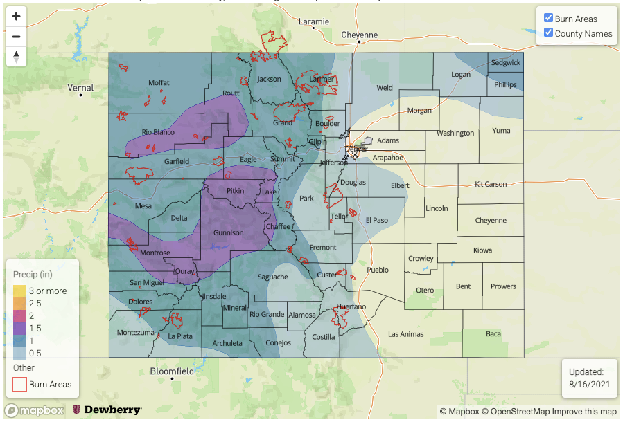
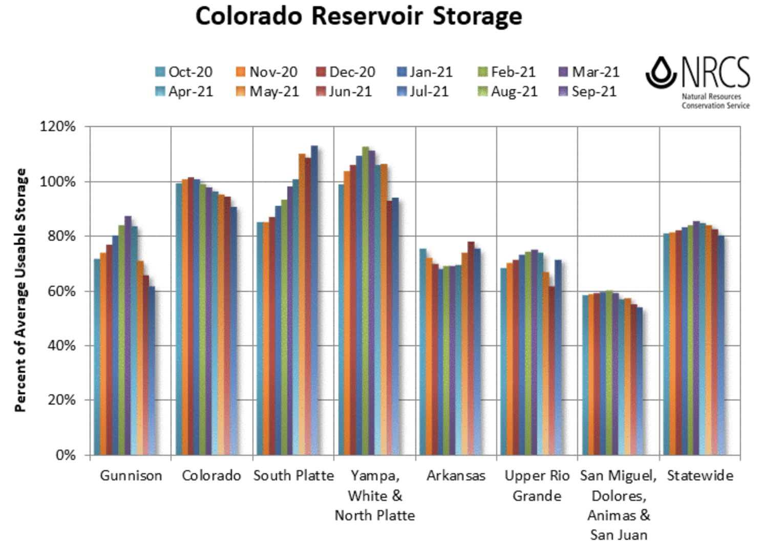
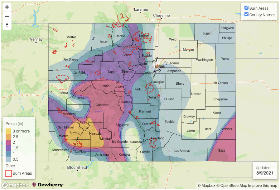
Before moving on to discuss the precipitation events, it is interesting to note that, while the monsoon has been relatively active since late June, the Water Year total precipitation anomalies (% of normal) are still well below normal for almost all of western Colorado. It is quite surprising to see this is true for even large parts of AZ, which have experienced significant flooding issues this summer. But alas, the monsoon is only one relatively small portion of Colorado’s entire hydrologic cycle.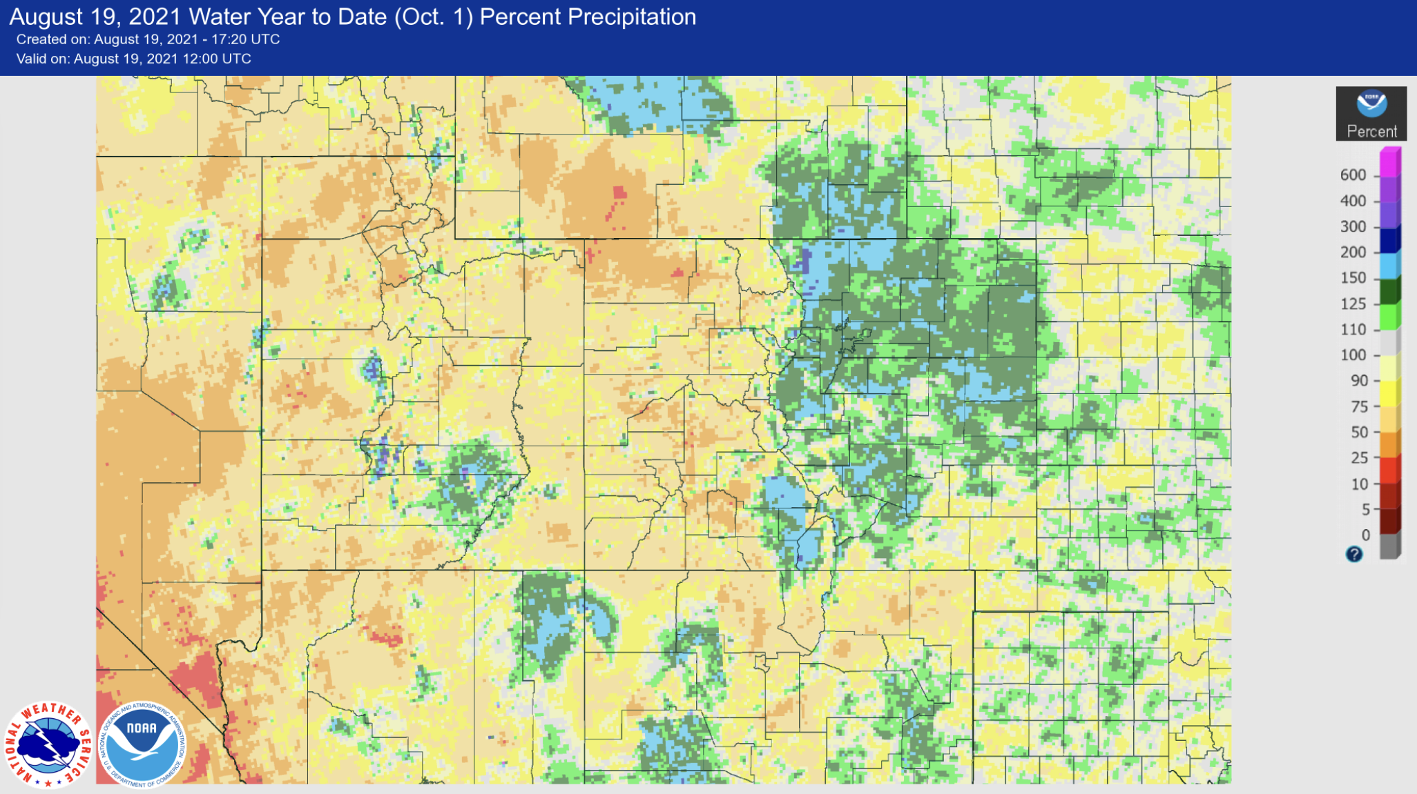
The two identified precipitation events are described in more detail below.
Event #1: Saturday – Sunday (August 21 – August 22)
No Apparent Flood Threat as widely scattered showers possible for mainly northern CO
Cold air aloft will make up for a relative lack of moisture to spark showers and weak storms across mainly northern Colorado. Max 1-hour precipitation up to 0.4 inches will be possible both Saturday and Sunday. Scattered coverage will be seen on Saturday, but only isolated coverage is expected by Sunday.
Event #2: Wednesday – Sunday (August 25 – August 29)
Precipitation Chances To Increase But No Apparent Flood Threat Still At This Time
Guidance continues to show a rebound in moisture courtesy of a cool front passage by early next week, followed by a more uncertain contribution of monsoonal origin from the south. On Wednesday, light to moderate precipitation is expected over the Northeast Plains and Southeast Plains where max 1-hour rainfall up to 0.6 inches looks possible. Beginning Thursday and onwards, isolated to widely scattered shower and storm activity is looking more likely for the climatologically favored San Juan Mountains, Southeast Mountains and Central Mountains. Max 1-hour rainfall up to 0.5 inches appears possible, but rainfall coverage looks isolated to widely scattered at best. Over the course of the entire 5-day period, however, lucky high-elevation spots in the San Juans could pick up a little over 1 inch. But there is currently no expected flood threat from this event.