Issue Date: Sunday, August 9th, 2020
Issue Time: 10:05AM MDT
— Flooding is NOT expected today
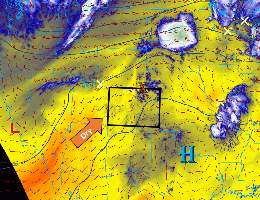
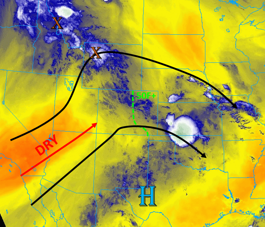
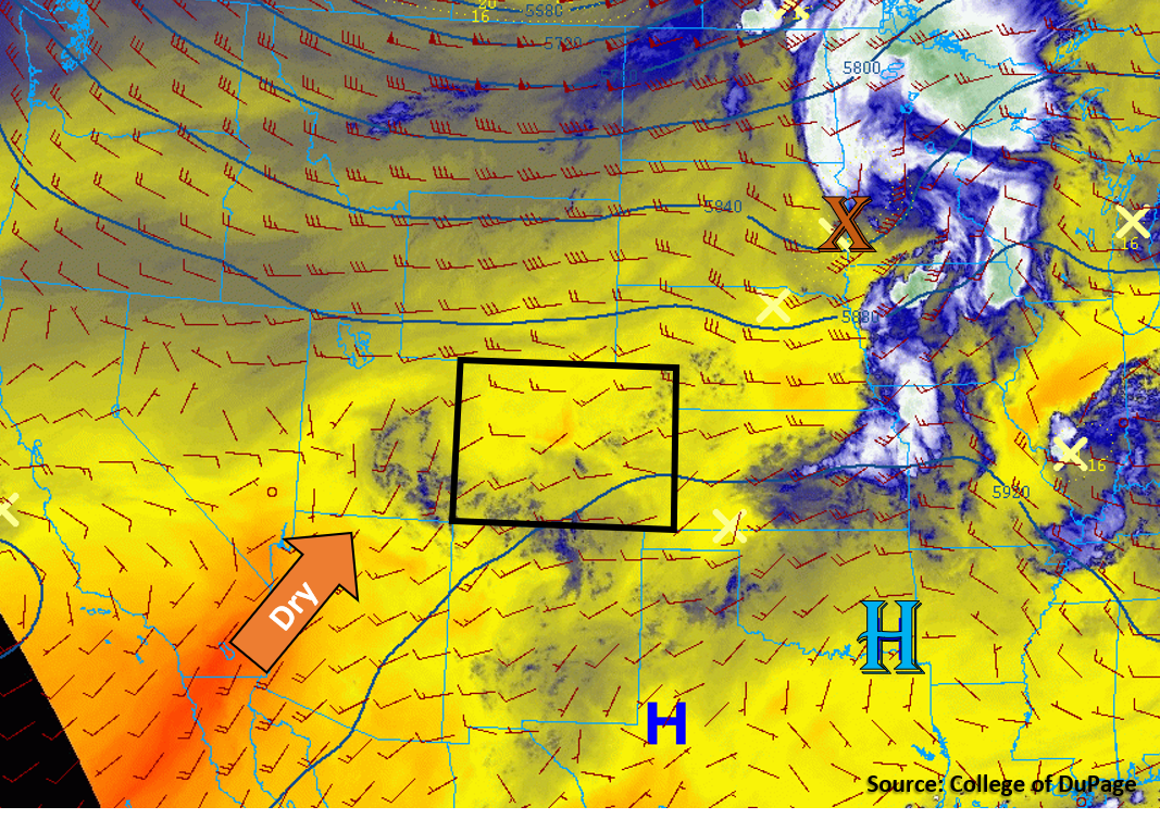
Today’s weather setup is similar to yesterday, as Colorado is situated between a broad high pressure ridge to the southeast and a broad trough to the north (see image below). The shortwave that initiated storms along the northeastern and eastern border of Colorado yesterday is now moving up into Minnesota. Strong mid-level flow is largely confined within the trough to the north of Colorado. Weak (10-20 mph) mid-level southwesterly/westerly flow is present over Colorado today, as indicated by the 500 mb analysis overlaid on the satellite image below. Some mid-level energy and moisture are creating some clouds over southern Colorado (blue on water vapor image below). This mid-level energy will increase chances for light showers over the southern mountains today. However, dew points are quite dry over Colorado this morning, with 10Fs over northwestern Colorado and 30Fs over southern Colorado. This dry surface air will limit rain accumulation at the surface. The Grand Junction sounding this morning shows a record low PW value of 0.26 inches, which shows just how dry the airmass is over western Colorado. No flooding is expected today.
The eastern border of Colorado is the only place where some moisture is able to hang on, where dew points are in the 50Fs. Farther west over the Urban Corridor, the air is much drier, with dew points in the 30Fs and a below-normal Denver PW value of 0.43 inches. A broad area of low pressure will remain over the plains of Colorado, but small pressure gradients will generally favor weak westerly and northerly winds over the plains. This will not allow higher moisture east of Colorado to be pushed west into Colorado, so much of the low-level moisture that exists along the eastern border of Colorado this morning will be mixed out with diurnal heating today. In fact, temperatures will climb to near-record levels along the Urban Corridor and plains regions today. There still exists a low chance of thunderstorms developing along the eastern border of Colorado today, but the limited moisture will cut down on instability and potential rainfall from these storms. No flooding is expected.
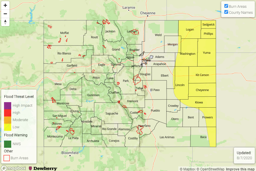
Today’s Flood Threat Map
For more information on today’s flood threat, see the map below. Hover over the threat areas for more details, and click on burn areas to learn more about them. For Zone-Specific forecasts, scroll below the threat map.

Zone-Specific Forecasts:
Northeast Plains, Urban Corridor, Palmer Ridge, & Southeast Plains:
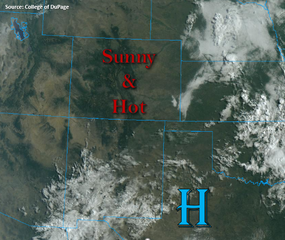
Partly cloudy and hot, and locations near the eastern border could see a storm or two fire where low-level moisture is able to stay in place. Storms will be fighting plenty of dry air, so max rain rates should stay under 0.5 in/hr. Flooding is not expected with these storms. Near-record high temperatures are expected for the Urban Corridor, with a high of 98F forecast for Denver and a high of 99F forecast for Fort Collins.
Primetime: 1PM to 8PM
Grand Valley, Northwest Slope, Northern Mountains, Central Mountains, Front Range, Southwest Slope, San Juan Mountains, San Luis Valley, Southeast Mountains, & Raton Ridge:
Mountain clouds and showers are possible this afternoon, with the highest chances of cloud cover and showers over the San Juan Mountains. Northern regions will likely just see some clouds and smoke from the Pine Gulch Fire. Extremely dry air at the surface will limit any rainfall to high elevation locations, where up to 0.05 inches of rain could fall. No flooding is expected. A fire danger still exists for much of western Colorado due to the continued dry weather.
Primetime: 11AM to 8PM