FTB 09-14-2020: High and Dry with Some Smoke

Issue Date: Monday, September 14th, 2020
Issue Time: 09:25AM MDT

— Flooding is NOT expected today

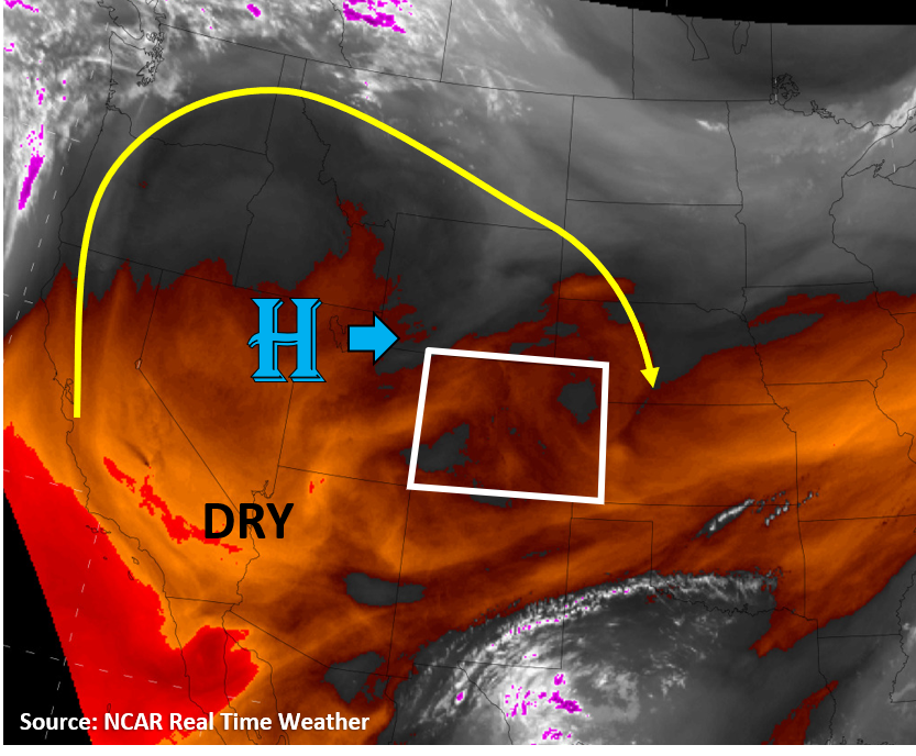
Today will feel like déjà vu as we once again have mainly clear skies, a few mountain clouds, and temperatures only a couple degrees warmer than yesterday. Colorado is directly under a high pressure ridge today (see image below), which means there is very little upper-level winds and no large-scale driver of more interesting weather. Low-level moisture is not very strong, with dew points generally in the 30Fs over the mountain valleys, increasing to the 40Fs along the eastern Plains. This will be just enough moisture to allow clouds and a few showers to form over the San Juan and Central Mountains this afternoon as the abundant sunshine allows the atmosphere to bubble up some convection near mountaintops. Another slight bump in increased chances of showers exists for these regions today compared to yesterday, closer to 50/50 today for the San Juan Mountains. However, limited moisture and small convective cores will prevent any heavy rain accumulations. No flooding is expected today.

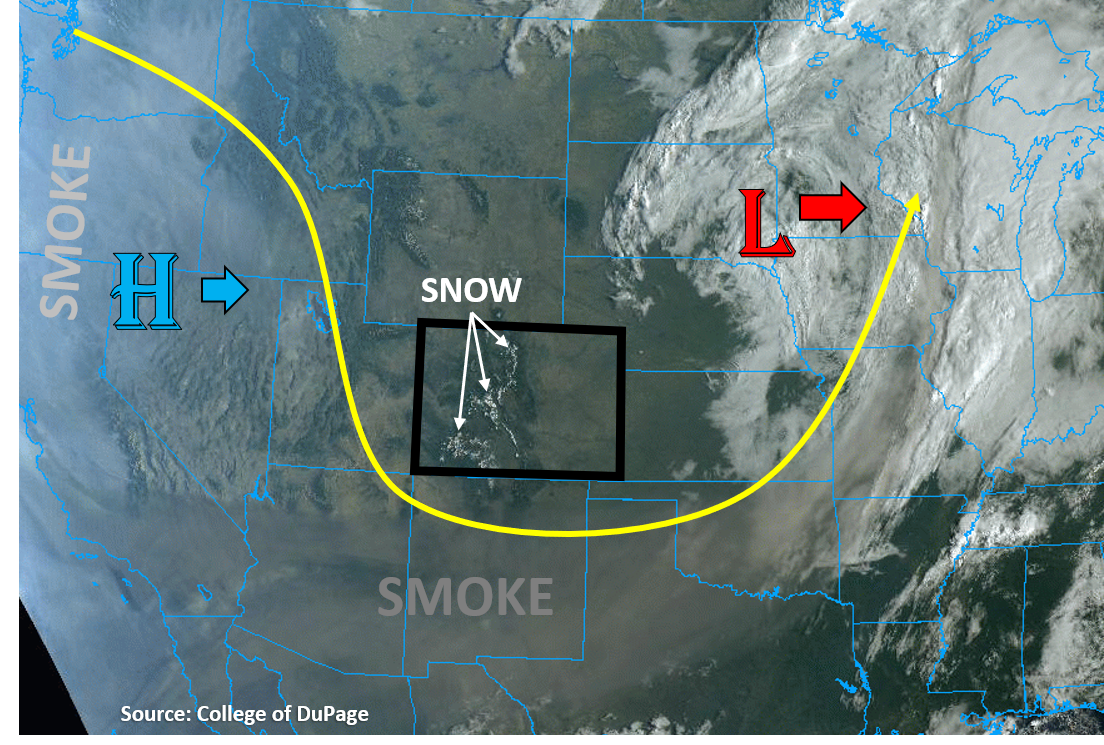
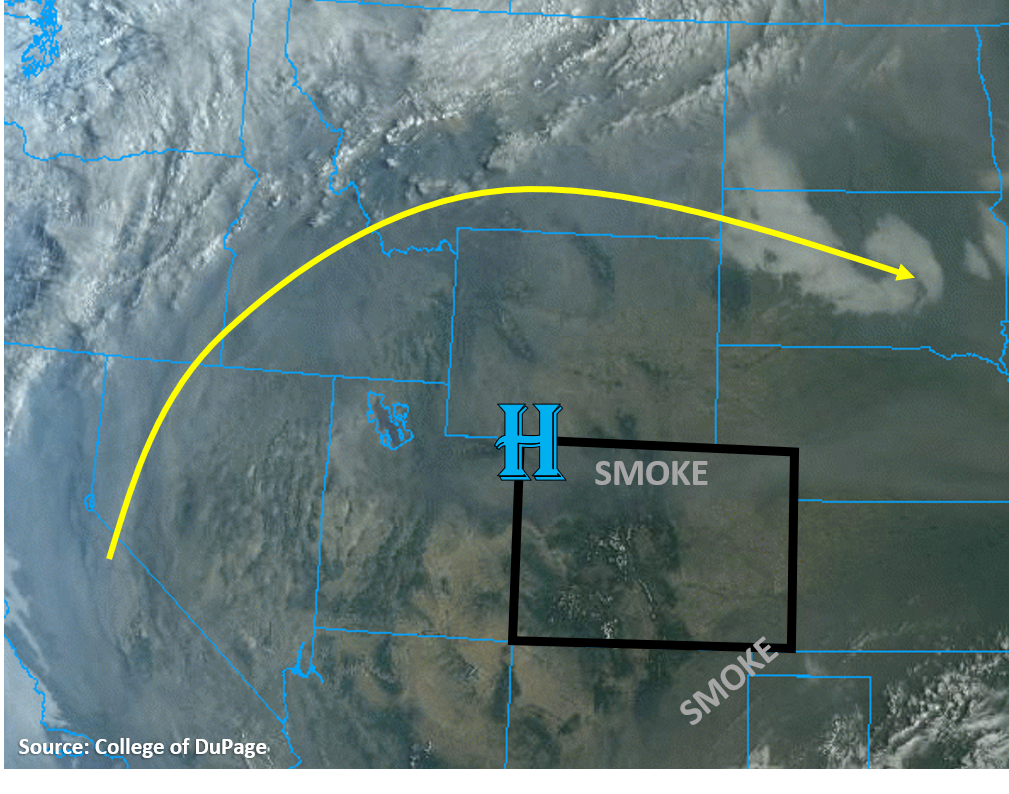
The true-color satellite image below shows that wildfire smoke from the West Coast is circulating around this high pressure ridge and has moved into northern Colorado. Some additional smoke is touching the southeast corner of the state. Fortunately, this appears to be upper-level smoke as air quality remains in the Good range for most locations across Colorado today. Smoke should stay limited over Colorado today, with the active Middle Fork and Cameron Peak fires in Colorado the likely source of most near-surface smoke. Hopefully the light winds will prevent any rapid fire growth today, though.

Today’s Flood Threat Map

For more information on today’s flood threat, see the map below. Hover over the threat areas for more details, and click on burn areas to learn more about them. For Zone-Specific forecasts, scroll below the threat map.

Zone-Specific Forecasts:

Grand Valley, Northwest Slope, Northern Mountains, Central Mountains, Front Range, Southwest Slope, San Juan Mountains, Southeast Mountains, & San Luis Valley:

Daytime heating will once again allow clouds and some showers to develop over the high elevation mountain regions. The highest chances for seeing precipitation reaching the ground will be over the San Juan Mountains, where up to 0.15 inches of rain could accumulate over the day. Any showers should be small in size and remain over the higher terrain. No flooding is expected today. Temperatures will remain a few degrees above normal for valley locations and remain cool for high elevation locations, but the freezing level should remain above the highest mountaintops.

Primetime: 12PM to 8PM

Northeast Plains, Urban Corridor, Palmer Ridge, Raton Ridge, & Southeast Plains:

Mainly sunny skies today, with some smoke potentially visible aloft for the northern parts of the state. Temperatures will be similar to yesterday or a few degrees warmer, especially along the northern half of the state where temperatures could get into the upper 80Fs. Generally light southerly winds can be expected, with gusts 15-20 mph possible as a surface low pressure develops well north of Colorado. No precipitation or flooding is expected today.

FTB 09-13-2020: Another Dry Day with Warmer Temperatures

Issue Date: Sunday, September 13th, 2020
Issue Time: 09:20AM MDT

— Flooding is NOT expected today

Today will be very similar to yesterday as mainly clear skies dominate Colorado’s weather as the High pressure ridge continues its journey east over Colorado (see image below). Temperatures will continue their upward climb into the 80Fs for lower elevations today. With dew points in the 30Fs across much of Colorado this morning, some of which will mix out with daytime heating and dry air aloft, relative humidity will stay low today. The water vapor satellite image this morning shows there is plenty of dry air over Colorado (orange colors on image below). Mountain clouds and weak showers are still not out of the question, especially over the San Juan Mountains, where a slight increase in chances of measurable precipitation exists today. However, any mountain showers that do form do not pose a flood risk today due to plenty of dry sub-cloud air and low rain rates. Due to weak mid-level winds within this High pressure ridge, any mountain showers that form likely won’t move far off its mountain ignition point, which will prevent precipitation for valley locations. No flooding is expected today.

Today’s Flood Threat Map

For more information on today’s flood threat, see the map below. Hover over the threat areas for more details, and click on burn areas to learn more about them. For Zone-Specific forecasts, scroll below the threat map.

Zone-Specific Forecasts:

Northeast Plains, Urban Corridor, Palmer Ridge, Raton Ridge, & Southeast Plains:

It should stay mainly clear today with temperatures ~ 5F warmer than yesterday, which should climb into the 80Fs for most plains locations. Winds should stay weak today, with general upslope flow expected from diurnal heating. Skies should generally stay smoke-free for now. No flooding is expected.

Grand Valley, Northwest Slope, Northern Mountains, Central Mountains, Front Range, Southwest Slope, San Juan Mountains, Southeast Mountains, & San Luis Valley:

It will start out clear this morning, but fair weather clouds will develop over the mountains by noon. It will be warmer today, with low-elevation valley locations in the Grand Valley, Northwest Slope, and Southwest Slope reaching into the 80Fs. Temperatures should stay cooler for high elevation mountain locations, decreasing to the freezing level near or just above the tops of the highest Colorado mountain peaks (14,000 ft). Some clouds that form over the high terrains may be able to generate some light precipitation, with the highest chances of showers over the San Juan Mountains and lower chances over the Central Mountains and southern Front Range. Due to the high freezing levels, this should mainly fall as rain. However, rain accumulation over the 24-hour period should stay below 0.1 inches and only over the higher elevations. No flooding is expected today. Skies should stay smoke-free today, but this will likely change this week, so enjoy it while you can.

FTB 09-12-2020: Back to Dry Weather and Seasonable Temperatures

Issue Date: Saturday, September 12th, 2020
Issue Time: 09:05AM MDT

— Flooding is NOT expected today

The upper-level Low pressure that has brought beneficial rain and snow to Colorado over the last week is well out of the state this morning, up in eastern South Dakota (see image below). The high-elevation snowfall from this system remains visible on the satellite imagery as well. This dip in the jet stream has fortunately kept the majority of the smoke from wildfires in the West to our west and south, which is very evident in the visible satellite imagery below. Unfortunately, the trough will start to be replaced with a High pressure ridge from the west, which will bring smoke back into Colorado.

Almost no chance of precipitation exists across Colorado today as the departing Low is taking its moisture and lift with it. With temperatures warming a few more degrees today into the 70Fs and low 80Fs (lower elevations), relative humidity will drop this afternoon into the 10% and 20% range as dew points stay in the 20Fs and 30Fs. The only interesting weather today should be some fair weather clouds over the high terrain, with maybe a cell or two producing a brief shower over the high elevations of the southern mountains. Some gusty northerly winds up to 30 mph may impact the northern and eastern plains regions as stronger winds aloft from the departing Low mix down, but winds should die down by evening. Flooding is not expected today.

Today’s Flood Threat Map

For more information on today’s flood threat, see the map below. Hover over the threat areas for more details, and click on burn areas to learn more about them. For Zone-Specific forecasts, scroll below the threat map.

Zone-Specific Forecasts:

Northeast Plains, Urban Corridor, Front Range, Palmer Ridge, Raton Ridge, Southeast Mountains, & Southeast Plains:

Expect mainly sunny skies today with temperatures climbing into the 70Fs and low 80Fs for most low-elevation locations along the plains, which is near to just below seasonal normals. Temperatures will be cooler as you go up in elevation, with temperatures approaching freezing between 13,000 and 14,000 ft. Some winds up to 30 mph could gust over the northern Urban Corridor, Northeast Plains, Palmer Ridge, and eastern Southeast Plains this morning and afternoon, but winds should decrease by evening. Downslope winds just east of the Continental Divide in the Front Range should die down by afternoon. Some afternoon fair weather clouds are possible over the high mountain terrains, but no accumulating rainfall is expected. No flooding is expected today.

Grand Valley, Northwest Slope, Northern Mountains, Central Mountains, Southwest Slope, San Juan Mountains, & San Luis Valley:

Afternoon fair weather clouds will likely build over the high mountaintops and ridgelines, with a shower or two possible for the San Juan, Central, and Southeast Mountains. Any isolated showers that are able to build will not be able to produce significant accumulations, but up to 0.15 inches of 24-hour precipitation accumulation is possible for only the highest elevations. Some of this could fall as a rain/snow mix above 13,000 ft. No flooding is expected.

Temperatures will climb into the mid 70Fs for the lower elevations of the Southwest Slope, Grand Valley, and Northwest Slope, but the air will remain chilly for the San Luis Valley (60Fs) and mountain regions (50Fs & 40Fs). Some smoke may also work its way back into the western and southern part of the state.

FTB 09-11-2020: The Low Finally Exits the State, Ending Snowfall by Midday

Issue Date: Friday, September 11th, 2020
Issue Time: 8:45AM MDT

— Flooding is NOT expected today

The upper level Low will continue to move northeast and away from the state throughout the day, which will start to clear and warm conditions by this afternoon. Currently, there’s quite a bit of fog over the plains and northern Urban Corridor, and a mix of dense fog and clouds over the mountains. This should start to burn off with a little daytime heating. While conditions will become clear or partly cloudy across the state as the day progresses, a little wrap around moisture and strong upper flow will provide lift over the northern and central mountains for some snow this morning. This should come to an end by about midday. Then, as the Low tracks further east, some light rainfall may be possible along and just south of Colorado’s northern border with some upper level lift on the south side of the Low. Due to the gradual nature of the rainfall, flooding is not forecast.

Today’s Flood Threat Map

For more information on today’s flood threat, see the map below. If there is a threat, hover over the threat areas for more details, and click on burn areas to learn more about them. For Zone-Specific forecasts, scroll below the threat map.

Zone-Specific Forecasts:

Northern Mountains, Central Mountains, Front Range, Urban Corridor, & Northeast Plains:

Some snow showers are forecast this morning over these mountain zones, so an extra couple of inches is possible in the area of the orange oval. The scattered precipitation should come to an end by early afternoon and more sun should return to the forecast later today. Winds look to pick up as well with the upper level jet in the area, so westerly wind gusts around 30 to 35 mph are possible throughout the day over the mountains near the Continental Divide. As the Low progresses east, the precipitation should follow and turn into light rain over the adjacent plains. Some higher totals are likely over the Cheyenne Ridge (isolated totals up to 0.25 inches), but for the most part these should mostly be light, scattered showers. Therefore, flooding is not expected.

Primetime: ongoing to 7PM

Palmer Ridge, Raton Ridge, Southeast Mountains, San Luis Valley, & Southeast Plains:

As the fog and cloud cover begin to decrease throughout the day, more sunshine is expected. That means warmer temperatures by this afternoon. The Southeast Plains will likely reach into the 70Fs with 60Fs for the I-25 Corridor. Over the mountains, highs will be in the upper 50Fs for the valleys. The San Luis Valley will be a bit cooler with highs forecast in the upper 50Fs, and the interior SLV may reach 60F. It should remain dry today, so flooding is not forecast. It may be a bit windy with 15 to 20 mph westerly winds possible over the Southeast Mountains this afternoon, and gusts in the 25 to 30 mph range are possible over the northern portion of the Southeast Mountains.

Grand Valley, Southwest Slope, San Juan Mountains, & Northwest Slope:

It looks like the Grand Valley and lower elevations of the Southwest Slope could reach 70F today with 60Fs for the mountain valleys. Highs will be a bit cooler than this over the higher elevations and the Northwest Slope, and the latter will likely reach into the 60Fs. It could get a little windy along the northern border with the upper level jet in the area, but these stronger winds will likely be confined to the Northern Mountains.