FTB 05-07-2021: Scattered High-Based Storms with Little Rainfall

Issue Date: Friday, May 7th, 2021
Issue Time: 8:55AM MDT

— Flooding is NOT expected today

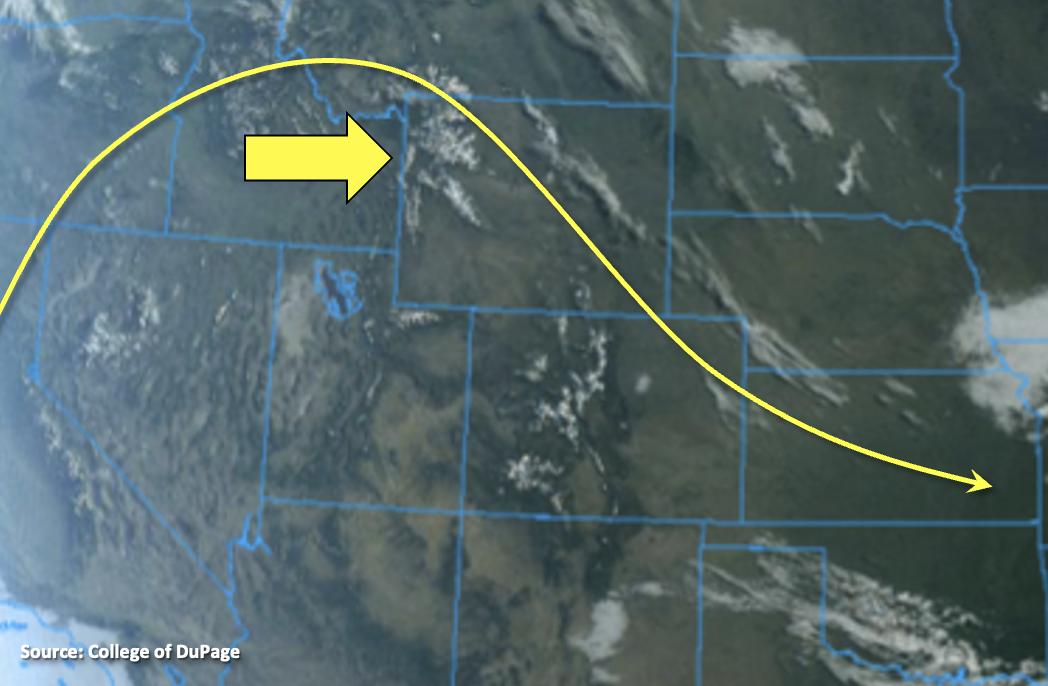
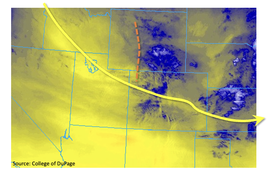
High temperatures will continue to slightly rise for another day with the ridge overhead. Expect a large change in the pattern starting tomorrow as the next system continues to move inland over the west coast and displaces the ridge eastward. PW remains down this morning and was measured at 0.26 inches and 0.36 inches in Denver and Grand Junction, respectively. The moisture looks to be mostly located in the mid-level of the atmosphere and can be seen in water vapor imagery below (blue shades). This is expected to help generate a few afternoon showers over the southern and central high terrains and near the eastern Raton Ridge this afternoon, but a very dry surface layer means that the main threat will be gusty outflow winds and lightning instead of wetting rainfall.

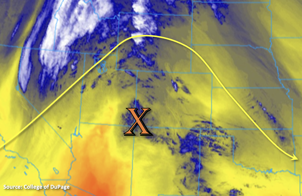
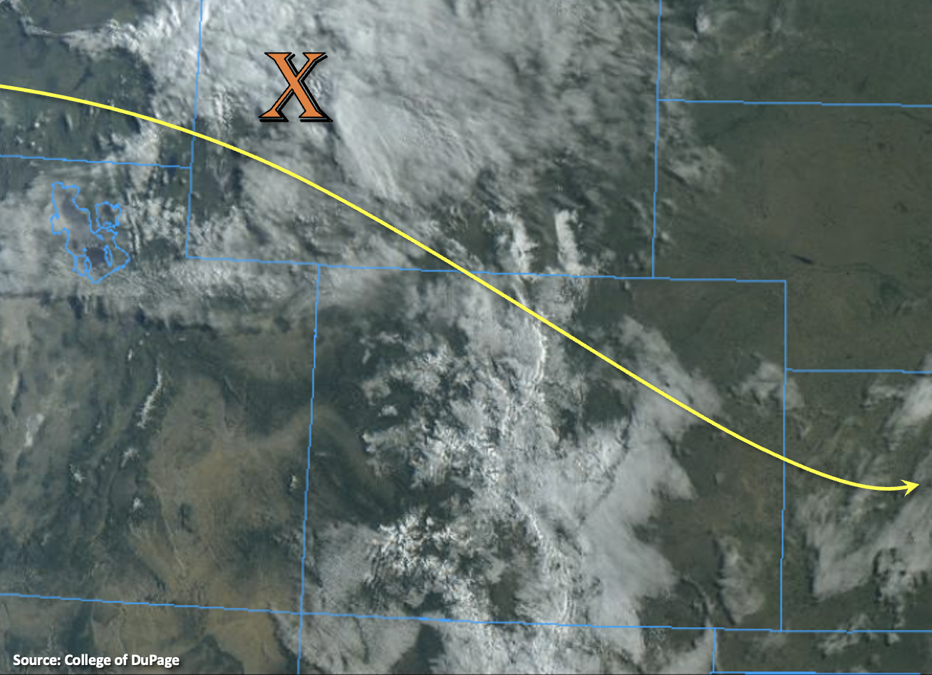
Weaker mid-level moisture and lift will move across the northern border this afternoon as well, which is expected to spark some weak storms over the Front Range and Northern Mountains. Again, these will be high-based storms so plenty of virga will limit the flood threat over the mountains and adjacent plains. Best chance for wetting rainfall will be isolated storms that can make it into the far Northeast Plains. Flooding is not anticipated, but a quick 0.75 inches may be possible. As anticipated, no flood threat will be issued today.

Today’s Flood Threat Map

For more information on today’s flood threat, see the map below. If there is a threat, hover over the threat areas for more details, and click on burn areas to learn more about them. For Zone-Specific forecasts, scroll below the threat map.

Zone-Specific Forecasts:

Southeast Plains, Central Mountains, Southeast Mountains, Raton Ridge, Grand Valley, San Juan Mountains, Southwest Slope & San Luis Valley:

Scattered storms are possible this afternoon with some mid-level moisture and lift moving through the flow. The lower elevations of the Southwest Slope, San Luis Valley and Grand Valley look to remain dry with Red Flag Warnings issued over these areas. Over the mountains, the best chance for accumulation will be near and along the Continental Divide where isolated rain rates up to 0.25 inches will be possible. Over eastern Raton Ridge/Southeast Plains, max 1-hour rain rates up to 0.60 inches will be possible due to southerly/south easterly surface winds pulling in some higher moisture. Flooding is NOT forecast today with the high cloud bases, but dangerous lightning, brief, strong outflow winds and hail (east) will be possible under the strong thunderstorms that develop.

Primetime: 1PM to 10PM

Northwest Slope, Northern Mountains, Northeast Plains, Front Range, Urban Corridor & Palmer Ridge:

Storms that pop over these region’s high terrains are forecast to be more scattered early this afternoon. Plenty of virga is forecast, but isolated 1-hour totals around 0.20 inches are possible. As storms move off the higher elevations, they may produce some brief outflow wind and rain rates should be reduced. If a storm or two can stay intact and make it into the far Northeast Plains, max 1-hour rain rates up to 0.75 inches will be possible along with brief, outflow wind and hail. Flooding is NOT forecast this afternoon or evening.

Primetime: 1PM to 10PM

FTB 05-06-2021: Warming Up & Drying Out

Issue Date: Thursday, May 6th, 2021
Issue Time: 8:05AM MDT

— Flooding is NOT expected today

Outside of a few clouds over eastern Colorado it’s a clear morning across the state, which is showing off the snow-capped Rocky Mountains very well in the visible satellite imagery below. A ridge will begin to slide east throughout the day, which will help produce warm and dry conditions statewide. PW this morning at Denver and Grand Junction has fallen to 0.37 inches and 0.24 inches, respectively. This means afternoon and evening storms today are unlikely today with only some cloud cover forecast for this afternoon over the mountains and Northwest Slope. Flooding is not forecast and be sure to get out and enjoy this beautiful spring day.

Today’s Flood Threat Map

For more information on today’s flood threat, see the map below. If there is a threat, hover over the threat areas for more details, and click on burn areas to learn more about them. For Zone-Specific forecasts, scroll below the threat map.

Zone-Specific Forecasts:

Northeast Plains, Front Range, Urban Corridor, Southeast Mountains, Southeast Plains, Raton Ridge & Palmer Ridge:

Highs will reach into the upper 60F and 70Fs across the lower elevations this afternoon with the hottest temperatures over the Southeast Plains. Light surface winds are also expected with the jet being pushed east, so it’s going to be a beautiful day. Rainfall is not forecast.

Northern Mountains, Central Mountains, Grand Valley, San Juan Mountains, Northwest Slope, Southwest Slope & San Luis Valley:

It’s already dried out quite a bit with the ridge overhead, so rainfall chances really drop off this afternoon. Expect mostly clear skies with perhaps some cloud cover over the mountains and Northwest Slope this afternoon and evening. Highs will reach into the mid-70Fs with perhaps a couple regions reaching 80F across the lower elevations and 60Fs and lower 70Fs for the mountain valleys. Rainfall is not forecast.

FTB 05-05-2021: Isolated, Gusty Storms Mainly Northeast

Issue Date: Wednesday, May 5th, 2021
Issue Time: 8:45AM MDT

— Flooding is NOT expected today

Colorado remains under the influence of a large-scale eastern US trough, with shorter wave disturbances rippling through the flow. One such disturbance brought scattered showers and a few weak thunderstorms across the state yesterday. Another such disturbance, as seen on the low-level water vapor image (orange dashed line), below, will do the same today.

This morning’s Precipitable Water (PW) at Denver and Grand Junction was just under 0.5 inches, which is very close to seasonal normal for early May. With low moisture content and cooler than normal afternoon temperatures, expect very limited atmospheric instability. Nonetheless, the atmosphere will be able to muster isolated to widely scattered showers and weak thunderstorms mainly over the northeast quadrant of the state. However, flooding is not expected today. With very strong steering winds in the upper levels of the atmosphere, any slightly stronger storms will be able to efficiently transfer that wind down to the surface. Thus, there is a chance of marginally severe wind gusts, up to 60mph, along the Kansas border.

Switching over to a check of hydrologic conditions, we note that the recent cool temperatures have kept snowmelt generally in check. The only area that currently bears watching is the northern Front Range basins: in particular, the Cache la Poudre and Big Thompson. These rivers are currently experiencing elevated flows from recent rain and snow, but are expected to recede a bit with the lack of rain over the next few days. However, given the large (and growing) snowpack in their upper basins, we will continue to watch these areas closely over the coming weeks.

Today’s Flood Threat Map

For more information on today’s flood threat, see the map below. If there is a threat, hover over the threat areas for more details, and click on burn areas to learn more about them. For Zone-Specific forecasts, scroll below the threat map.

Zone-Specific Forecasts:

Northeast Plains, Southeast Plains, Northern Mountains, Front Range, Urban Corridor, Central Mountains & Palmer Ridge:

Partly to mostly cloudy and seasonably cool with isolated to scattered showers and weak thunderstorms this afternoon and into early evening. Early snow showers possible above 7,500 feet. Maximum 1-hour rainfall up to 0.2 inches above 6,000 feet and 0.5 inches below 6,000 feet. Gusty winds up to 60 mph are possible with the stronger storms, especially towards the Kansas border. Flooding is NOT expected today.

Primetime: 11AM to 7PM

Grand Valley, San Juan Mountains, Southwest Slope & San Luis Valley, Northwest Slope, Southeast Mountains & Raton Ridge:

Mostly sunny to partly cloudy and warmer with high temperatures close to seasonal normal. Isolated rain and snow showers are possible in northern areas this morning and early afternoon. Max 1-hour rainfall up to 0.1 inches. Gusty winds are possible, mainly over higher elevations. Flooding is NOT expected today.

FTB 05-04-2021: More Sunshine & Isolated PM Storms

Issue Date: Tuesday, May 4th, 2021
Issue Time: 9:05AM MDT

— Flooding is NOT expected today

A shift in the weather pattern will take place today, which means more sunshine and warmer temperatures. The trough that brought a nice round rainfall and snow to the state the last couple of days is currently to our southeast, and more dry, northwesterly flow aloft has begun to fill in over the state. Both the Grand Junction and Denver sounding’s this morning show this much drier air mass in the mid to upper levels of the atmosphere. Nonetheless, the visible satellite image below (from 8AM this morning) still shows plenty of cloud cover and some fog, which means there will be enough residual moisture for a round of scattered storms this afternoon.

A shortwave (orange X) is expected to travel through this northwesterly flow, which will help create lift out in front of it. As this shortwave progresses through the northern and northeast portion of the state, it will help produce scattered storms across the Northern, Central and Front Range Mountains during the early afternoon. Storms will push into the adjacent plains (Urban Corridor, Palmer Ridge and Northeast Plains), but fast northwest steering flows and high cloud bases indicate rainfall accumulation will be limited. Flooding is not expected, and the main threat from the thunderstorms that develop today will be brief outflow winds and lightning.

Today’s Flood Threat Map

For more information on today’s flood threat, see the map below. If there is a threat, hover over the threat areas for more details, and click on burn areas to learn more about them. For Zone-Specific forecasts, scroll below the threat map.

Zone-Specific Forecasts:

Northeast Plains, Northwest Slope, Northern Mountains, Front Range, Urban Corridor, Central Mountains & Palmer Ridge:

Another round of scattered storms is expected this afternoon. Snow showers are likely over the highest elevations, but precipitation should mostly fall as rain. A couple scattered thunderstorms are not out of the question over the mountains, but heavy rainfall is not expected. Isolated max 1-hour rain rates up to 0.20 inches will be possible. Additionally, forecasting westerly and northwesterly surface winds to pick up over the high terrains as the jet moves overhead. As storms move swiftly off the mountains into the adjacent plains with southeast movement, they will likely produce a little more lightning, brief wind gusts and light to moderate rainfall. Isolated storm totals may come close to 0.30 inches. Light showers look to develop over the Palmer Ridge tonight and move into the Southeast Plains by the early morning hours with favorable lift from the jet overhead. Flooding is not forecast.

Primetime: 12:30PM to 11PM

Southeast Mountains, Southeast Plains & Raton Ridge:

Moisture and lift won’t be quite as strong over these regions today and downsloping winds will help dry out the lower levels even more. The isolated storms that are able to develop likely won’t produce much (if any) accumulation. Best chance for accumulation will be if storms can stay intact from the northwest and make it to the eastern Southeast Plains or eastern Raton Ridge. Totals up to 0.25 inches will be possible. Light showers may be possible in the early morning hours over the Southeast Plains. Flooding is not forecast.

Primetime: 3PM to 11PM

Grand Valley, San Juan Mountains, Southwest Slope & San Luis Valley:

Broken cloud cover is forecast over the high terrains with sunny conditions for the San Luis Valley and Southwest Slope. With dew points in the teens and 20s, rainfall is not forecast for these regions. Northwesterly surface winds are forecast to pick up over the Grand Valley, San Luis Valley and San Juan Mountains with the windiest conditions over the San Juan Mountains as the jet moves in. High temperatures should be around normal for early May.