Issue Date: Wednesday, May 5th, 2021
Issue Time: 8:45AM MDT
— Flooding is NOT expected today
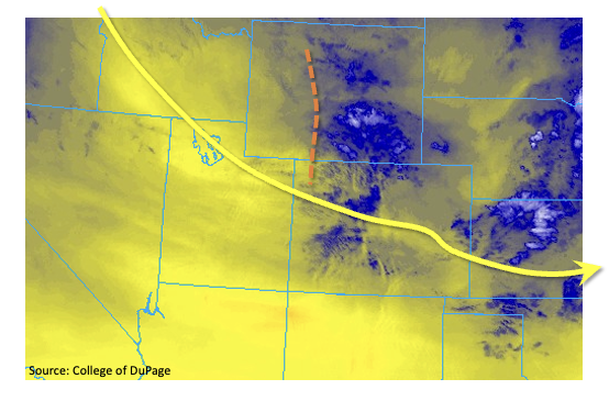
Colorado remains under the influence of a large-scale eastern US trough, with shorter wave disturbances rippling through the flow. One such disturbance brought scattered showers and a few weak thunderstorms across the state yesterday. Another such disturbance, as seen on the low-level water vapor image (orange dashed line), below, will do the same today.
This morning’s Precipitable Water (PW) at Denver and Grand Junction was just under 0.5 inches, which is very close to seasonal normal for early May. With low moisture content and cooler than normal afternoon temperatures, expect very limited atmospheric instability. Nonetheless, the atmosphere will be able to muster isolated to widely scattered showers and weak thunderstorms mainly over the northeast quadrant of the state. However, flooding is not expected today. With very strong steering winds in the upper levels of the atmosphere, any slightly stronger storms will be able to efficiently transfer that wind down to the surface. Thus, there is a chance of marginally severe wind gusts, up to 60mph, along the Kansas border.
Switching over to a check of hydrologic conditions, we note that the recent cool temperatures have kept snowmelt generally in check. The only area that currently bears watching is the northern Front Range basins: in particular, the Cache la Poudre and Big Thompson. These rivers are currently experiencing elevated flows from recent rain and snow, but are expected to recede a bit with the lack of rain over the next few days. However, given the large (and growing) snowpack in their upper basins, we will continue to watch these areas closely over the coming weeks.
Today’s Flood Threat Map
For more information on today’s flood threat, see the map below. If there is a threat, hover over the threat areas for more details, and click on burn areas to learn more about them. For Zone-Specific forecasts, scroll below the threat map.
Zone-Specific Forecasts:
Northeast Plains, Southeast Plains, Northern Mountains, Front Range, Urban Corridor, Central Mountains & Palmer Ridge:
Partly to mostly cloudy and seasonably cool with isolated to scattered showers and weak thunderstorms this afternoon and into early evening. Early snow showers possible above 7,500 feet. Maximum 1-hour rainfall up to 0.2 inches above 6,000 feet and 0.5 inches below 6,000 feet. Gusty winds up to 60 mph are possible with the stronger storms, especially towards the Kansas border. Flooding is NOT expected today.
Primetime: 11AM to 7PM
Grand Valley, San Juan Mountains, Southwest Slope & San Luis Valley, Northwest Slope, Southeast Mountains & Raton Ridge:
Mostly sunny to partly cloudy and warmer with high temperatures close to seasonal normal. Isolated rain and snow showers are possible in northern areas this morning and early afternoon. Max 1-hour rainfall up to 0.1 inches. Gusty winds are possible, mainly over higher elevations. Flooding is NOT expected today.