Issue Date: Saturday, May 15th, 2021
Issue Time: 9:30AM MDT
— A LOW flood threat has been issued for the Palmer Ridge and portions of the Urban Corridor, Northeast Plains and Southeast Plains
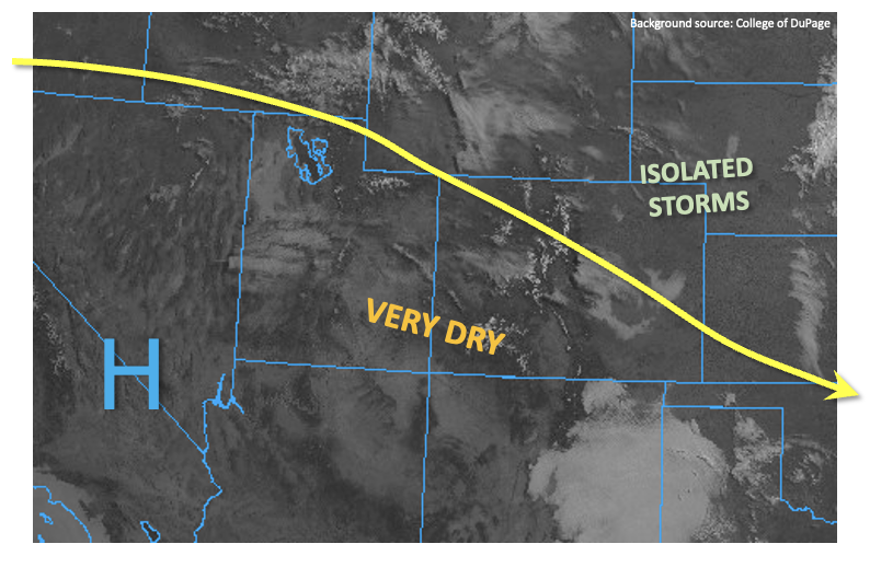
On tap for today is a very similar pattern to yesterday with a few key differences. Below in the water vapor imagery, you’ll see two distinct areas of lift. The orange “X” over NV and ID is associated with the approaching cutoff low, while the “X” over Utah is the shortwave that will help spark numerous storms across the eastern mountains this afternoon. Moisture remains high to the east and low to the west. PW at Grand Junction was measured at 0.35 inches with the majority of the moisture around 500mb. This indicates that virga and cloud cover will be prevalent again this afternoon, and the scattered high-based storms that develop over the southern high terrains could again mix down some strong winds to the surface. However, measurable rainfall is not forecast.
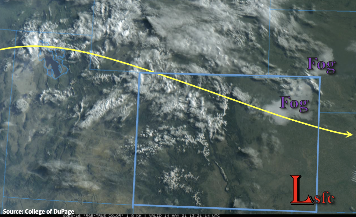
Back to the east, moisture has been building over the last couple of days with PW at Denver going from 0.38 inches 48-hours ago to 0.64 inches this morning. To put that in perspective, that’s close to the 90th percentile for this time of year. Fog and dew points in the upper 40Fs and 50Fs across the adjacent plains are another indication that storms that develop this afternoon and evening will be developing in a moisture-rich environment. Moderate upslope flow (east and southeast surface winds) around 10 mph will continue to hold this moisture in place throughout the day.
Expect storms to fire over the eastern mountains and ridges early this afternoon and move into the adjacent plains where they should pick up in intensity with the pooling moisture, increased CAPE and eroding cap. Slow steering flow from the west and training storms will produce a flood threat over the Palmer Ridge. Except storms to quickly form a line of convection as the move into the plains due to the high CAPE and moisture environment. More widespread severe storms will be possible today with the main threats being local heavy rainfall, hail and strong outflow winds. A Low flood threat has been issued.
With the low-level jet kicking back in tonight, some nocturnal convection may be possible over the far Southeast Plains. High moisture and slow steering winds means storms will be capable of producing heavy local rainfall. Additionally, this is the same area that received decent rainfall yesterday. Thus, the Low flood threat has been extended eastward.
Today’s Flood Threat Map
For more information on today’s flood threat, see the map below. If there is a threat, hover over the threat areas for more details, and click on burn areas to learn more about them. For Zone-Specific forecasts, scroll below the threat map.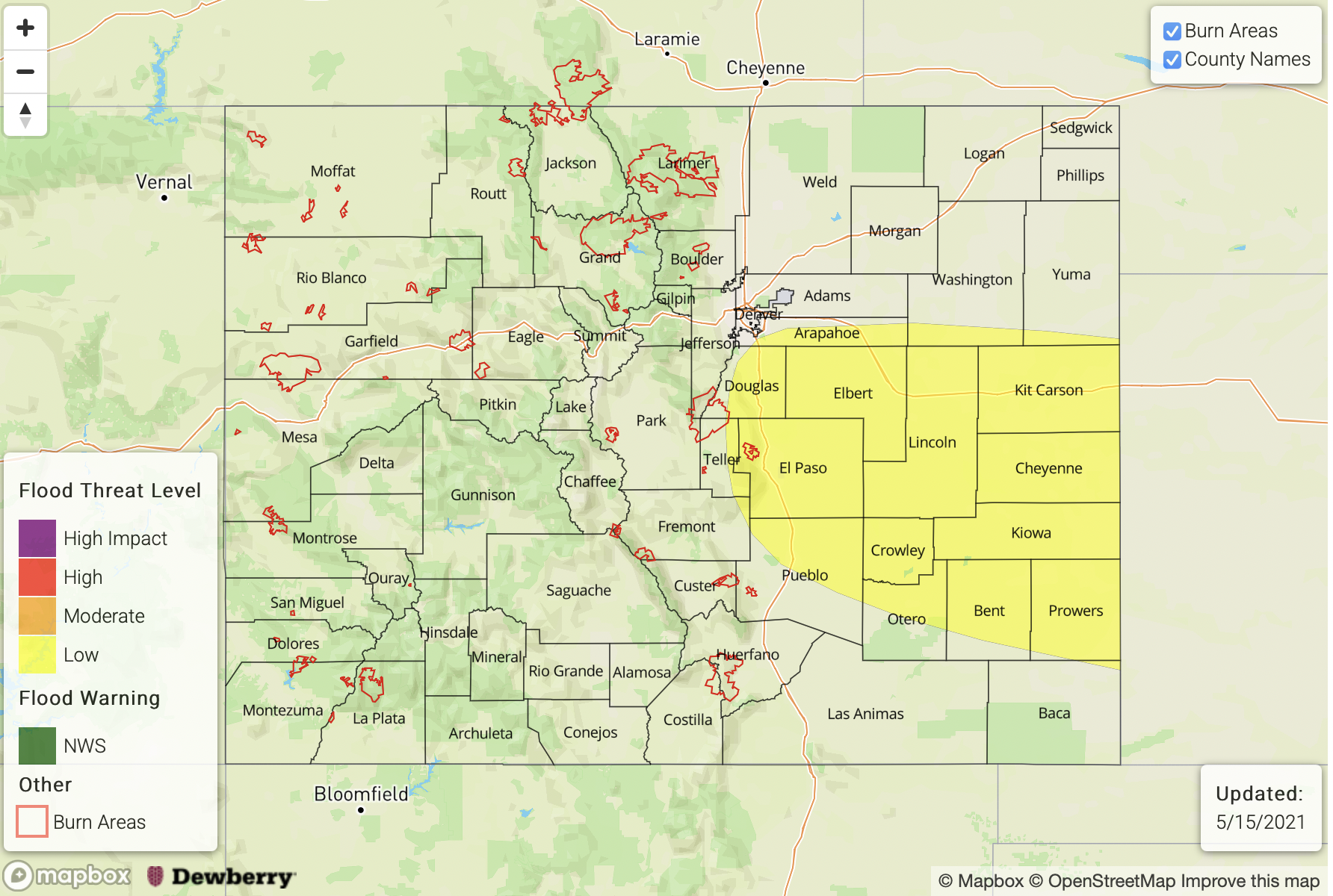
Zone-Specific Forecasts:
Front Range, Urban Corridor, Northeast Plains, Southeast Plains, Southeast Mountains, Raton Ridge & Palmer Ridge:
Once again by early afternoon, scattered storms are forecast to develop over the high terrains and elevated Ridges with more widespread activity over the Front Range. Max 1-hour rain rates up to 0.25 inches will be possible over the foothills along with small hail. As storms move into the adjacent plains and develop over the ridges, expect rainfall to intensify due to pooling moisture and higher CAPE. Over the Palmer Ridge, slow storm motion and training storms mean 1-2 hour rainfall totals around 1.50 inches will be possible along with hail. This combination of hail and heavy rainfall could cause street, low-land and local stream flooding issues. A Low flood threat has been issued. Brief strong outflow winds and severe hail will also be possible with the stronger storms that develop across the Urban Corridor this afternoon.
As storms move into higher moisture and increased instability over the plains, a line of convection is expected to form (southern Northeast Plains and Southeast Plains). These severe storms could produce winds around 60 mph, large hail (2 inches) and local heavy rainfall. Evening and overnight storms will likely continue over the eastern plains with 1-hour rain rates up to 1.75 inches. Thus, the Low flood threat has been extended east for excessive runoff, local stream flooding, road flooding and field ponding.
Primetime: 1PM to 3AM
Northwest Slope, Northern Mountains, Grand Valley, Central Mountains, San Juan Mountains, Southwest Slope & San Luis Valley:
A few high-based storms are possible over the San Juan and Central Mountains with an increase in cloud cover across all these regions today. Storms that develop south are forecast to produce plenty of virga, which could mix some strong winds down the surface (50 to 60mph gusts) similar to yesterday. Unfortunately, measurable rainfall is not forecast, but a few sprinkles will be possible along and near the Continental Divide. Flooding is NOT forecast.