Issue Date: Friday, May 14th, 2021
Issue Time: 9AM MDT
— Flooding is NOT expected today
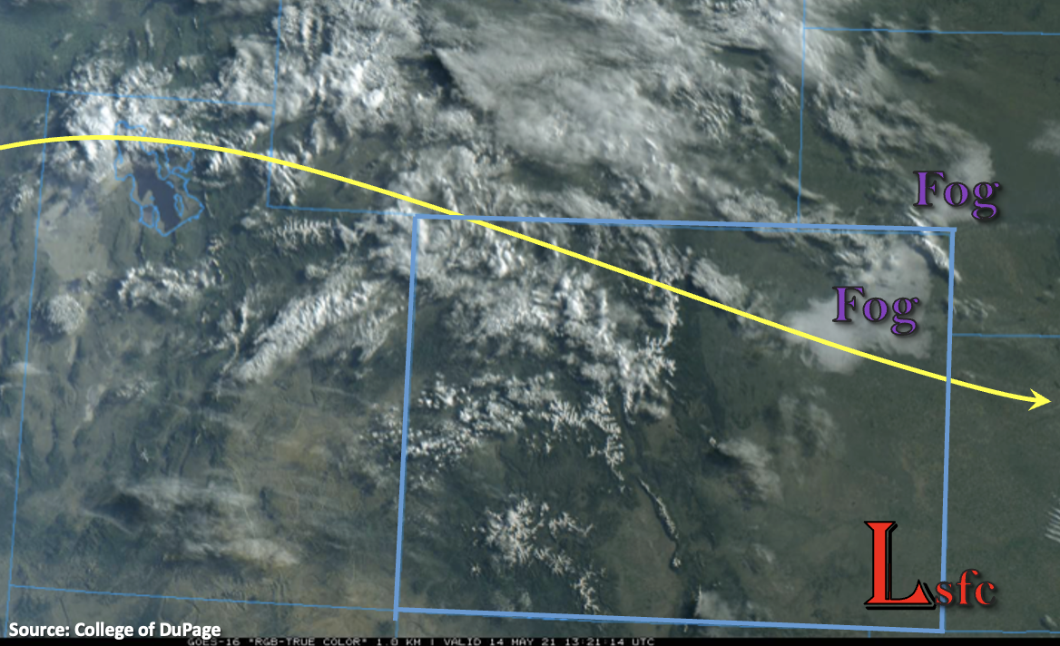
The visible satellite imagery below shows dense fog over the Northeast Plains along with some mid-level cloud cover over the northwest corner of the state. As anticipated and shown by these features, PW has rebounded slightly with 0.41 inches measured at Grand Junction and 0.47 inches at Denver. Due to a very dry surface layer west of the Continental Divide, only cloud cover and not rainfall is forecast this afternoon.
A surface Low is expected to develop over the Southeast Plains this afternoon. This will help pull in higher moisture with easterly and northeastly flow on its north side and set up a dryline. Higher dew points from the dryline look to be south and east of the state, so not currently anticipating any severe storm development from this feature. Further north, weak northwest flow aloft will continue, which will move another shortwave across the northern portion of the state. With slightly higher moisture today, this shortwave will help to spark some storms off the eastern Mountains and Palmer Ridge early this afternoon. Brief, heavy rainfall and wind will be the main threat from the storms that develop west.
East and southeast steering flows will push these storms into the adjacent plains where they will likely intensify due to higher moisture content. As the storms make it into the far Southeast and Northeast Plains, increased CAPE and modest shear may help produce a couple severe thunderstorms. The main threat from these severe storms will be local, heavy rainfall, strong outflow winds and large hail. Due to the small size of the intense rain cores, flooding is not forecast.
Today’s Flood Threat Map
For more information on today’s flood threat, see the map below. If there is a threat, hover over the threat areas for more details, and click on burn areas to learn more about them. For Zone-Specific forecasts, scroll below the threat map.
Zone-Specific Forecasts:
Front Range, Urban Corridor, Northeast Plains, Southeast Plains, Southeast Mountains, Raton Ridge & Palmer Ridge:
Scattered showers are forecast to develop over the high terrains and Palmer Ridge this afternoon. As storms move into the adjacent plains, expect rainfall to intensify. Max 1-hour rain rates up to 0.25 inches (mountains) and 0.75 inches (adjacent plains) will be possible. As storms move east/southeast into higher moisture, a couple severe storms will likely develop over the Northeast and Southeast Plains. Strong outflow winds, local heavy rainfall and hail up to 1.25 inches will be possible with these storms. Additionally, max 1-hour rain rates up to 1.50 inches will be possible, but due to the small area of the intense rainfall cores, flooding is NOT forecast. Expect thunderstorms to cross the eastern border around 10PM and lingering showers over the plains to end shortly after that.
Primetime: 12:30PM to 11PM
Northwest Slope, Northern Mountains, Grand Valley, Central Mountains, San Juan Mountains, Southwest Slope & San Luis Valley:
Westerly and southwesterly surface winds will pick up again this afternoon over these regions. Expect wind speeds just under 20 mph with higher gusts. Paired with low relative humidity values and plenty of dry fuel, a Red Flag Warning has been issued for the lower elevations of the Southwest Slope. High temperatures will reach into the mid 70Fs to 80Fs for the valleys and upper 60Fs to low 70Fs for the mountain valleys. Measurable rainfall is not forecast, though light showers may reach the ground over the Northern Mountains along and near the Continental Divide. Flooding is NOT forecast.