Issue Date: Wednesday, June 16th, 2021
Issue Time: 10:15AM MDT
— A LOW flood threat has been posted for parts of the Northeast Plains, possibly persisting into the early overnight hours
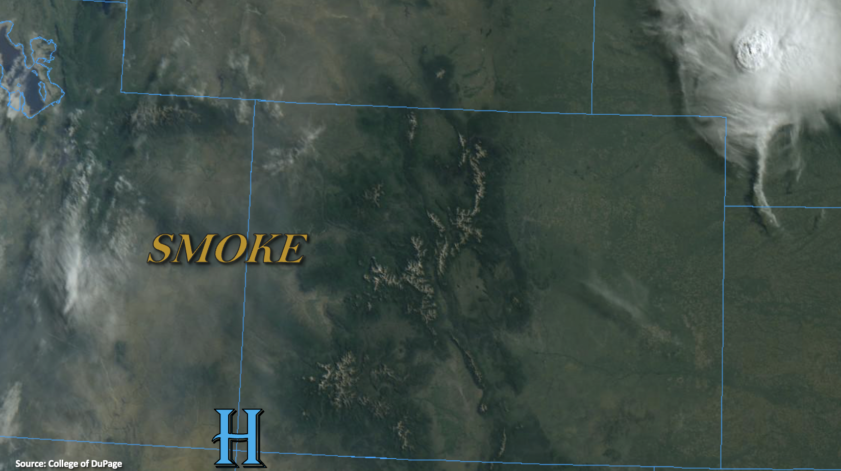
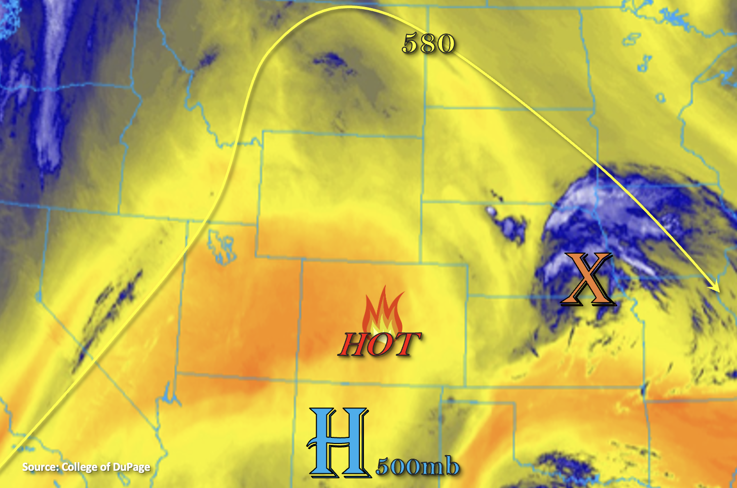
As the summer solstice approaches, we are reminded that the devil is always in the details when it comes to summer forecasting. Today is a good example of that. As shown in the visible satellite image, below, this morning’s mostly cloud free conditions across Colorado are a testament to the strength of the strong upper-level ridge. The ridge is centered directly over the Four Corners this morning. Compared to yesterday, dewpoints have crept up slightly west of the Continental Divide, but even with that, the Grand Junction PW shows a meager 0.48 inches of water vapor with most of that held high above the boundary layer. In short, little if any rainfall is expected west of the Continental Divide today.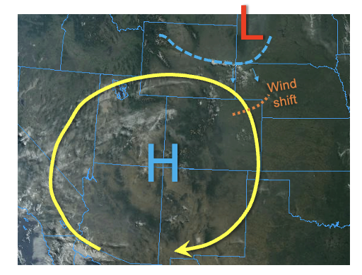
East of the Continental Divide, Denver’s sounding showed a PW of 0.49 inches, which is below normal for this time of year. However, higher PW, just under 1 inch, was observed at the North Platte (NE) and Dodge City (KS) soundings. Furthermore, model guidance appears to be biased low in all measures of moisture such as PW, which was underestimated by 10-20% along the CO/KS/NE borders. Even larger dry biases were noted in the high-resolution guidance today. As shown below, this morning’s 4AM (10Z) run of the HRRR underestimated the 8AM dewpoints across eastern Colorado by up to 6F. This is a very large bias for only a 4-hour forecast, which can easily make the difference between heavy rainfall and dry conditions. The bias is likely a testament to both how shallow the moisture is, along with the presence of isolated pockets of higher moisture due to wet soils remaining from the wet May.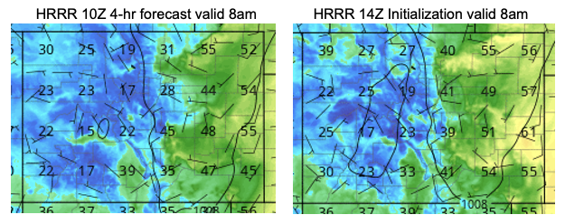
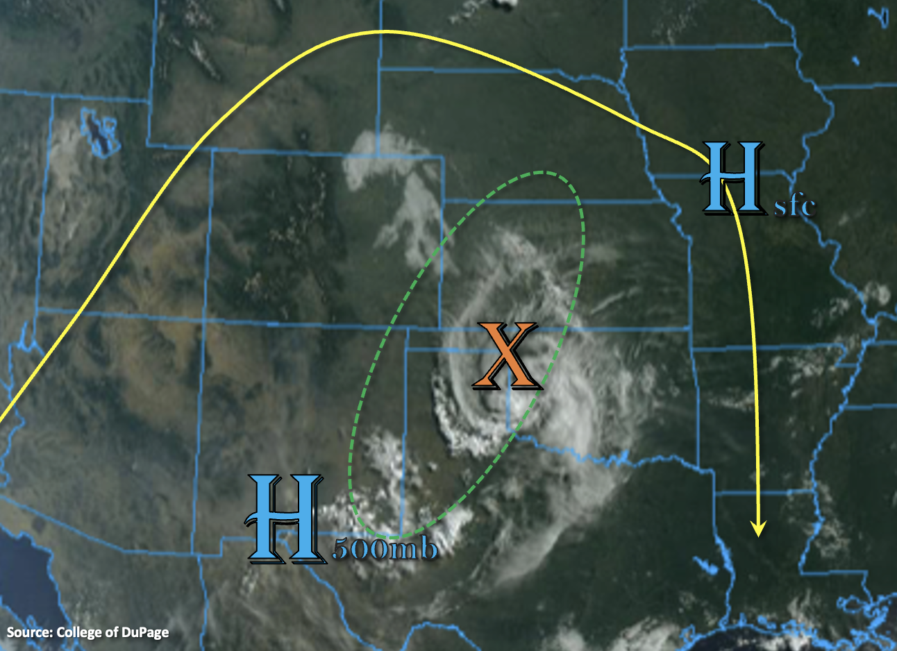
Returning the focus back on today’s forecast, we see a few forcing features of note. First, a cool front (more appropriately called a wind shift boundary) was noted over central Wyoming, which will race south across eastern Colorado this afternoon. Second, another wind shift boundary was also noted in northeast Colorado, with higher dewpoints and more southerly winds to its south. We expect these features to help concentrate the stronger storm activity today along eastern Northeast Plains, near the Kansas border. With forecast soundings indicating the potential for training cells due to the combination of (i) deep southerly boundary winds, (ii) light northerly winds aloft but (iii) weak shear overall, a Low flood threat has been issued for a small part of the Northeast Plains for isolated flash flooding.
Elsewhere, isolated to scattered showers and thunderstorms are expected mainly over the higher terrain east of the Continental Divide. But, with only shallow boundary layer moisture, flooding is not expected for these areas although short-term moderate rainfall will be possible.
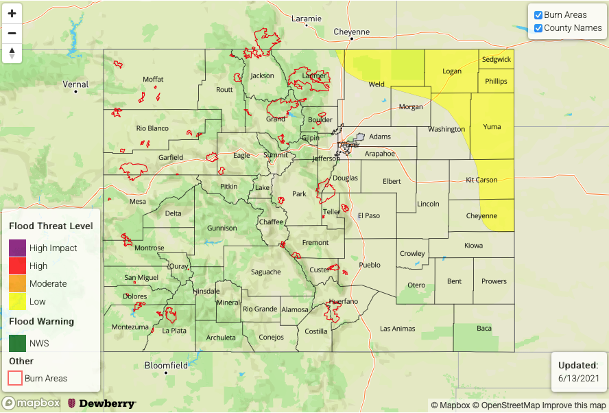
Today’s Flood Threat Map
For more information on today’s flood threat, see the map below. If there is a threat, hover over the threat areas for more details, and click on burn areas to learn more about them. For Zone-Specific forecasts, scroll below the threat map.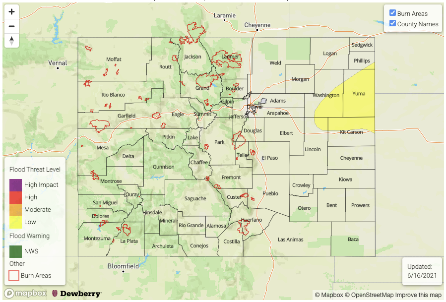
Zone-Specific Forecasts:
Northeast Plains:
Continued very hot today with scattered showers and thunderstorms developing this afternoon and possibly lasting into the early overnight hours. Max 1-hour rainfall up to 2.3 inches will be possible with the strongest cells, leading to the risk of isolated flash flooding. A Low flood threat has been posted for parts of the region. Large hail will be possible with the strongest storms. Note that this will persist into the early overnight hours.
Primetime: 1PM through 2AM
Front Range, Urban Corridor, Palmer Ridge, Southeast Plains, Raton Ridge, Southeast Mountains:
Continued very hot with isolated to scattered showers and thunderstorms this afternoon and evening. Max 1-hour rainfall up to 0.6 inches above 6,000 feet and 0.8 inches for lower elevations. Flooding is NOT expected today.
Primetime: 12PM through 9PM
San Luis Valley, Grand Valley, Southwest Slope and Northwest Slope, Central Mountains, Northern Mountains and San Juan Mountains:
Mostly sunny and continued very hot today with a isolated to widely scattered showers and weak storms possible over the San Juan Mountains. Max 30-minute rainfall up to 0.4 inches. Flooding is NOT expected today.