Issue Date: Monday, June 14th, 2021
Issue Time: 10:00AM MDT
— Flooding is NOT expected today
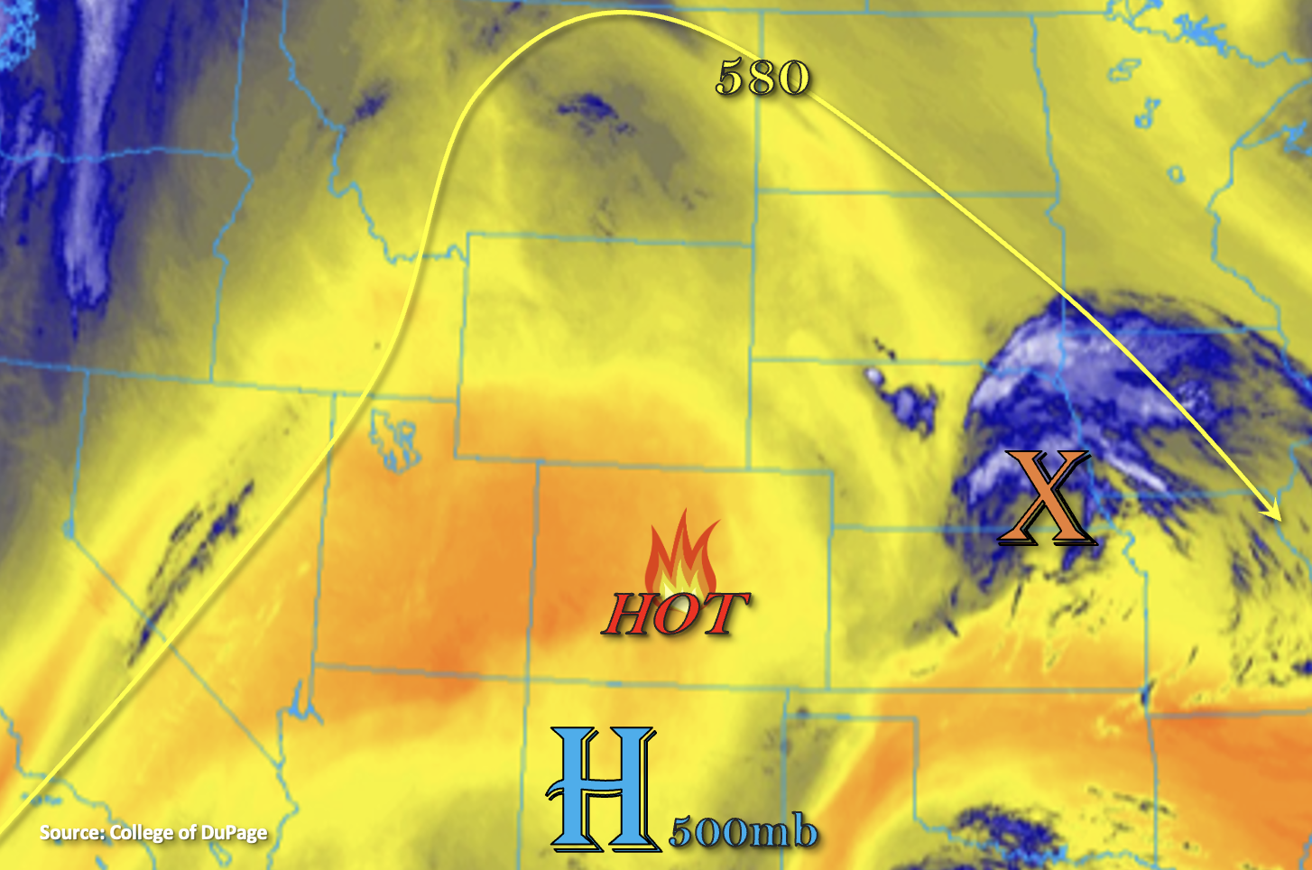
Today marks the first day of a very hot temperature streak. While temperatures already reached 100F across the lower elevations of western Colorado yesterday, the building 594mb ridge today will raise afternoon high temperatures statewide. The wake of last night storms over the Nebraska panhandle are currently located eastern Nebraska (orange “X”). There’s some residual low level moisture from the feature near Colorado’s eastern border. Elsewhere, the dry air mass continues to dominate as shown by Grand Junctions morning sounding where PW was measured at 0.26 inches. That will translate to another dry day for the majority of Colorado (areas of orange below).
Looking back to the eastern adjacent plains where there is some residual moisture under the ridge, PW at Denver remains about the same as yesterday (0.70 inches). Similar to yesterday, this moisture gradient increases quite a bit as you move towards the eastern border. However, it looks like the dry westerly flow aloft will have a better chance of mixing out the surface moisture throughout the day when compared to yesterday, especially along the I-25 corridor. Outside of a couple weak showers over the elevated ridges, rainfall is not forecast for the immediate adjacent plains. There’s no identifiable shortwave moving through the flow, so that should help to keep the eastern plains capped as the storms and outflow boundaries move into the area late this afternoon and evening. There’s also a chance for a couple late night storms to cross over the northern border from Nebraska, but with lower instability, flooding is not expected.
Today’s Flood Threat Map
For more information on today’s flood threat, see the map below. If there is a threat, hover over the threat areas for more details, and click on burn areas to learn more about them. For Zone-Specific forecasts, scroll below the threat map.
Zone-Specific Forecasts:
Northeast Plains & Southeast Plains:
Temperatures will reach into the upper 90Fs and may reach 100F over portions of these regions this afternoon. A cap will likely inhibit any convection over the area as storms and outflow boundaries move into the area this afternoon and evening. Low confidence storms will break the cap, but if they do, max 1-hour rain rates up to 1.75 inches will be possible along with severe thunderstorms (hail and damaging outflow winds). Again, chances of this occurring are low enough that no flood threat will be issued. Late night storms may cross the northern border, and if they can survive, rain rates up to 1.5 inches per hour will be possible along with damaging outflow winds and some hail. Flooding is NOT forecast.
Primetime (if storms break the cap): 5:30PM to 2AM
Urban Corridor, Southeast Mountains, Front Range, Palmer Ridge & Raton Ridge:
Temperatures this afternoon will reach into the upper 90Fs across the Urban Corridor with upper-80Fs/low 90Fs forecast for the mountain valleys. Rising heights and decreasing surface moisture throughout the day mean storm develop chances will be low. A couple isolated storms could form over the elevated ridges where the surface flow has a bit more of an easterly component to it. Isolated max 1-hour rain rates up to 0.40 inches will be possible with wind as the main threat. Flooding is NOT forecast.
Primetime: 3PM to 8PM
Grand Valley, San Luis Valley, Southwest Slope, Northwest Slope, San Juan Mountains, Central Mountains & Northern Mountains:
An excessive heat warning has been issued again for dangerously hot conditions across the lower elevations out west. Highs will reach past 100F again for the Grand Valley. The century mark will also not be out of reach for the lower elevations of the Southwest and Northwest Slopes. San Luis Valley will reach into the 90Fs. Rainfall is not forecast.