Issue Date: Sunday, May 1st, 2022
Issue Time: 9:40AM MDT
— Flooding is NOT expected today
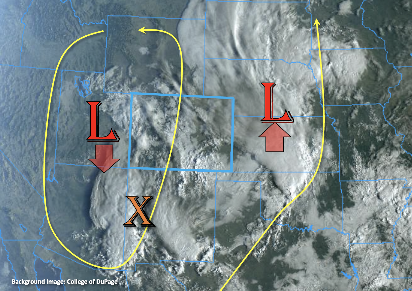
In true Colorado fashion, Mother Nature decided to kick off the 2022 Flood Threat Bulletin season with some fireworks. As shown in the water vapor image below, a small but potent upper-level disturbance is currently positioned over the Great Basin. It will rapidly move eastward into Colorado today, inducing widespread precipitation, with the best coverage being over the northern half of the state.
The main limiting factor to heavy rainfall potential will be moisture. Morning Precipitable Water (PW) at Denver and Grand Junction measured a meager 0.28 and 0.29 inches, respectively. As the disturbance approaches Colorado, it will stage an impressive return of moisture via strong southerly flow. The best chance for isolated heavy rainfall will be over southeast Colorado, where by late afternoon PW will exceed 0.50 inches and perhaps approach 0.75 inches. However, the more notable threat will be severe weather in the form of large hail and tornadoes. Short-term heavy rainfall will be possible with these storms, but with rapid northeast steering flow of 35mph or greater, flooding is NOT expected.
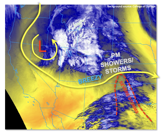
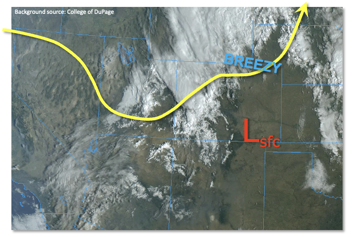
Moving on to some great news, steady rainfall and higher elevation snow will increase in coverage during the late evening and overnight hours over most of Colorado’s higher terrain as well as northeast Colorado. Scattered elevated thunderstorms (yes, including thundersnow!) will also be possible especially over the Northeast Plains. By tomorrow morning widespread rainfall exceeding 1 inch is likely over the Northeast Plains, which will be most welcome for the region’s farmers after the dry, windy and dusty April over that part of the state.
Lastly, a Red Flag Warning is in place over parts of southern Colorado where warm temperatures, winds and low humidity will combine to elevate the threat of wildfire initiation and spread.
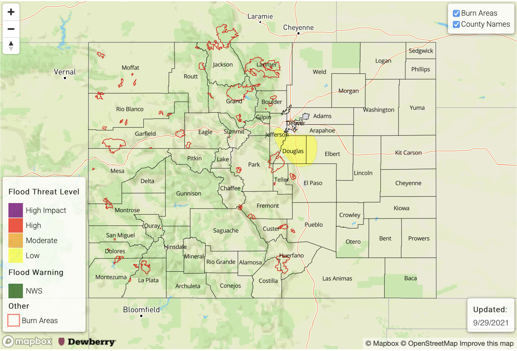
Today’s Flood Threat Map
For more information on today’s flood threat, see the map below. If there is a threat, hover over the threat areas for more details, and click on burn areas to learn more about them. For Zone-Specific forecasts, scroll below the threat map.
Zone-Specific Forecasts:
Southeast Plains:
Becoming partly cloudy, warm and windy with isolated to scattered thunderstorms developing mainly over far eastern areas along the OK and KS border. Max 1-hour rainfall up to 1.4 inches is possible. However, flooding is NOT expected today.
Severe storms will also be possible with large hail and tornadoes being the main threats, along with damaging straight-line winds.
Primetime: 4PM through 8PM, then light/moderate rainfall during the overnight hours
Northeast Plains, Front Range, Urban Corridor, Palmer Ridge:
Becoming partly to mostly cloudy with seasonably warm temperatures. Rainfall and high elevation snow will develop during the late evening and overnight hours. Max 1-hour rain rainfall up to 0.8 inches mainly over far eastern areas towards the KS border. Max 24-hour rainfall up to 1.9 inches is expected along and north of the South Platte River. The snow level will drop to 7,500 feet by tomorrow morning. Flooding is NOT expected today.
Primetime: 8PM through the overnight hours.
Northern Mountains, Central Mountains, San Juan Mountains, Grand Valley, Northwest Slope:
Partly to mostly cloudy with seasonably cool temperatures. Rain and snow will develop during the overnight hours, mainly over the higher elevations. Max 1-hour rainfall up to 0.4 inches is possible early in the event. Widespread precipitation amounts of 0.25 – 0.5 inches are expected by tomorrow morning. Flooding is NOT expected today.
Primetime: 7PM through the overnight hours
Southwest Slope, San Luis Valley, Southeast Mountains, Raton Ridge:
Mostly sunny, warm and windy with a Red Flag Warning in effect for most of the area. Isolated to scattered rain and high-elevation snow showers are expected during the overnight hours, but coverage will be limited. Flooding is NOT expected today.
Primetime: 10PM through the overnight hours