Issue Date: Thursday, September 30th, 2021
Issue Time: 10:20AM MDT
This is the last scheduled Flood Threat Bulletin post for the 2021 season. The next FTB season begins on May 1, 2022. It has been a pleasure to serve you!
— Flooding is NOT expected today
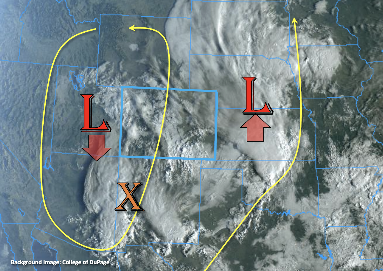
Unsettled weather continues with cooler temperatures and plenty of cloud cover forecast over Colorado for the last day of September. The upper-level pattern is expected to split today, and another Low will become cut off from the main flow (Utah). This should help to hold slightly higher PW values in place over the western portion of the state (0.68 inches at Grand Junction this morning). Mid-level lift will rotate around the cutoff Low (orange “X”) as it traverses southward throughout the day. This vorticity maximum and remaining moisture is expected to spark a few rounds of showers over western Colorado with better coverage of precipitation south of I-70. Not confident that a lot of instability will be able to build, which should assist in moderating the rainfall rates. Nonetheless, some embedded convection may be possible and 2 to 3 hour accumulations will likely bring a good soaking to the area. As far as the flood threat for the area, rainfall over the southwest corner has been spotty with accumulations on the lower end the last couple of days. That means that soils in the region likely aren’t saturated yet, and they should be able to absorb a large portion of the rainfall today. The one exception is over the southern/eastern San Juan Mountains where a second round of precipitation tonight, driven by the jet, may help to boost 24-hour accumulations. Rain turning to snow tonight should help to limit the rainfall threat over the area as the snow line falls just below 10K feet. Outside of some nuisance ponding both during the overnight hours and this afternoon, flooding is NOT expected today.
Over the rest of the state, outside of isolated showers over the eastern mountains, it should remain dry. Forecasting below average temperatures today and for the cloud cover to hang around. Drier air is expected move into the plains this afternoon, which should allow some blue skies to break through for a few hours. This will help to increase afternoon high temperatures a couple of degrees over the region. Glad to see that the FTB will be ending on a fall-like note with another round of precipitation for western Colorado.
Today’s Flood Threat Map:
For more information on today’s flood threat, see the map below. If there is a threat, hover over the threat areas for more details, and click on burn areas to learn more about them. For Zone-Specific forecasts, scroll below the threat map.

Zone-Specific Forecasts:
San Juan Mountains, Central Mountains & Northern Mountains:
A couple rounds of showers are anticipated today with the snow line sitting above 10K feet during the day and dropping to around 9.5K overnight. More widespread showers are anticipated over the San Juan & Central Mountains with more isolated PoPs forecast over the Northern Mountains. Max 1-hour rain rates up to 0.70 inches (south) and 0.45 inches (north) will be possible if some embedded convection can develop. Small hail could also accompany those stronger storms. Over the southern/eastern San Juan Mountains, 24-hour accumulations up to 1.60 inches may be possible with the overnight precipitation forecast. Outside of some possible nuisance road and field ponding, flooding is NOT expected today.
Primetime: 1PM to Ongoing
Grand Valley, San Luis Valley, Northwest Slope & Southwest Slope:
Best chance for rainfall in the valleys will be over the SLV and Southwest Slope. Spottier shower coverage is expected over the Grand Valley and only light showers/cloud cover are anticipated over the lower elevations of the Northwest Slope. Max 1-hour rain rates up to 0.50 inches (south) and 0.25 inches (central) will be possible. Storm totals by morning could reach up to 0.40 inches for the SLV, 0.90 inches for the Southwest Slope and 0.40 inches for the Grand Valley. Flooding is NOT expected today, although there could be increased runoff in the Grand Valley if storms track over an area with saturated soils.
Primetime: 1:30PM to Ongoing
Southeast Mountains, Front Range, Urban Corridor, Northeast Plains, Southeast Plains, Raton Ridge & Palmer Ridge:
Much cooler today without much rainfall forecast as drier air moves over most of the lower elevations. Weak upslope flow and some residual moisture may cause some isolated showers to develop over the eastern mountains this afternoon. The southern Southeast Mountains/Raton Ridge intersect may see some weak precipitation overnight as well. Totals over the next 24-hour period up to 0.60 inches (south) and 0.25 inches (north) may be possible. Cloud cover will likely remain present all day over the Urban Corridor and elevated ridges, but there could be some clearing over the eastern plains for a bit this afternoon. Flooding is NOT expected.
Primetime: 1PM to 3AM