Issue Date: 6/03/2015
Issue Time: 10:20 AM (Updated: 1:26 PM)
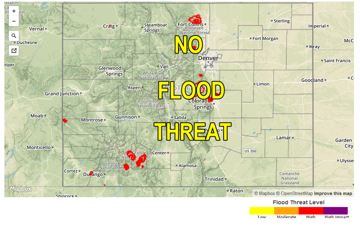
UPDATE: EXTENDING THE LOW FLOOD THREAT UNTIL 8 AM TOMORROW MORNING.
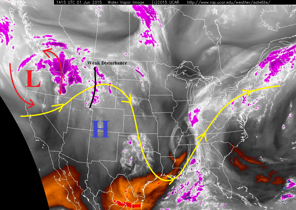
Moist, upslope flow will likely continue tonight over the low flood threat area as the surface low remains over SW KS/SE CO. This will maintain moisture convergence into NE Colorado into the overnight hours. Uncertainties exist regarding placement of the low level jet and associated convergence axis, but it is likely that a few thunderstorms capable of heavy rain will be ongoing after midnight across the Northeast Plains and Palmer Ridge. These storms will be capable of producing rain rates of 1-2 inches/hour, large hail, and strong winds. Be sure and stay up-to-date on the evolving weather scenario with your local NWS office for all watches and warnings. Updates have been added to the Zone-Specific forecast, as well.
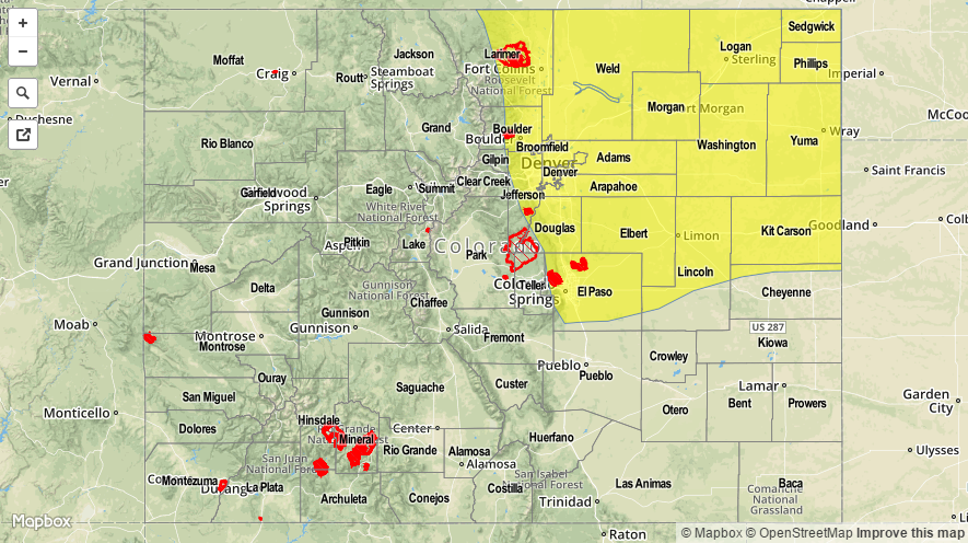
A LOW FLOOD THREAT IS FORECAST FOR THE URBAN CORRIDOR, PALMER RIDGE, NORTHEAST PLAINS, AND PORTIONS OF THE FRONT RANGE AND SOUTHEAST PLAINS. A LOW FLOOD THREAT CONTINUES FOR PORTIONS OF THE CACHE LA POUDRE AND SOUTH PLATTE RIVERS.
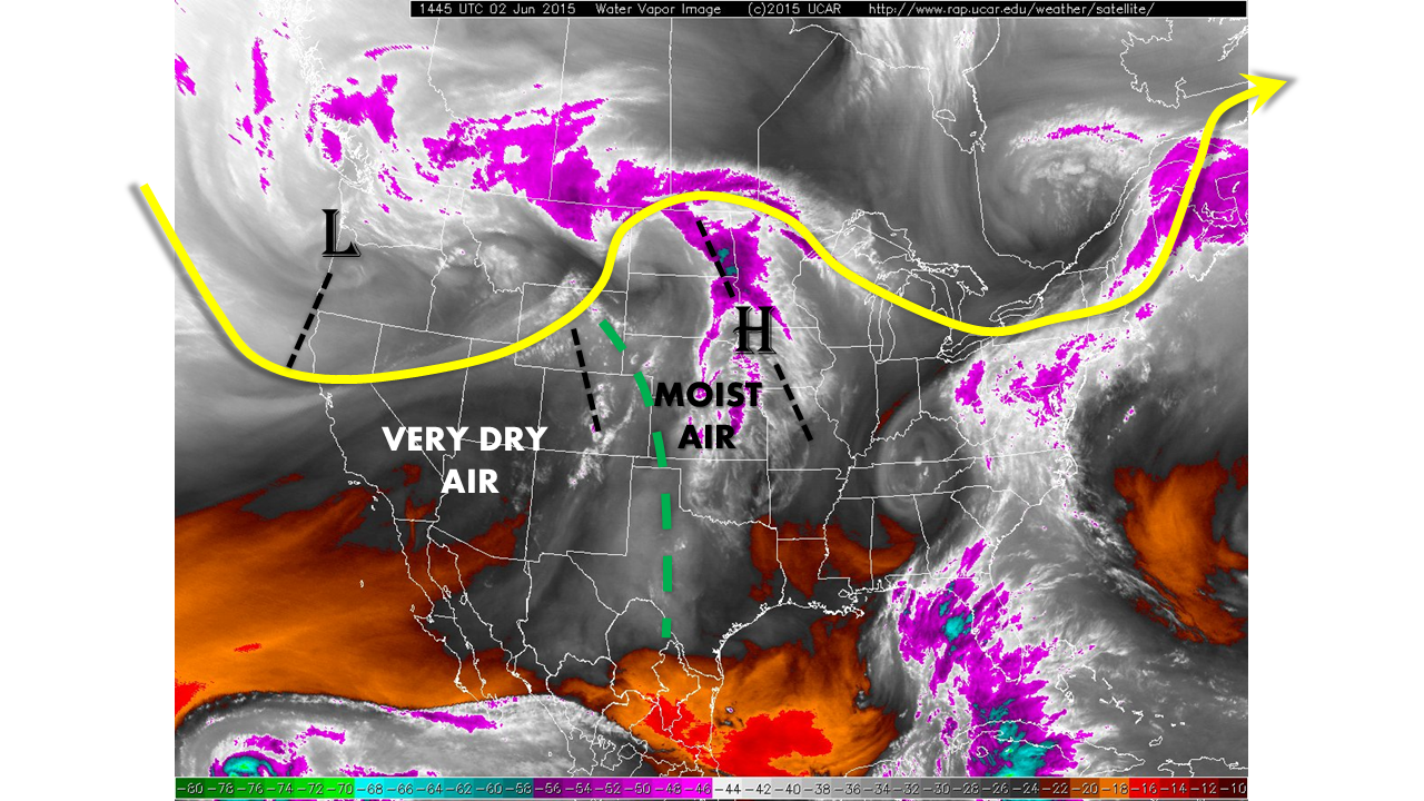
Today’s forecast is a tale of two different environments, thanks to a few factors: a surface “low,” moist, upslope flow, and dry mid- and upper-level air. All of these factors are easy to pick out in the visible imagery below. The moisture being brought in by the easterly, upslope flow is confined to the lower levels, with westerly winds and dry air existing above ~ 750 mb. Due to this, the moisture is confined east of the mountains and north of the surface low, which really sets up a defined boundary for thunderstorm development during this forecast period. For locations without the low-level moisture (west of the Continental Divide and south of Highway 50), the weather will be dry and warm, underneath mostly sunny skies.
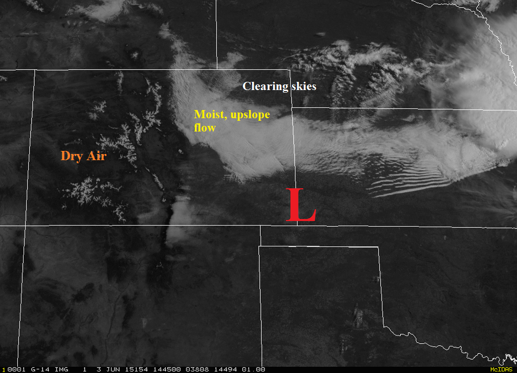
The area of interest today is for locations along and east of the Front Range and north of Highway 50; this is where the low-level moisture, instability, and shear will reside. Even with the best moisture located in this region, precipitable water values are ~average due to the drier mid- and upper-levels. This means that storms will not be the most efficient at producing heavy rain, and thus, the flood threat will remain low. However, with storm motions not expected to be quick, a slow-moving cell will be capable of producing a heavy amount of rain.
Strong instability and sufficient deep-layer shear will be favorable for supercells producing large hail (1-2 inches in diameter) and damaging winds (gusts up to 60-70 mph) in the aforementioned area. Low-level flow and strong updrafts will support a tornado threat, as well. Be sure to stay up-to-date on all watches and warning from your local NWS office.
For a look into maximum rain rates and timing of storms, check out the Zone-Specific forecasts below the map.
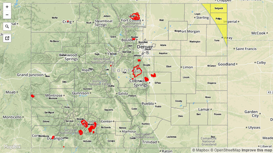
Today’s Flood Threat Map
For more information on today’s flood threat, see the map below (hover over threat areas for more details). For Zone-Specific forecasts, jump below the map.

Zone-Specific Forecasts
Front Range, Urban Corridor, Palmer Ridge, Southeast Plains (along and North of Highway 50), and Northeast Plains:
Isolated-to-scattered strong-to-severe thunderstorms are expected, beginning between 1-2 PM over the Front Range, 1-3 PM over the Urban Corridor and Palmer Ridge, 3-5 PM for the Northeast Plains, and 2-5 PM for the Southeast Plains. The regions that will receive the greatest relative coverage of storms will be the Urban Corridor, Palmer Ridge, and Northeast Plains. Maximum rain rates will be in the 1.75-2.25 inches/hour range for the Urban Corridor, Palmer Ridge, and Northeast Plains; 0.6-1.0 inches/hour for the Front Range; and 0.6-1.2 inches/hour for the Southeast Plains.
Traffic in the Urban Corridor will likely be impacted by any strong-to-severe storm with the threat of heavy rain and large hail, especially between the hours of 3 PM and 8 PM. This will be important to monitor for the afternoon/evening commute.
Thunderstorms will end from west to east as they continue to push eastward into NE and KS.
The latest observations and trends warrant an update to the forecast. Moisture continues to stream in northeastern Colorado, and it is likely that this will continue through the overnight as the surface low stalls over SW KS/SE CO. This means that a few thunderstorms capable of heavy rain will be ongoing after midnight across the Northeast Plains and Palmer Ridge. These storms will be capable of producing 1-2 inches/hour rain rates, large hail (1-1.5 inches in diameter), and strong winds.
Northern Mountains, Northwest Slope, Central Mountains, San Juan Mountains, Grand Valley, San Luis Valley, Southwest Slope, Southeast Mountains, Raton Ridge, and Southeast Plains (south of Highway 50):
It will be a warm and sunny day across these regions as dry air rules the forecast. High temperatures will be a few degrees above normal; very pleasant for any outdoor activities you may have planned. As the surface low moves east this evening, an isolated shower/weak thunderstorm cannot be ruled out near the CO/KS border for the Southeast Plains, but chances look slim. Otherwise, a clear night is on tap.