Issue Date: 6/02/2015
Issue Time: 10:45AM MDT
—Low flood threat for parts of Northeast Plains
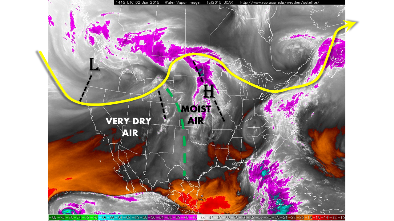
It is no secret that most of the state had a very wet May. Part of this rainfall percolated deep into the soils and is now being called back up through evaporation. Partly as a result of this, dewpoints east of the Continental Divide are very high this morning: in the 50s to low 60s. Typically, this may be the first sign of an impending heavy rainfall threat. However, this morning there is a clash between very dry middle and upper-level air to the west and a moist low-level air to the east, as shown by the water vapor image. In addition, the image shows that the ridge of the past few days has scooted east, and is being replaced by an approaching upper-level low.
Today will mark a transition day. The moist air is expected to be eroded by drier air by early afternoon. This is confirmed by this morning’s soundings at Denver and Grand Junction as well as low precipitable water values of 0.2 to 0.4 inches. However, a weak overhead disturbance is expected to fuel isolated to scattered thunderstorms for the very far northeast corner of the state. Those storms will have access to very large instability and moisture, and will be capable of producing rain rates up to 2.5 inches per hour. A Low flood threat has been posted for parts of the Northeast Plains for localized flash flooding.
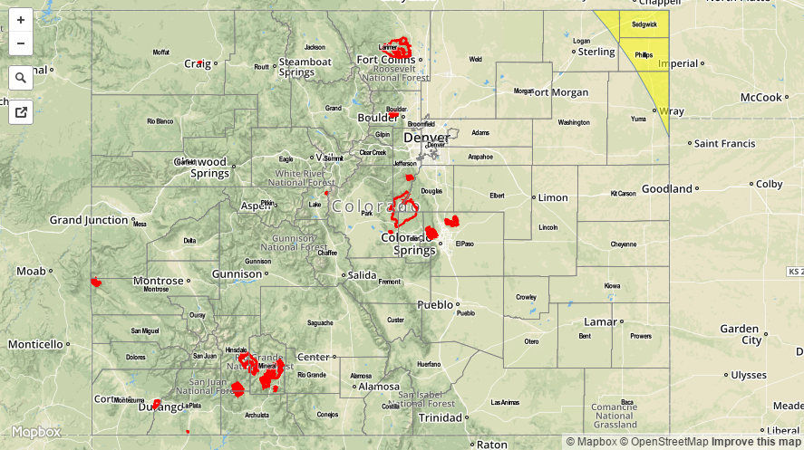
Today’s Flood Threat Map
For more information on today’s flood threat, see the map below (hover over threat areas for more details). For Zone-Specific forecasts, jump below the map.

Zone-Specific Forecasts
Northeast Plains:
Sunny early, then turning partly cloudy. Isolated to scattered thunderstorms forming in the far northeast corner. Hourly rain rates up to 2.5 inches possible, along with hail up to 1.5 inches and wind gusts to 60 mph. A Low flood threat has been posted.
Primetime: 3pm through 8pm
Southwest Slope, Northwest Slope, Grand Valley, and San Luis Valley:
Mostly sunny, warm and dry with temperatures rising into the 80s to near 90F. No flood threat is expected today.
Northern Mountains, Central Mountains, San Juan Mountains, Front Range, Urban Corridor, Northeast Plains, Palmer Divide, Southeast Plains, Southeast Mountains, Raton Ridge:
Mostly sunny with a few afternoon clouds possible. Much drier todays with dewpoints falling into the 10s and 20s, and perhaps even lower for some high elevation areas. No flooding is expected today.