Issue Date: 6/6/2015
Issue Time: 10:40 AM
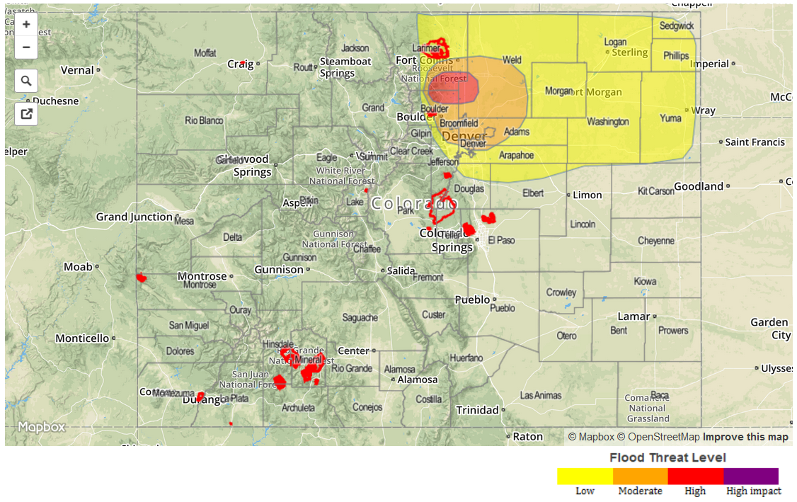
A MODERATE FLOOD THREAT HAS BEEN ISSUED FOR PORTIONS OF THE SAN JUAN MOUNTAINS AND SOUTHWEST SLOPE.
A LOW FLOOD THREAT HAS BEEN ISSUED FOR PORTIONS OF THE SOUTHWEST SLOPE, SAN JUAN MOUNTAINS, CENTRAL MOUNTAINS, AND GRAND VALLEY.
A LOW FLOOD THREAT CONTINUES FOR THE WEST SALT CREEK LANDSLIDE AREA.
A LOW FLOOD THREAT HAS BEEN ISSUED FOR PORTIONS OF THE FRONT RANGE, URBAN CORRIDOR, PALMER RIDGE, SOUTHEAST PLAINS, SOUTHEAST MOUNTAINS, AND RATON RIDGE.
A LOW FLOOD THREAT CONTINUES DUE TO ACTION-TO-MINOR STAGE FLOODNG FOR PORTIONS OF THE ARKANSAS RIVER, SOUTH PLATTE RIVER, AND CACHE LA POUDRE RIVER.
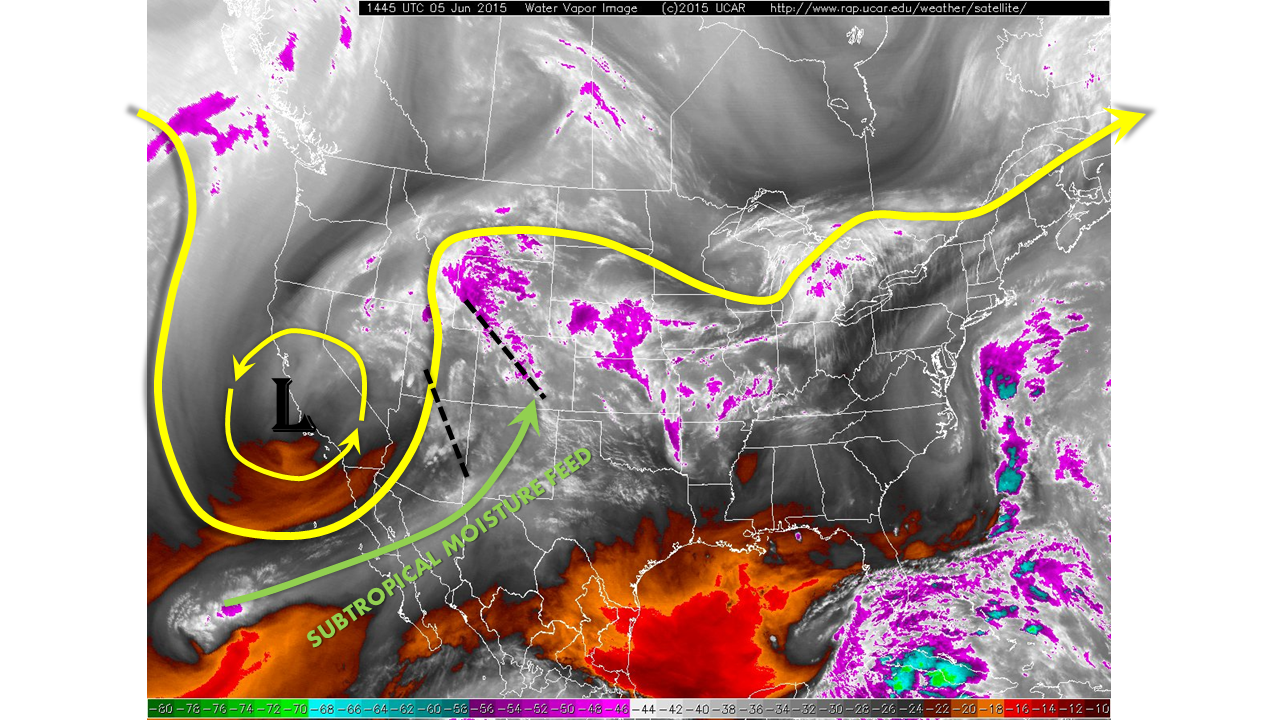
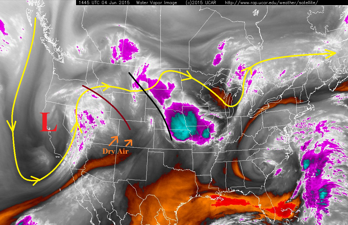
The slow-moving upper-level low continues to spin over the Southwestern US, currently centered over southern NV (as seen on the water vapor image below). It will continue its track slowly to the ENE today, continuing the stream of moisture-rich air over Colorado. The best moisture/lift will stay over western Colorado today as the upper-level Jet noses across the 4-corners region. This will provide upper-level support to areas already influenced by favorable orographic lift (specifically the San Juan Mountains and Central Mountains regions), producing widespread showers and thunderstorms throughout today and tonight. Storm motions will be fairly quick (ESE at 25-35 mph), and this will help lessen the flash flood threat for today. However, soils are nearly saturated after bouts with moderate-to-heavy rain yesterday and showers ongoing this morning, and burn scars are of particular concern for Flash Flooding today. For this reason, the moderate flood threat has been hoisted for the San Juan Mountains.
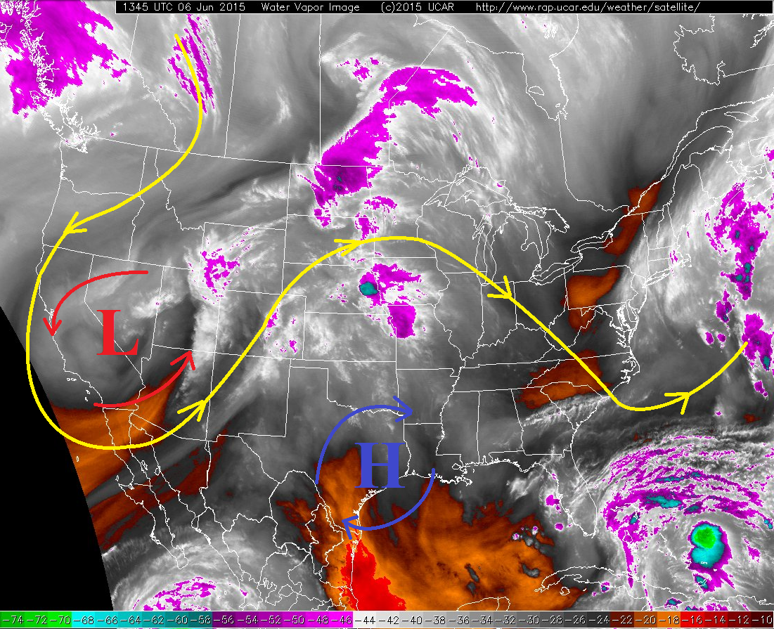
For areas east of the Continental Divide, showers and thunderstorms will not be nearly as widespread, and a bit less-intense as compared to yesterday. This is due, in part, to the lessening easterly flow thanks to the developing surface low over the northern plains. This will bring surface dewpoints and instability lower than yesterday, as well as lessen the low-level shear that brought yesterday’s tornado threat. While an isolated tornado or two cannot be ruled out over the Palmer Ridge and Northeastern Plains, the chances are much less than the previous two days. Hail, strong winds, and locally heavy rainfall will be the main threats of stronger storms. Storm motions will be fairly quick today (E at 15-25 mph), and this will lessen the potential flooding threat. With that said, though, previous days rainfall and burn scars will warrant a low flood threat across portions of the Front Range, Urban Corridor, Palmer Ridge, Southeast Plains, Southeast Mountains and Raton Ridge.
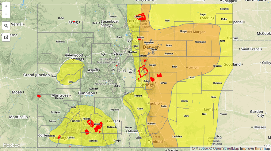
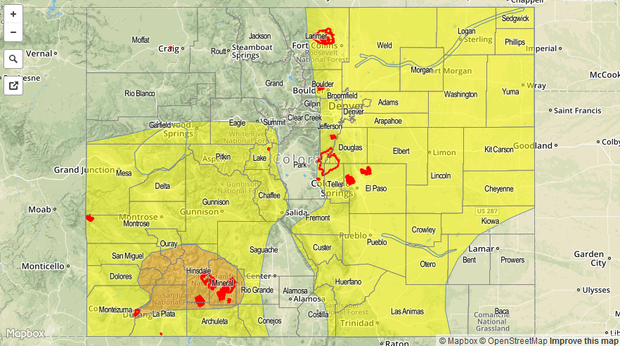
Today’s Flood Threat Map
For more information on today’s flood threat, see the map below (hover over threat areas for more details). For Zone-Specific forecasts, jump below the map.

Zone-Specific Forecasts
Front Range, Urban Corridor, Palmer Ridge, Northeast Plains, Southeast Plains, and Raton Ridge:
Scattered showers and thunderstorms, a few will be strong-to-severe, are expected today and into the overnight hours. After the activity of this afternoon and evening clears out to the east, some redevelopment during the overnight hours is expected as a weak cool front pushes in from the north at the same time that upper-level lift increases from the northeastward moving upper-level low.
Maximum rain rates will be in the 1.2-2.0 inches/hour range during the afternoon and evening hours, lessening somewhat to 0.8-1.5 inches/hour during the overnight hours.
Timing: Noon – 5 AM
Northern Mountains and Northwest Slope:
Scattered showers and thunderstorms are expected, though generally less than locations to the south. Rain rates will also be slightly less in these regions, with maximum rain rates in the 0.6-0.8 inches/hour range.
Timing: 11 AM – 9 PM, with a few weak showers continuing overnight and into tomorrow morning.
Central Mountains, San Juan Mountains, San Luis Valley, Grand Valley, Southeast Mountains and Southwest Slope:
Widespread showers and thunderstorms, a few will be strong-to-marginally severe over the Southwest Slope and San Juan Mountains. In fact, an isolated tornado cannot be ruled out over the lower elevations in far SW Colorado, where favorable shear and instability will be present this afternoon and evening.
Maximum rain rates will be in the 0.7-1.4 inches/hour range, with the highest likelihood across the San Juan Mountains and Central Mountains due to favorable orographic lift from NW-to-SE oriented mountain ranges.
Timing: 11 AM – 10 PM, with a few showers and weak thunderstorms continuing into the early morning hours.