Issue Date: 6/04/2015
Issue Time: 10:10 PM
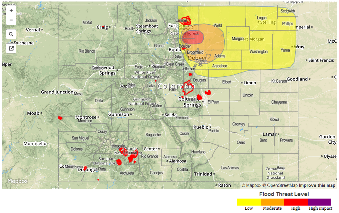
HIGH FLOOD THREAT IS ONGOING ACROSS PORTIONS OF THE FRONT RANGE AND URBAN CORRIDOR. A MODERATE FLOOD THREAT HAS BEEN ISSUED FOR PORTIONS OF THE URBAN CORRIDOR, FRONT RANGE, AND NORTHEAST PLAINS. A LOW FLOOD THREAT HAS BEEN ISSUED FOR PORTIONS OF THE FRONT RANGE, URBAN CORRIDOR, PALMER RIDGE, AND NORTHEASTERN PLAINS.
This special update is due to the unfolding situation across portions of the Front Range, Urban Corridor, and Palmer Ridge. There are two big culprits responsible for this result:
1. Easterly, upslope, low-level flow continues to stream moisture-rich air back into Front Range and Urban Corridor.
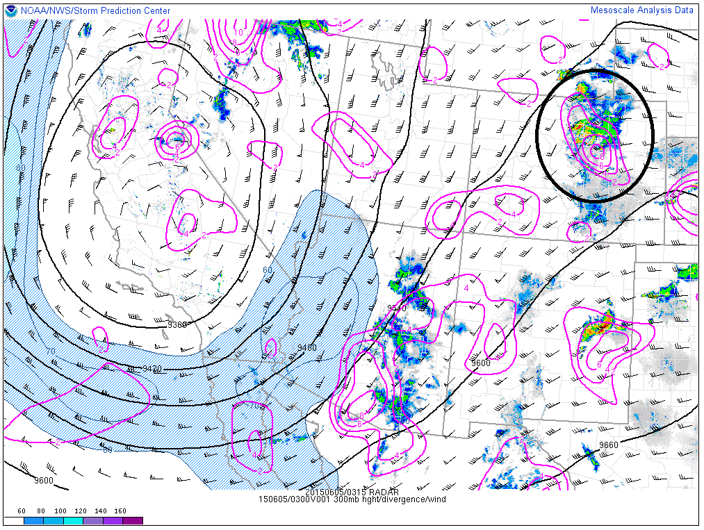
2. The picture below shows that a ribbon of 300-mb divergence (produces lift) has rotated across Colorado ahead of a weak shortwave, providing upper-level support that wasn’t present up until late this evening when these strong thunderstorms producing heavy rain developed.
Showers and thunderstorms capable of producing heavy rain will continue across the Front Range, Urban Corridor, Palmer Ridge, and western portions of the Northeastern Plains until 3-5 AM, before continuing to the east across the rest of the Northeastern Plains and exiting the state around 8-9 AM tomorrow morning.