Issue Date: 6/26/2015
Issue Time: 10:10AM
— Low flood threat for Palmer Ridge, Southeast Plains, Southeast Mountains and Raton Ridge
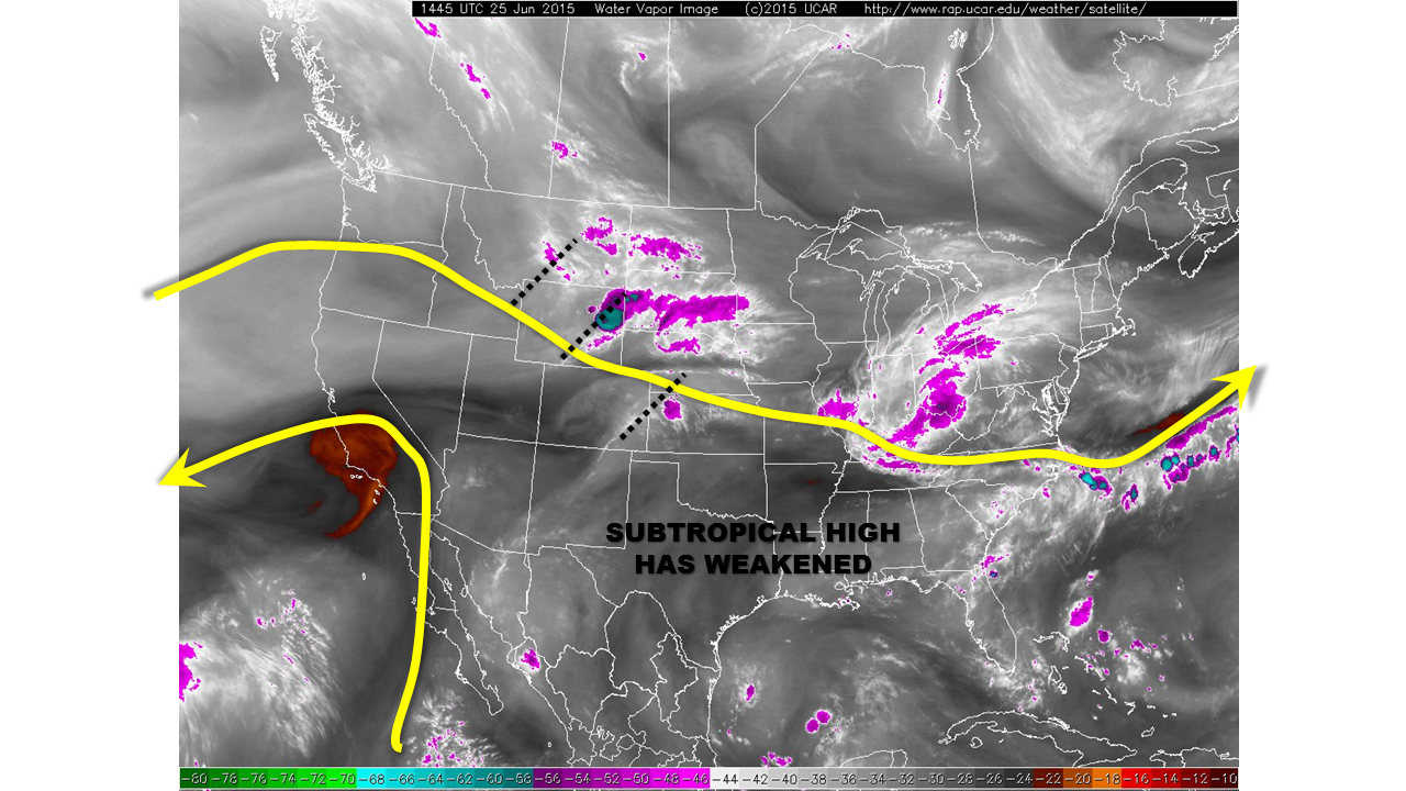
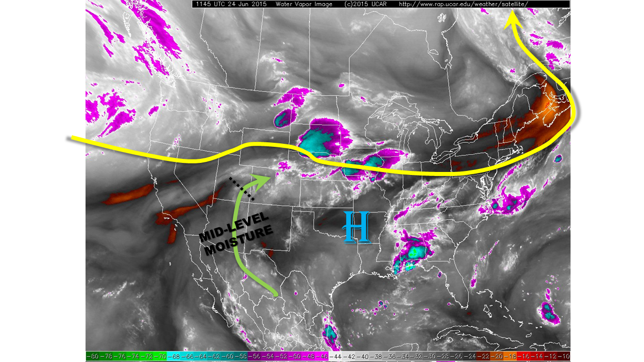
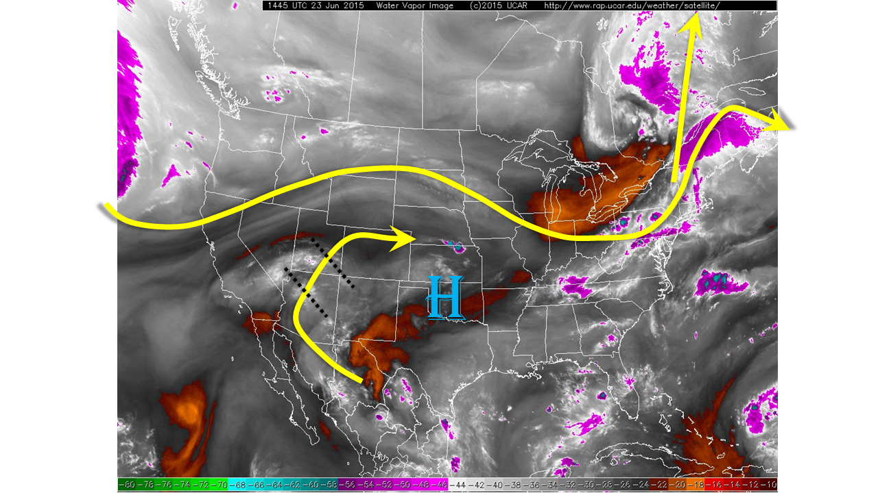
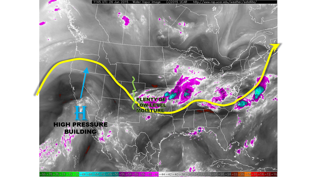
A new upper-level high pressure system is developing along the western North American coast and is easily seen on this morning’s water vapor imagery (see below). One the one hand, the high pressure will cause a 2-6 degrees Celsius increase in mid-level temperatures, which tends to suppress thunderstorm chances. On the other hand, this morning, as in the past two to three weeks, low-level moisture was very high with dewpoint temperatures in the 40s/50s west of the Divide and 50s/60s east of the Divide. Precipitable water values were in the 0.6 to 1.0 inch range across the state, but we expect these to lower gradually through the day. All in all, storms are expected to be confined to the higher terrain as well as the southeast portion of the state today.
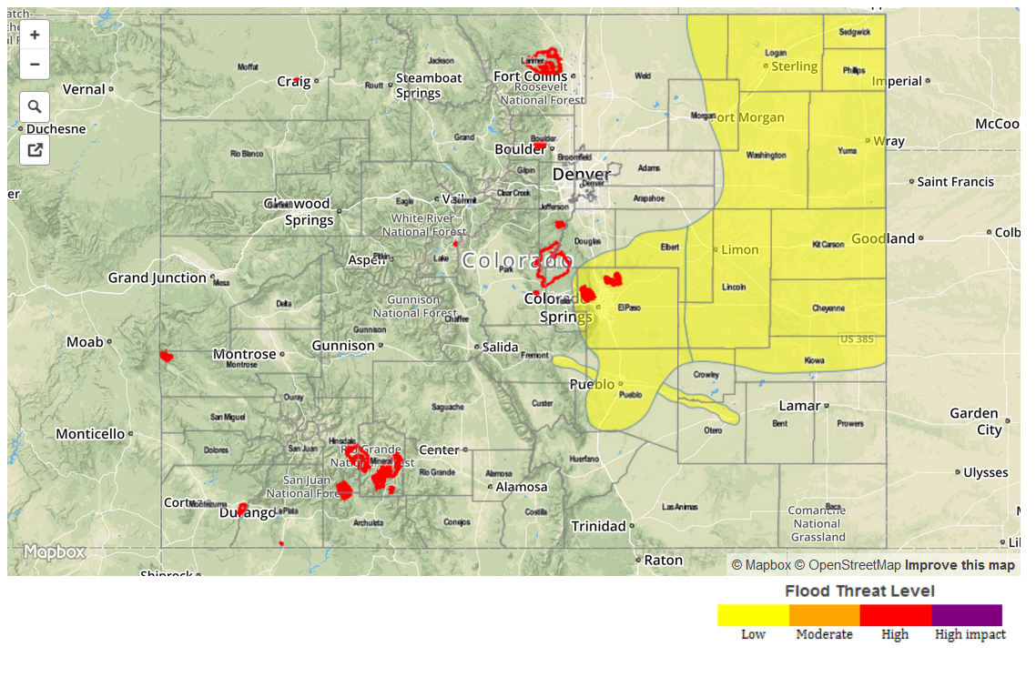
We expect partly to mostly sunny skies this morning to lead to thunderstorms over the highest terrain of the Northern, Central and Southeast Mountains. Early storms will yield only light rainfall, up to 0.5 inches. As storms mature and move southeast, rainfall intensities will increase and a Low flood threat has been issued for parts of southeast Colorado. Activity may persist as late as midnight as stubborn outflow boundaries maintain convergence zones that could fuel storm activity. In the late afternoon and evening, storms may produce hail up to 1.25 inches in diameter over the Low threat area.
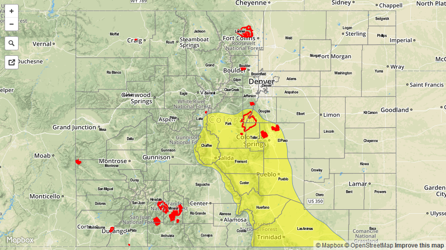
We have finally removed the flood threat for the Arkansas River as only very isolated stretches (notably near La Junta) remain in minor flood stage. Please check your National Weather Service products for detailed information on river stage levels.
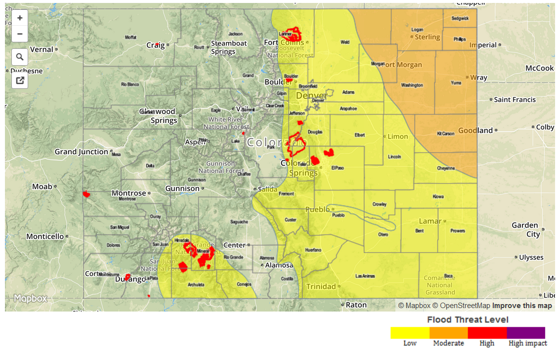
Today’s Flood Threat Map
For more information on today’s flood threat, see the map below (hover over threat areas for more details). For Zone-Specific forecasts, jump below the map.

Zone-Specific Forecasts
Grand Valley, Northwest Slope, Northern Mountains, San Juans, Southwest Slope, San Luis Valley:
Mostly sunny and turning warmer with high temperatures up to 100F in the lowest elevations by the Colorado River. A thunderstorm cannot be ruled out over eastern parts of the area, but rainfall will be less than 0.25 inches. No flooding is expected.
Central Mountains, Front Range, Urban Corridor, Northeast Plains:
Mostly sunny early, then turning partly cloudy with scattered thunderstorms forming over the highest terrain shortly after noon. Rainfall will be limited to about 0.7 inches, so no flooding is expected.
Palmer Ridge, Southeast Plains, Raton Ridge and Southeast Mountains:
Sunny early then partly cloudy with isolated to scattered thunderstorms developing by early afternoon over the highest terrain. Storms will move southeastward over the plains by mid-afternoon. Most storms will have light rainfall, generally under 1 inch. However, some of the strongest cells will be capable of 1.8 inch per hour rainfall. A Low flood threat has been issued for parts of the area. Hail up to 1.25 inches is also possible, mainly over the plains.
Activity will diminish after sunset, but isolated storms may last through 1AM over the Raton Ridge.
Primetime: 2PM through 9PM, except through 1AM near the New Mexico border