Issue Date: 6/25/2015
Issue Time: 10:45AM
— Moderate flood threat for Northeast Plains, and parts of Palmer Ridge and Southeast Plains
— Low flood threat for San Juans
— Low flood threat for Arkansas River from below Pueblo dam through La Junta
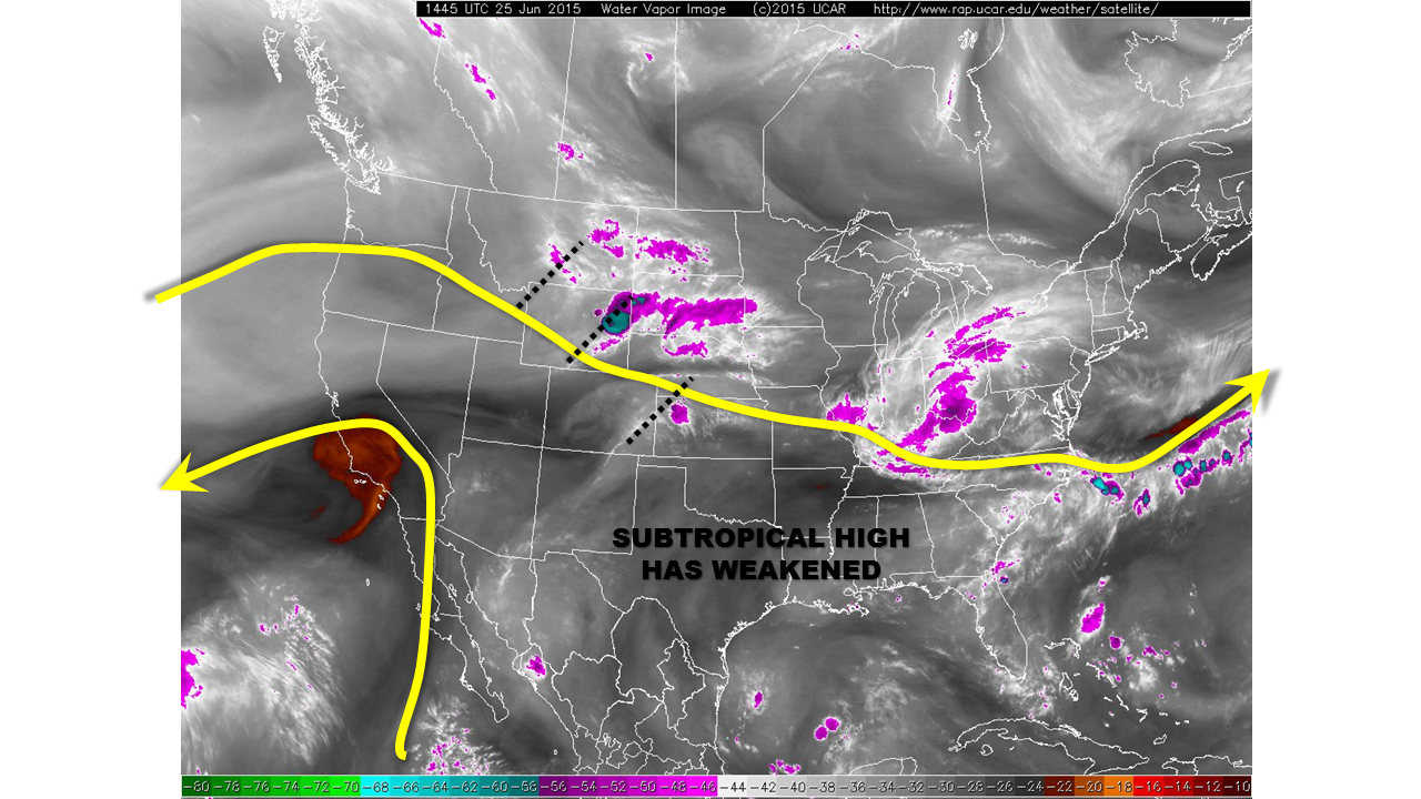
Since yesterday, the subtropical high that has been scooting eastward with every passing day has weakened. As shown in the water vapor image, below, this has allowed the jet stream to encroach on Colorado from the north. At least three “shortwave” ripples are noted this morning. The easternmost feature is leaving the state, and taking with it some weak thunderstorms noted over the Arkansas River valley near the Kansas border. The western two features will dive into Colorado and promote scattered to widespread thunderstorm activity. Coverage will be highest the farther east one goes. However, adequate moisture will allow for thunderstorms west of the Divide also.
For today, we expect morning sunshine to lead to thunderstorms by early afternoon, starting with the highest terrain of the San Juans, Central Mountains and the Front Range. Most of these storms will be relatively light rain producers, but a few will be capable of rainfall up to 1 inch per hour west of the Divide and 1.3 inches per hour east of the Divide. A Low flood threat has been posted. Later in the afternoon, storms will move eastward over the Plains. The heavy rainfall threat will increase as storms gain access to higher moisture. Torrential short-term rainfall, with rain rates up to 0.8 inches in 30 minutes and 1.4 inches per hour will be possible. However, over the northeast portions of the state, 1-hr rainfall up to 2.5 inches and 3-hr rainfall up to 3.5 inches is possible. Additionally, the evolution of strong atmospheric wind shear will support a potential for very, very large hail, up to 3 inches in diameter towards the Nebraska and Kansas borders. A Moderate flood threat has been posted for parts of Eastern Colorado.
Today’s Flood Threat Map
For more information on today’s flood threat, see the map below (hover over threat areas for more details). For Zone-Specific forecasts, jump below the map.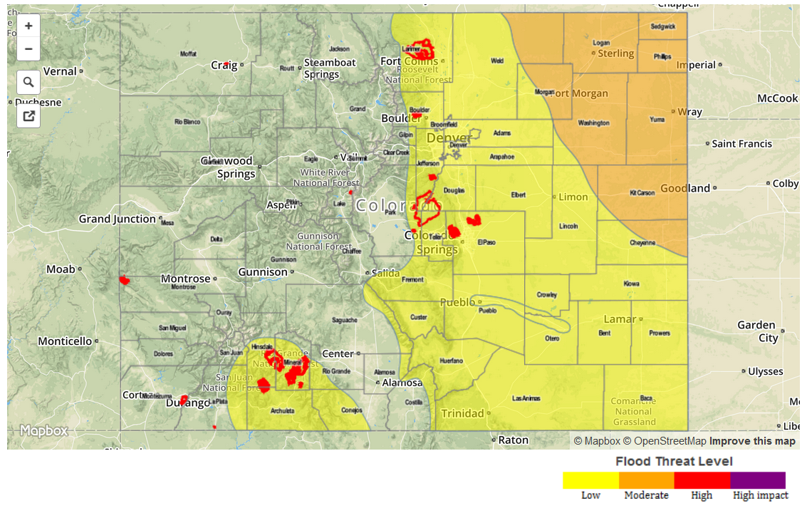
Zone-Specific Forecasts
Grand Valley, Northwest Slope, Northern Mountains, Central Mountains:
Partly cloudy early, then scattered thunderstorms forming by early afternoon, with higher coverage and intensity as one moves eastward. Maximum one-hour rainfall is expected to stay below 0.8 inches, and no flooding is expected. Stronger storms may produce gusty winds up to 65 mph.
San Juans, Southwest Slope, San Luis Valley:
Sunny early, then turning partly cloudy. Scattered thunderstorms are likely by early afternoon with maximum one hour rainfall up to 1.0 inch possible. This could lead to isolated flash flooding, mud slides and debris flows. Gusty winds up to 65 mph may accompany the stronger storms. A Low flood threat has been posted.
Primetime: 1pm through 8pm
Front Range, Urban Corridor, Northeast Plains, Palmer Ridge, Southeast Plains, Raton Ridge and Southeast Mountains:
Partly cloudy early, with scattered storms developing by early afternoon over the higher terrain. Storms will the move eastward with additional redevelopment over the Plains. Very heavy rainfall will be possible, with generally higher intensity the farther east one goes. Closest to the mountains, 1-hr rainfall up to 1.4 inches is possible. Farther east, 1-hr rainfall up to 2.5 inches is likely. Moderate and Low flood threats have been issued.
Additionally, there is the potential for very large hail, up to 3 inches in diameter, in the Moderate threat area.
Primetime: 2PM through 11PM, except through 1AM near the Kansas border