Issue Date: 7/12/2015
Issue Time: 9:45AM
— Low flood threat for San Juan Mountains and Southwest Slope
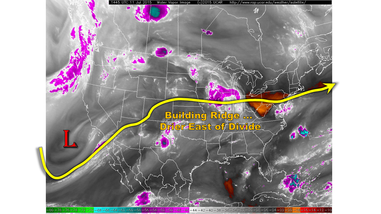
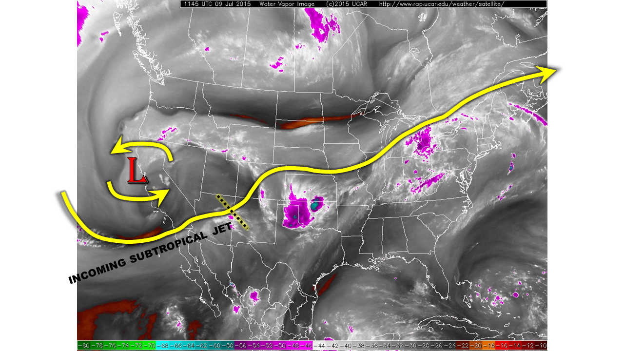
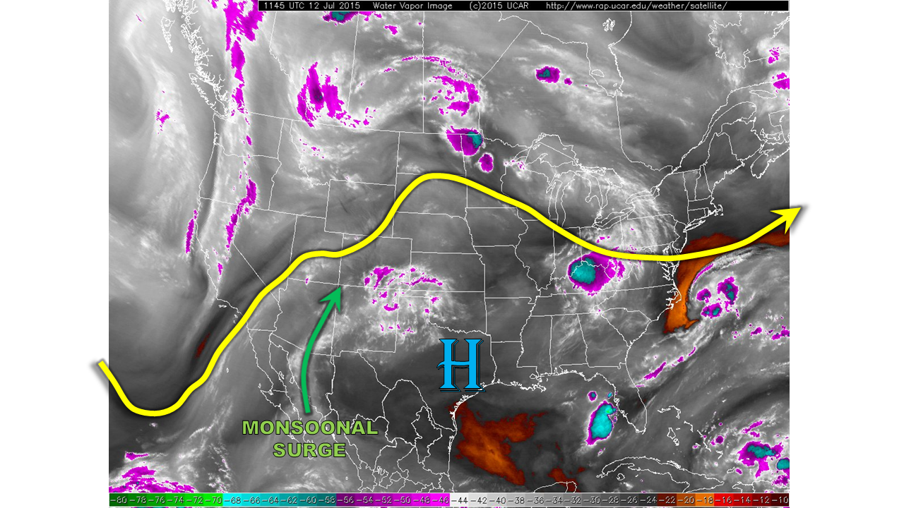
This morning, Colorado residents awoke to mostly clear skies and cool temperatures in the 40s and 50s. Overhead, our atmosphere is being increasingly dominated by a high pressure ridge to our southeast (see water vapor image below). However, return flow (or clockwise) around the high pressure is allowing for moisture to stream in from the subtropics. A distinct monsoonal moisture surge is noted this morning, from the Mexican Sierra Madre mountain range all the way north along the Arizona/New Mexico border. While morning precipitable water (PW) values across the state were in the 0.6 to 0.8 inch range, this surge will be carrying 1inch or greater PWs into southwest Colorado. East of the Divide, downsloping flow and subsidence from the high pressure will put a limit on rainfall rates.
For today, we expect mostly sunny skies this morning to lead to scattered thunderstorms over southwest Colorado and into the higher terrain of the Central Mountains. Most rainfall activity will be benign, with 1-hr rainfall rates up to 0.6 inches possible. However, over the southeast corner of the state, high moisture content will allow for 1-hr rainfall up to 1.0 inch. A Low flood threat has been posted for that region. In addition to the rainfall today, stronger storms will be capable of producing gusty winds up to 55 mph. Storm activity will diminish after sunset statewide.
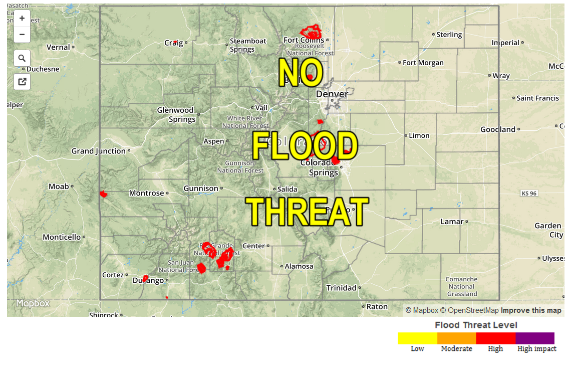
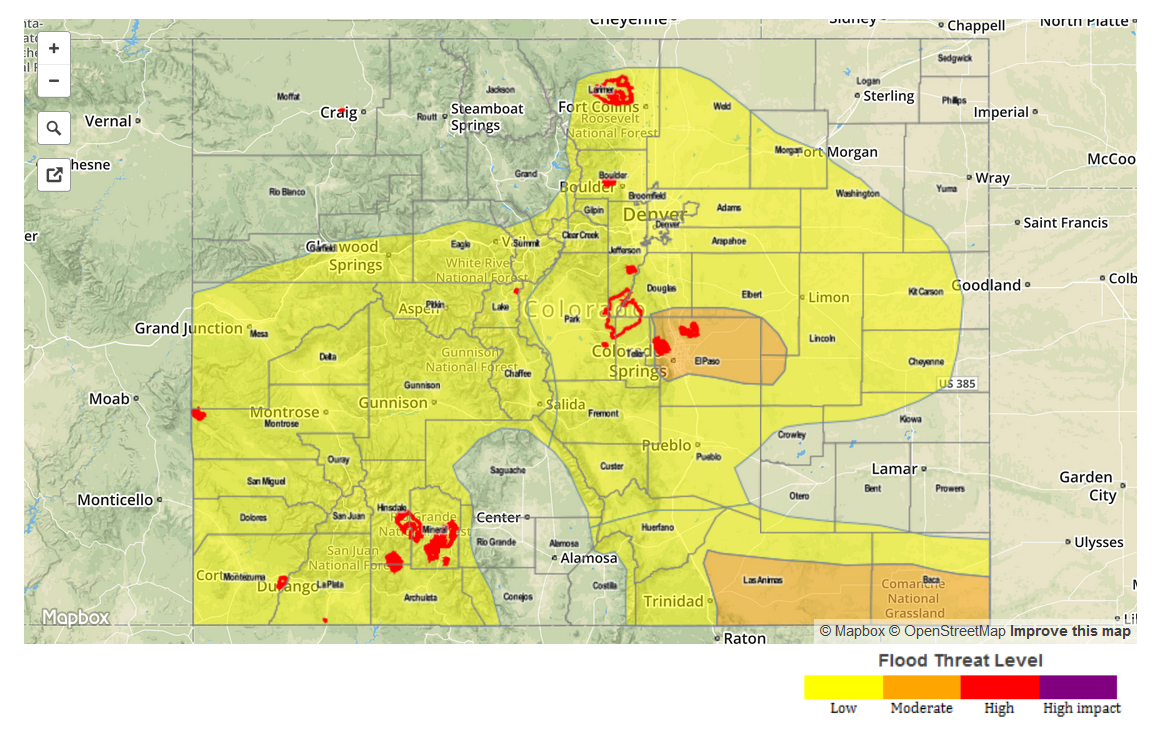
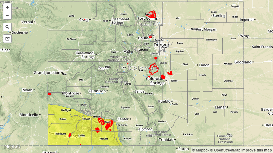
Today’s Flood Threat Map
For more information on today’s flood threat, see the map below (hover over threat areas for more details). For Zone-Specific forecasts, jump below the map.

Zone Specific Forecasts
Southwest Slope, San Juans:
Mostly sunny early with scattered thunderstorms developing by early afternoon. Maximum one-hour rain rates up to 1.0 inch will be possible, leading to isolated flash flooding mud flows and debris slides. Gusty winds, up to 55 mph, will also be possible. Storm activity will gradually diminish in the late evening. A Low flood threat has been posted for the area.
Grand Valley, Northwest Slope, Northern Mountains, Central Mountains, San Luis Valley:
Mostly sunny early, then turning partly cloudy. Isolated to widely scattered thunderstorms will be possible from early afternoon to around sunset. Max 1-hr rain rates up to 0.5 inches will be possible, along with gusty winds up to 55 mph. No flooding is expected today.
Northeast Plains, Southeast Plains, Palmer Ridge, Front Range, Urban Corridor, Raton Ridge, Southeast Mountains:
Mostly sunny and warmer with a few cumulus clouds possible by late afternoon. Rainfall is not expected today, but if a storm does form, it will be more of a gusty wind threat than rainfall. Flooding is not expected today.