Issue Date: 7/10/2015
Issue Time: 9:55AM
— Low flood threat for Northeast Plains and Southeast Plains
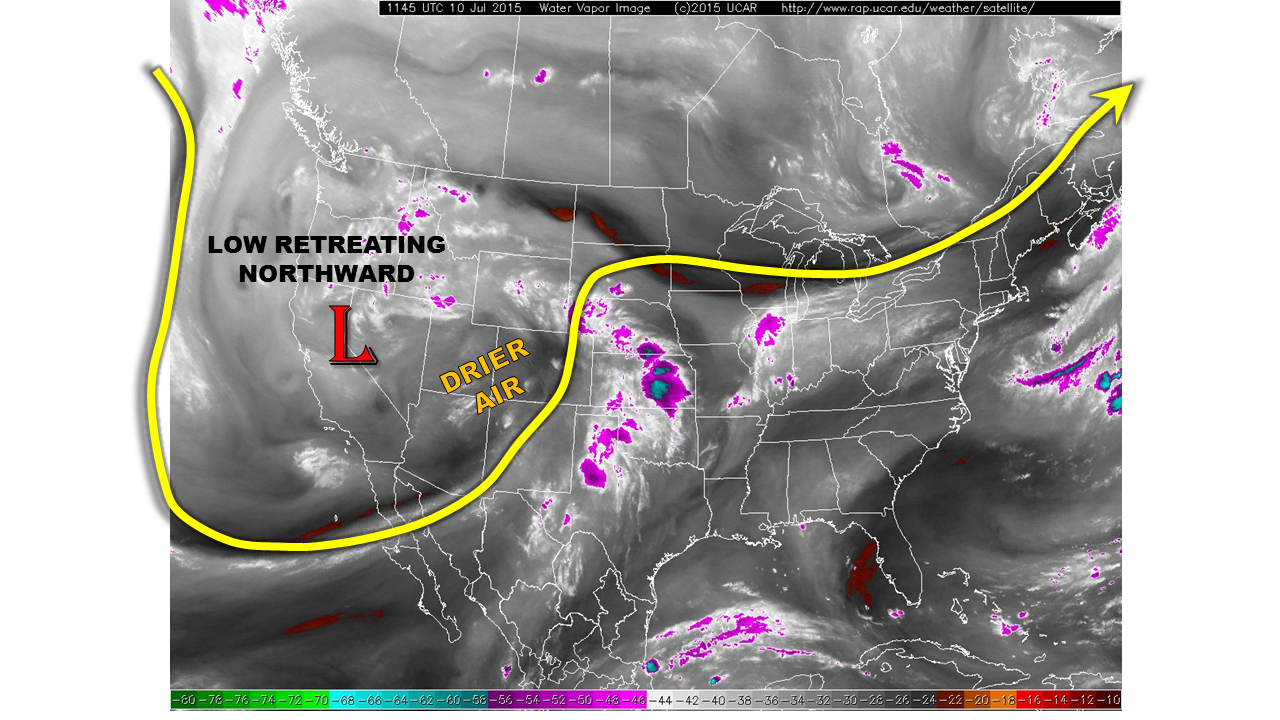
Even as late as yesterday, it appeared that the upper-level low pressure over California (see water vapor image below) may impact our weather today with more heavy rainfall. However, a look at this morning’s observations shows drier conditions, and warming mid/upper-level temperatures as the low pressure somewhat unexpectedly retreating northward. Both of these factors suggest a large reduction in the coverage and intensity of thunderstorm activity today. Nonetheless, there will be enough instability to produce thunderstorms capable of marginally heavy rainfall over both the Northeast and Southeast Plains. As such, a Low flood threat has been issued for these regions. For the rest of the state, expect weaker thunderstorms today and generally more sunshine.
 Today’s Flood Threat Map
For more information on today’s flood threat, see the map below (hover over threat areas for more details). For Zone-Specific forecasts, jump below the map.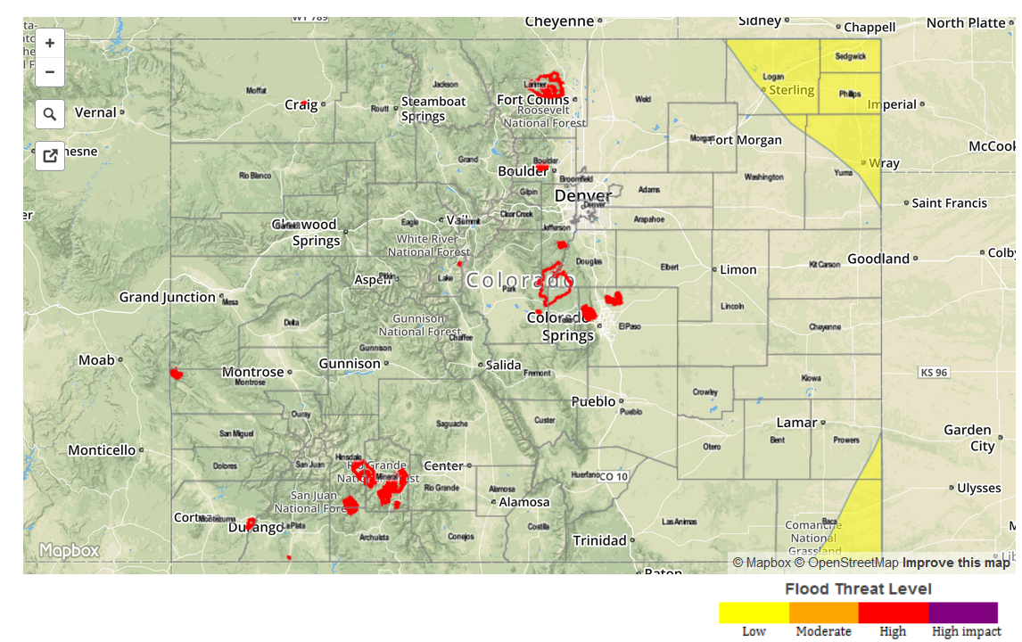 Zone Specific Forecasts
Southeast Plains, Northeast Plains:
Mostly sunny early with scattered thunderstorms developing by mid afternoon. One hour rain rates up to 1.7 inches could cause isolated flash flooding in the extreme northeast and southeast corners of the state. A Low flood threat is in place. Storms may be ongoing through the late evening hours as higher moisture returns into the area through the low-level jet. In addition to heavy rainfall, hail up to 1.25 inches may accompany the strongest storms.
Primetime: 2PM through 11PM
Palmer Ridge, Front Range, Urban Corridor, Raton Ridge, Southeast Mountains:
Mostly sunny early, then becoming partly cloudy. Warmer temperatures are expected today. Isolated to widely scattered thunderstorms will form over the highest terrain by early afternoon and spread eastward. One hour rain rates up to 0.7 inches will be possible, but flooding is not expected.
Southwest Slope, San Juans, Grand Valley, Northwest Slope, Northern Mountains, Central Mountains, San Luis Valley:
Mostly sunny early with scattered thunderstorms developing shortly after noon. Highest coverage will be in the San Juans. One hour rainfall up to 0.6 inches will be possible with the strongest storms. No flooding is expected. In addition to the rainfall, gusty winds up to 60 mph and hail up to 0.75 inches may accompany the strongest storms.