Issue Date: 7/28/2015
Issue Time: 9:47 AM
A LOW FLOOD THREAT IS FORECAST FOR THE EVENING/OVERNIGHT PERIOD ACROSS PORTIONS OF THE RATON RIDGE, SOUTHEAST MOUNTAINS, AND SOUTHEAST PLAINS.
Much of today will be marked by mostly sunny and stable conditions thanks to a few main players:
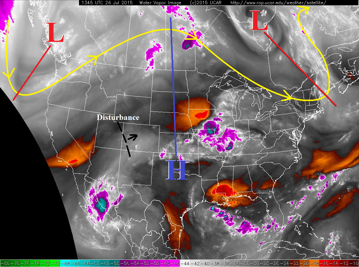
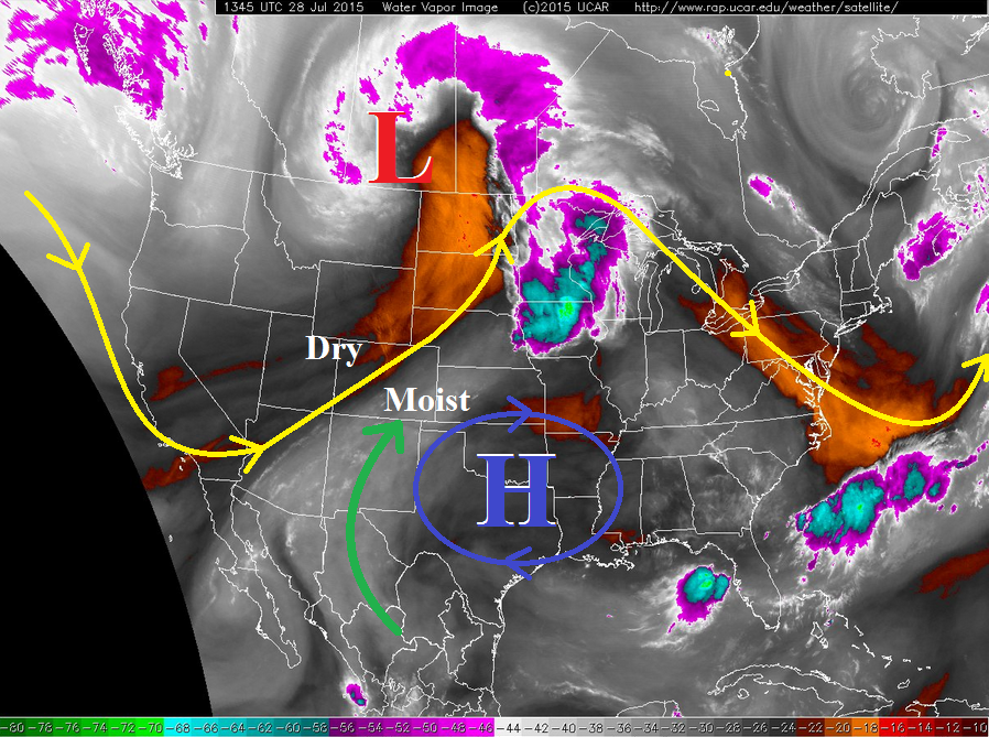
- Upper-level low tracking across south-central Canada (red “L”)
- Upper-level high anchored over the south-central US (blue “H”)
- A weak, cool front that passed through this morning
The upper-level low and high will promote the continued advection of dry air into Colorado, thanks to west-southwesterly flow aloft, and the weak cool front has brought drier and cooler conditions to the lower levels. Altogether, these main players will lead to a stable and dry start to the afternoon for most locations across the state.
As the day wears on, isolated, weak thunderstorms will develop this afternoon over the higher terrain; mainly the San Juan Mountains, Central Mountains, Front Range south of I-70, and Southeast Mountains. The main impacts from these storms will be gusty winds and light rain – there simply will not be much moisture to aid precipitation processes. One or two weak storms will move over adjacent locations of the Urban Corridor (south of I-70), Southeast Plains, and Raton Ridge, but will struggle to produce good rainfall.
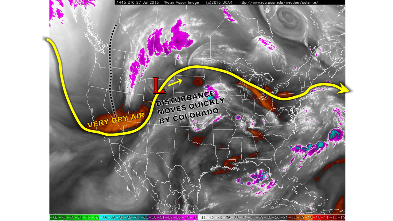
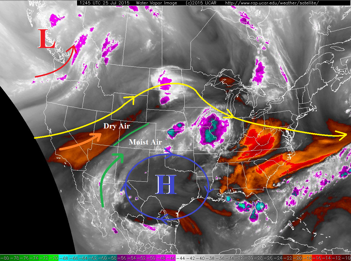
The main event will come during the evening and overnight hours, as a weak disturbance will rotate across New Mexico and into southeastern Colorado, leading to scattered showers and thunderstorms capable of producing heavy rain. Moisture will hold on best for these southeastern locations throughout the day as upslope flow reinforces surface moisture, and the plume of modest subtropical moisture continues overhead (green arrow). Please note the timing of the flood threat in the map/zone-specific discussions below.
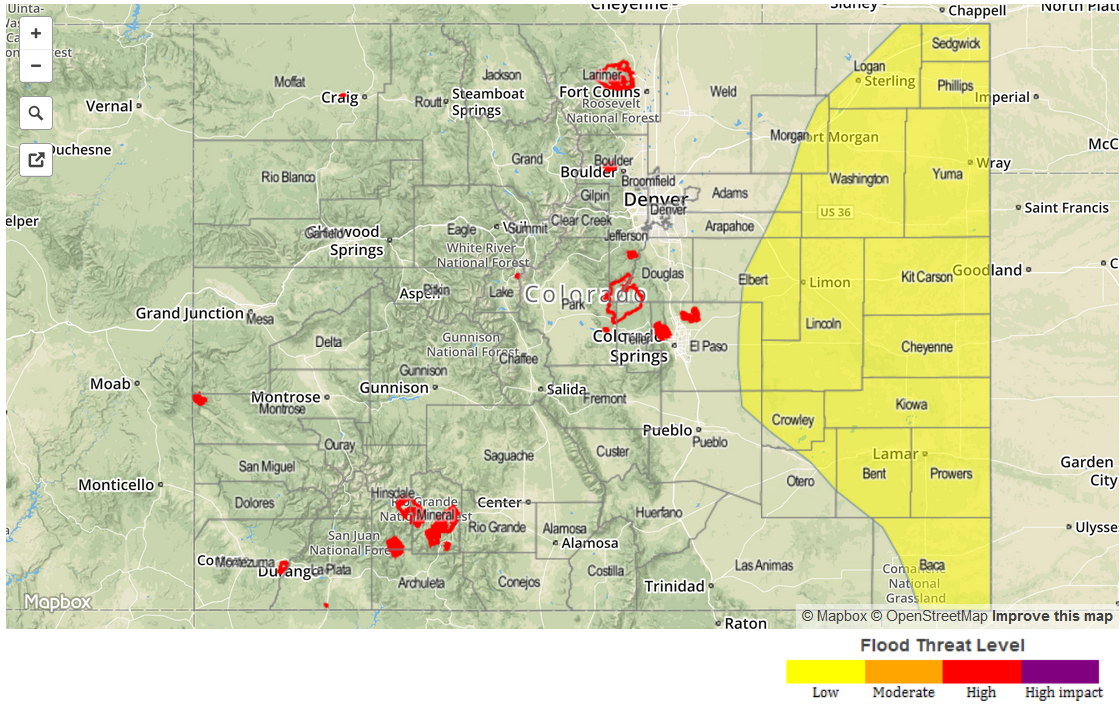
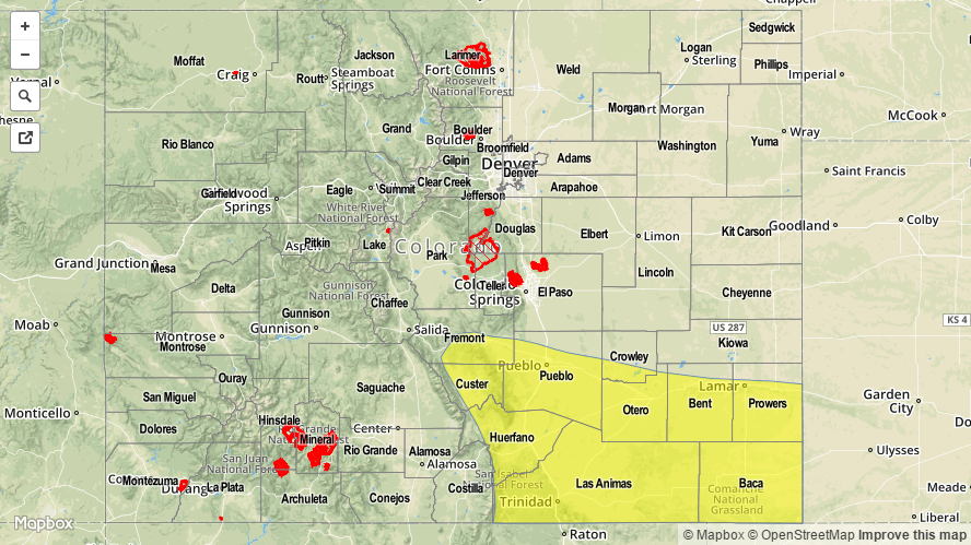
Today’s Flood Threat Map
For more information on today’s flood threat, see the map below (hover over threat areas for more details). For Zone-Specific forecasts, jump below the map.

Zone-Specific Forecasts
Front Range north of I-70, Urban Corridor North of I-70, Northeast Plains, Grand Valley, Northern Mountains, Northwest Slope, and Southwest Slope:
Mostly sunny and warm, with temperatures a few degrees cooler than yesterday. A few fair weather clouds will develop, but no precipitation is expected.
Front Range south of I-70, Urban Corridor south of I-70, Palmer Ridge, Southeast Plains, Southeast Mountains, and Raton Ridge:
Isolated weak thunderstorms over the higher terrain and adjacent lower elevations are expected to develop after noon, and continue through the late afternoon/evening hours. The main event, as described above, will begin later in the evening as a disturbance moves across southeastern Colorado. The flood threat will start around 8 PM, and continue into the early morning hours. Maximum rain rates will break down as follows:
Front Range/Urban Corridor south of I-70 and Palmer Ridge: 0.4-0.8 inches/hour
Southeast Mountains: 0.7-1.0 inches/hour
Raton Ridge: 1.2-1.8 inches/hour
Southeast Plains: 1.5-2.5 inches/hour
Central Mountains, San Luis Valley, and San Juan Mountains:
A few isolated, weak thunderstorms are expected over the higher terrain later this afternoon and into the evening hours. A couple of lingering showers will continue into the early morning tomorrow. Rain rates will be low, less than 0.2 inches/hour.