Issue Date: 7/25/2015
Issue Time: 9:30 AM
NO FLOOD THREAT IS FORECAST.
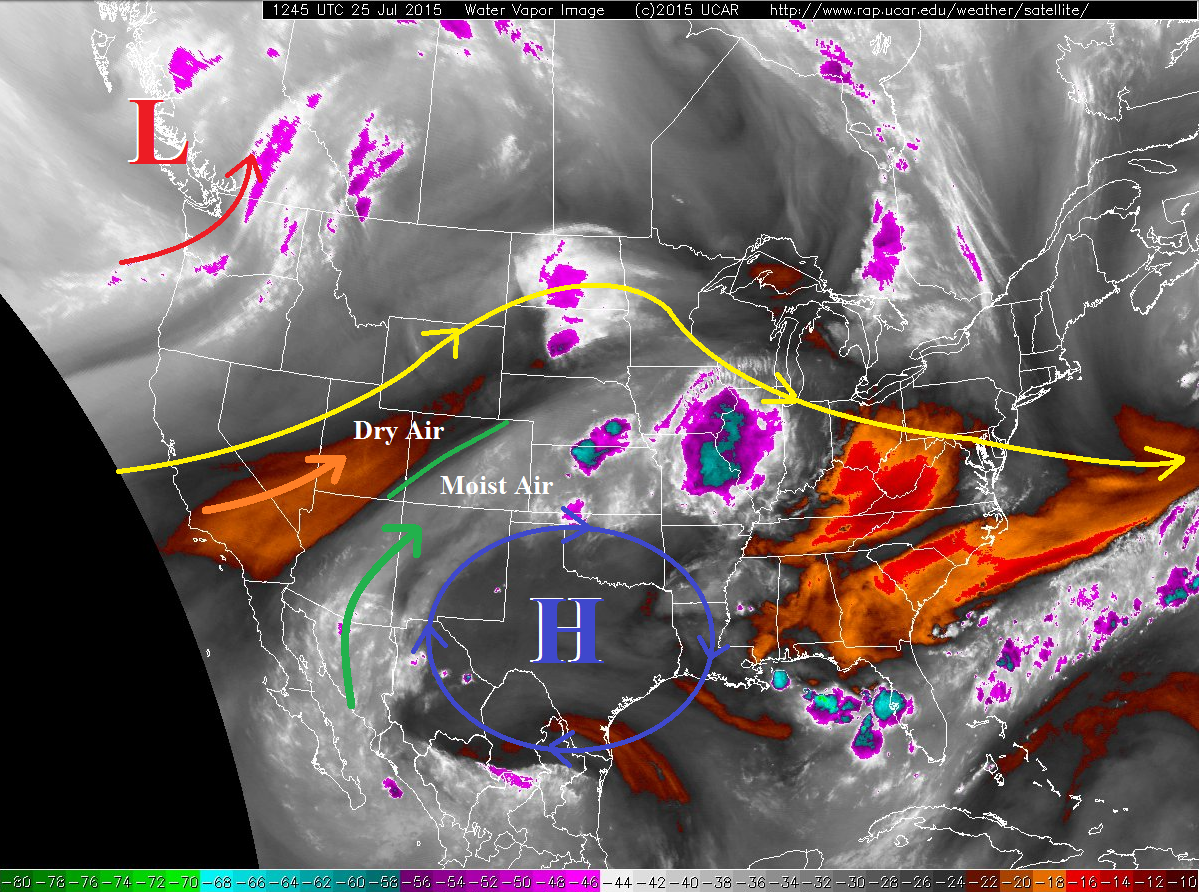
The same general upper-air pattern remains across the continental US, generally characterized by a high pressure ridge across the central US, flanked by a trough on either coast. The upper-level high pressure is expected to stay centered over Texas today; this is a bit further east than yesterday, thanks to the upper-level low pushing onshore over the Pacific Northwest. This will force drier air into the state today as flow becomes more westerly, but decent mid-level moisture will hang to the south and east of a line bisecting the state from southwest to northeast.
For High Country areas underneath the drier air, i.e., the Northwest Slope, Northern Mountains, Grand Valley, and Southwest Slope, sunny skies and hot temperatures will be the main story today, with fair weather clouds breaking up the sunshine. A bit better moisture will hang out over the Central Mountains and Front Range, so a couple isolated showers/weak thunderstorms cannot be ruled out, especially across southern portions.
Isolated-to-scattered coverage of thunderstorms is expected over the higher terrain of other western Colorado regions (San Juan Mountains, San Luis Valley, and Southeast Mountains). With precipitable water values running below average for this time of year, rain rates will not be particularly impressive, and the biggest impacts will be gusty outflow winds and dangerous lightning.
For eastern Colorado, mostly sunny skies and hot temperatures will be the name of the game for most. Near the interface with the higher terrain, a few isolated showers/weak thunderstorms will move overhead off the mountains for southern portions of the Urban Corridor and western portions of the Southeast Plains. The best chance for thunderstorms today will be along the CO/NM and CO/KS borders, where a surface boundaries will enhance thunderstorm development a bit. With relatively dry air still in place below cloud bases, the main threats will be strong winds and large hail. Brief moderate rainfall will attend the strongest storms near the CO/KS border across the Southeast Plains and southeastern portions of the Northeast Plains, but dry air and storm motions will limit the impacts to minor street/field ponding.
Today’s Flood Threat Map
For more information on today’s flood threat, see the map below (hover over threat areas for more details). For Zone-Specific forecasts, jump below the map.

Zone-Specific Forecasts
Urban Corridor, Raton Ridge, Palmer Ridge, Southeast Plains, and Northeast Plains:
Mostly sunny and hot will be the main story, with a few isolated-to-scattered showers and thunderstorms breaking the heat near the mountains south of I-70, and near the CO/KS and CO/NM borders (as described above). Temperatures will be a degree or two cooler than yesterday, so not really a noticeable change. Max rain rates break down like this:
Urban Corridor and Palmer Ridge: 0.25-0.5 inches/hour
Northeast Plains: 0.8-1.2 inches/hour
Raton Ridge: 0.9-1.3 inches/hour
Southeast Plains: 1.0-1.8 inches/hour
Timing: Noon – 9 PM, with a few isolated showers/thunderstorms lingering until midnight before crossing into Kansas.
Northwest Slope, Northern Mountains, Southwest Slope and Grand Valley:
Hot and dry, with a few fair weather clouds breaking up the otherwise sunny sky. Today would be a great Saturday to get outside and enjoy the summer. Remember to drink plenty of water and take breaks from the sun, when necessary.
Front Range, Central Mountains, Southeast Mountains, San Luis Valley, and San Juan Mountains:
Isolated storms for the Front Range and Central Mountains, becoming more scattered to the south. Main impacts will be gusty winds and lightning, with only light rainfall expected. Rain rates will be 0.2-0.4 inches/hour.
Timing: 11 AM – 9 PM