Issue Date: 7/26/2015
Issue Time: 9:44 AM
A LOW FLOOD THREAT IS FORECAST FOR PORTIONS OF THE NORTHEAST PLAINS, PALMER RIDGE, AND SOUTHEAST PLAINS.
The water vapor image below is a bit messier than previous days, but the same major players remain; an upper-level ridge across the central US with upper-level troughs flanking either side. One feature that hasn’t been present across Colorado the last few days is a mid-level disturbance, and one is forecast to move across the state today (marked by the black dashed line). This disturbance will be accompanied by a slight increase in mid-level moisture, mainly for southern and eastern regions. The disturbance and accompanying moisture will lead to more thunderstorms, overall, today and tonight.
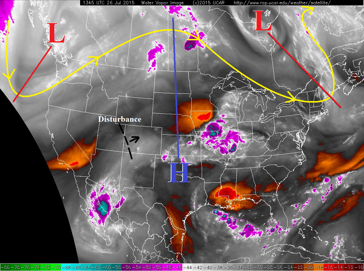
If one was to draw a line approximately from the Pawnee National Grassland -> Granby -> Glenwood Springs -> Grand Junction, the best chances for thunderstorms will be to the south and east where the better moisture resides. An isolated, high-based thunderstorm or two cannot be ruled out north and west of that line, but in that environment the biggest threats will be gusty winds and lightning, with very little rain.
The biggest threat for heavy rain today will be across the Palmer Ridge, Southeast Plains, and Northeast Plains regions, where the better surface moisture will be; surface dewpoints will likely remain in the 50s this afternoon. Near the mountains, i.e. the Urban Corridor and western extents of the Southeast Plains, drier air will mix down to the surface through the afternoon, creating more of an inverted-V environment; this means that the main threat will be gusty winds and lightning, with brief periods of moderate rainfall. Specifics such as rain rates and timing will be given in the zone-specific forecast discussions below.
Today’s Flood Threat Map
For more information on today’s flood threat, see the map below (hover over threat areas for more details). For Zone-Specific forecasts, jump below the map.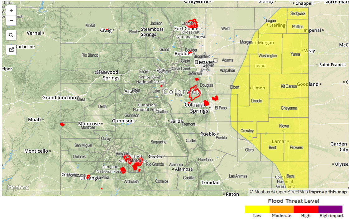
Zone-Specific Forecasts
Urban Corridor, Raton Ridge, Palmer Ridge, Southeast Plains, and Northeast Plains:
Scattered showers and thunderstorms are expected this afternoon and evening. A few will become strong-to-severe across the Palmer Ridge, Southeast Plains, and Northeast Plains regions. The main threat with strong-to-severe storms will be strong winds (gusts >50 mph) and large hail. Brief periods of heavy rainfall are also likely with those storms, see rain rates below.
Urban Corridor: 0.5-1.0 inches/hour
Raton Ridge and western extents of the Southeast Plains: 0.6-1.1 inches/hour
Palmer Ridge, Southeast Plains, and Northeast Plains: 1.5-2.5 inches/hour
Timing: Noon – 9 PM, with a few showers/thunderstorms lingering over the Raton Ridge and Southeast Plains until just after midnight.
Northwest Slope and Northern Mountains:
Mostly sunny and warm, with an isolated shower/weak thunderstorm over the highest terrain of the Northern Mountains possible. Gusty winds and lightning will be the impacts from any thunderstorm activity, and very little rain. Max rain rates will be less than 0.25 inches/hour.
Timing: Noon – 7 PM
Front Range, Central Mountains, Southeast Mountains, San Luis Valley, and San Juan Mountains, Southwest Slope and Grand Valley:
Isolated-to-scattered showers and thunderstorms, favoring the higher terrain. The best relative chances will be across the San Juan Mountains, Central Mountains, and Southeast Mountains. Maximum rain rates will be 0.25-0.5 inches/hour for all regions except the Front Range, where rain rates could push 0.4-0.8 inches/hour. Storm motions at 20 mph ENE will limit potential flood threats.
Timing: 11 AM – 8 PM, with a few showers lingering over southern areas until the early morning hours.