Issue Date: 9/5/2015
Issue Time: 9:05AM
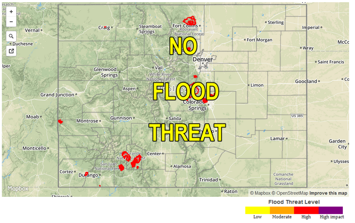
—NO FLOOD THREAT TODAY
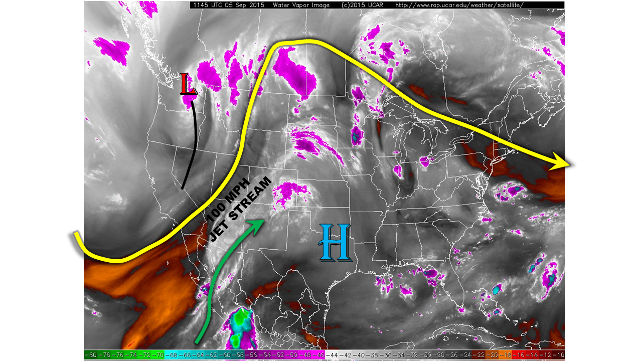
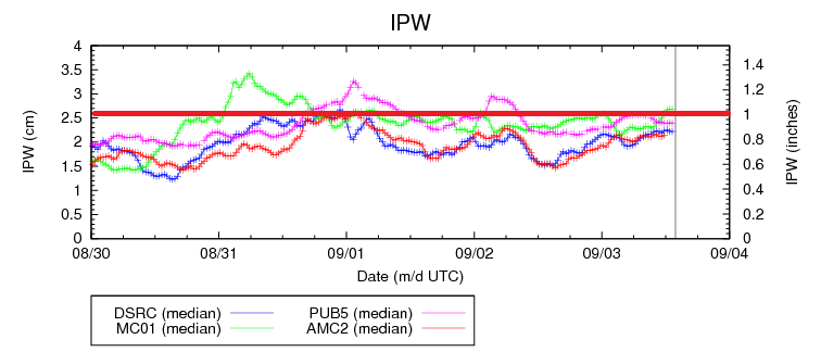
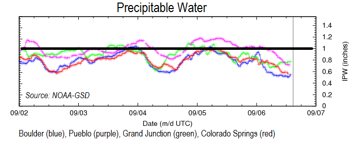
Coloradoans, or Coloradans, whichever you prefer, awoke to partly sunny skies this Sunday with streaks of mid and high clouds seen east of the Continental Divide. Although the dynamics of the atmosphere have not changed much since yesterday, a substantial import of dry air has lowered precipitable water values from the 0.8 – 1.1 inch range this time yesterday to the 0.5 – 0.8 inch range today (see chart below). A strong jet stream remains overhead, and with it there will be forcing for upward motion. However, without any appreciable instability, we only anticipate a few widely scattered showers and perhaps a very weak, brief thunderstorm in the far southwest corner of the state. Otherwise, the good weather will provide a nice opportunity to enjoy the outdoors on this Labor Day weekend.
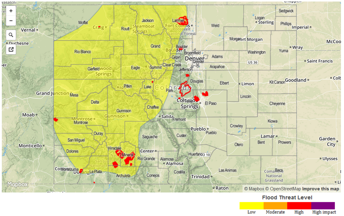
Today’s Flood Threat Map
For more information on today’s flood threat, see the map below (hover over threat areas for more details). For Zone-Specific forecasts, jump below the map.

Zone Specific Forecasts
Front Range, Urban Corridor, Northeast Plains, Southeast Plains, Palmer Ridge, Raton Ridge, Southeast Mountains:
Partly to mostly sunny today and seasonably warm with highs in the 50s in the higher terrain to the mid-90s F in the lower elevations of the Arkansas River valley. Scattered showers will be possible across the higher terrain from the mid-afternoon through early evening hours. However, max 1-hour rainfall rates will be limited to 0.2 inches or less due to weak instability. Flooding is not expected today. Strong winds, up to 50 mph, will be possible in the higher ridges of the Front Range through the early afternoon.
Southwest Slope, San Juans, San Luis Valley, Central Mountains, Northern Mountains, Grand Valley, Northwest Slope, Southwest Slope:
Partly cloudy with widely scattered showers and stray weak thunderstorm possible, mostly across the south and central portions of the area. Max 1-hour rain rates up to 0.25 inches will be possible. Flooding is not expected today. High temperatures will range from the 50s in the higher terrain to the upper 80s in the Colorado River lowlands.