Issue Date: 9/4/2015
Issue Time: 9:55AM
—NO Flood Threat Today
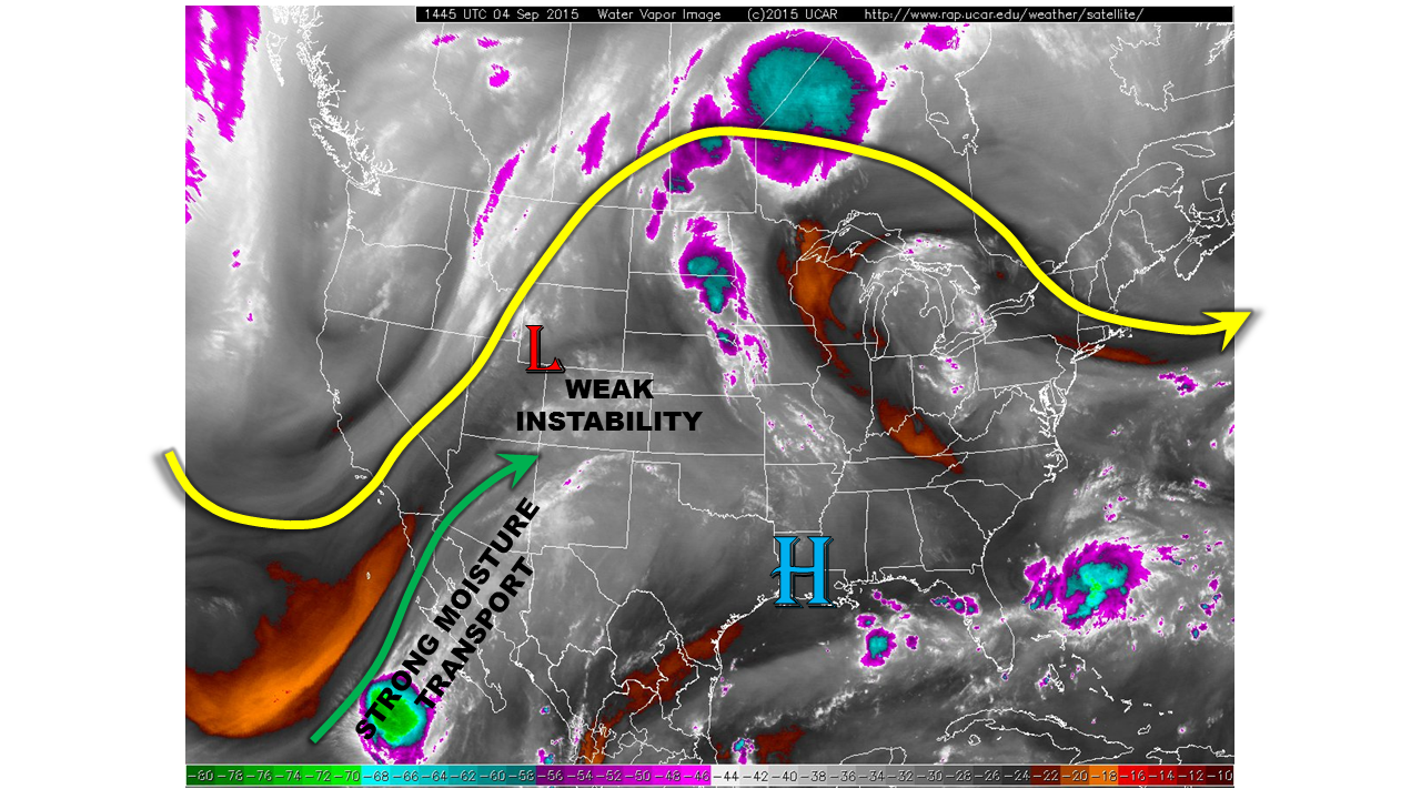
An unseasonably strong trough is positioned over the North American west coast, as shown in the water vapor image below. This large disturbance is helping to direct strong moisture transport from the subtropics into the southwest United States. Morning precipitable water (PW) values are in the 0.6 to 0.9 inch range, while surface dewpoints range from the mid-40s to the low-50s. Early in the summer, such a combination may have resulted in a heavy rainfall threat for Colorado. However, in early September, with a lower sun angle and weaker solar heating, there will simply not be enough instability for heavy rain today. Another negative factor is the fast steering level flow, resulting in storm motions of 30 to 40 mph.
We expect the ongoing rainfall over western Colorado to slightly intensify and grow in coverage. Rainfall will have a difficult time moving into the eastern plains due to the downsloping flow. Across the west, rain rates up to 0.75 inches will be possible along the south face of the San Juans, where instability will be greatest. Elsewhere, rain rates up to 0.5 inches will be possible. Total 24-hour rainfall amounts of up to 1.5 inches could occur over the Western Slope, Central Mountains and San Juans. However, flooding is not expected due to the lower rainfall intensities.
Today’s Flood Threat Map
For more information on today’s flood threat, see the map below (hover over threat areas for more details). For Zone-Specific forecasts, jump below the map.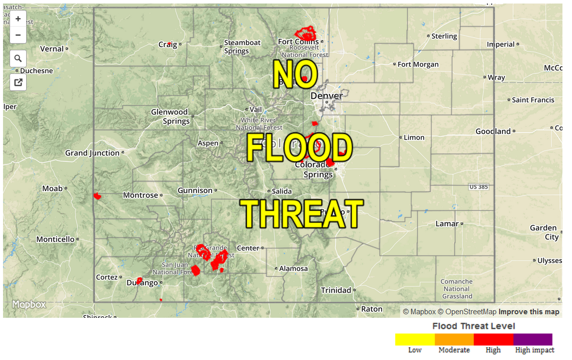
Zone Specific Forecasts
Front Range, Urban Corridor, Northeast Plains, Southeast Plains, Palmer Ridge, Raton Ridge, Southeast Mountains:
Mostly sunny to partly cloudy today and seasonably warm with highs in the 50s in the higher terrain to the lower 90s F in the lower elevations of the Arkansas River valley. Scattered thunderstorms will be possible closer to the mountains from the mid-afternoon through early evening hours. However, max 1-hour rainfall rates will be limited to 0.6 inches or less due to weak instability. Flooding is not expected today. Scattered showers will continue into the overnight hours.
Southwest Slope, San Juans, San Luis Valley, Central Mountains, Northern Mountains, Grand Valley, Northwest Slope, Southwest Slope:
Partly to mostly cloudy with scatter showers and thunderstorms developing and/or intensifying. Max 1-hour rain rates up to 0.75 inches will be possible over the San Juans, with 0.5 inches elsewhere. Thunderstorms will weaken by early evening, but showers will continue overnight. Flooding is not expected today due to the lower rainfall intensities. However, up to 1.50 inches of rainfall could occur for isolated regions by tomorrow morning.