Issue Date: 9/26/2015
Issue Time: 7:55AM
— NO FLOOD THREAT TODAY
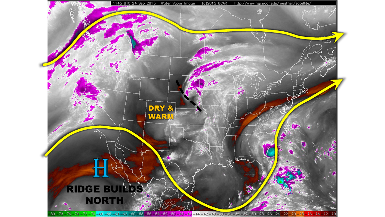
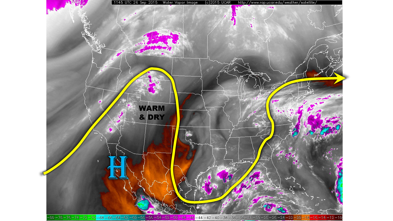
The mornings have been getting cooler, but the afternoons have been staying plenty warm for Colorado during the past few days. As the water vapor image shows, below, more of the same will continue for today as our resident high pressure ridge maintains dominance over the Southwest U.S. Warming mid-level temperatures will boost afternoon temperatures by a few degrees compared to yesterday. Some low-clouds may hang around the Nebraska and Kansas borders through early afternoon. However, once again, neither rainfall nor flooding are expected.
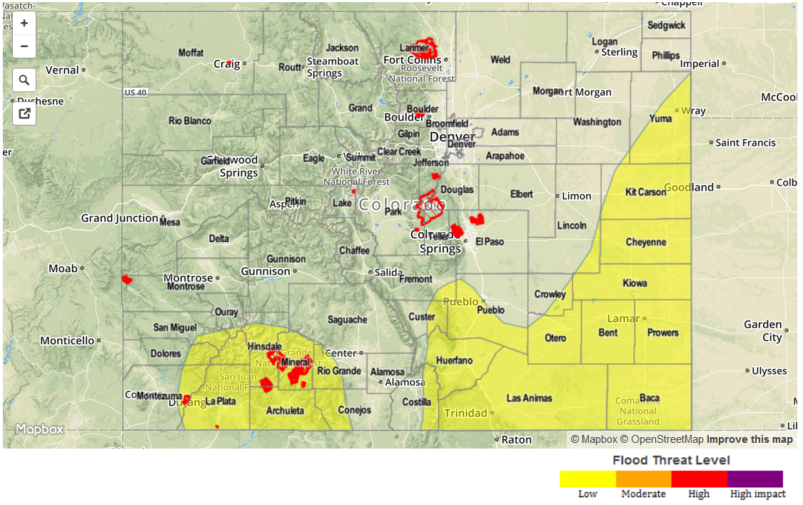
Today’s Flood Threat Map
For more information on today’s flood threat, see the map below (hover over threat areas for more details). For Zone-Specific forecasts, jump below the map.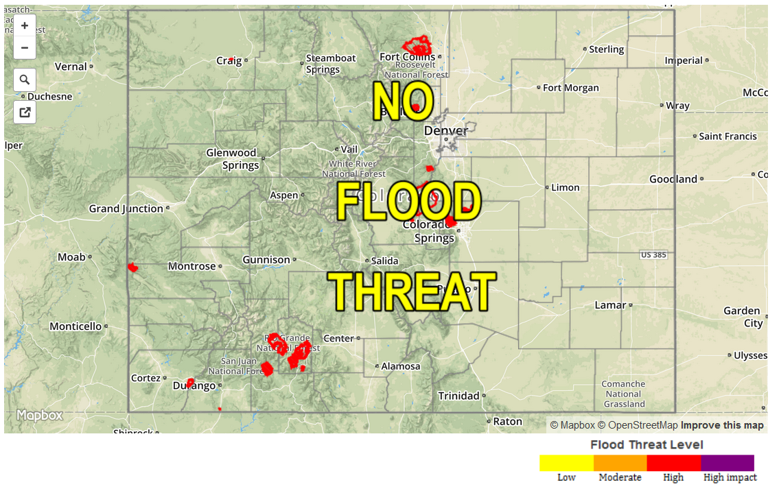
Zone Specific Forecasts
Front Range, Urban Corridor, Northeast Plains, Southeast Plains, Palmer Ridge, Raton Ridge, Southeast Mountains:
Mostly sunny skies with seasonable temperatures. Highs in the 50s in the highest terrain to the mid-80s across the lower elevations. Low clouds may hang around the extreme eastern parts of the area, but everyone else will see plenty of sunshine. Flooding is not expected.
Southwest Slope, San Juans, San Luis Valley, Central Mountains, Northern Mountains, Grand Valley, Northwest Slope, Southwest Slope:
Sunny skies for nearly all areas today. High temperatures will be seasonable, with readings in the 50s over the highest terrain to the upper-80s in the low elevations of the Colorado River valley. Flooding is not expected today.