Issue Date: 9/25/2015
Issue Time: 8:35AM
— No Flood Threat Today
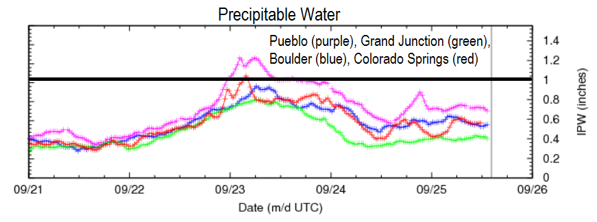
Coloradoans awoke to a seasonably cool start this Friday morning. The far northeast corner of the state was under the grips of a low cloud deck. Meanwhile, but all other areas were under clear skies. Another nearly cloud free day will boost temperatures to near seasonable levels today. Precipitable water values, shown below, continue to be subdued after peaking during the thunderstorm activity on Wednesday. Thus, aside from some morning sprinkles in the Northeast Plains, neither precipitation nor flooding issues are expected today.
Today’s Flood Threat Map
For more information on today’s flood threat, see the map below (hover over threat areas for more details). For Zone-Specific forecasts, jump below the map.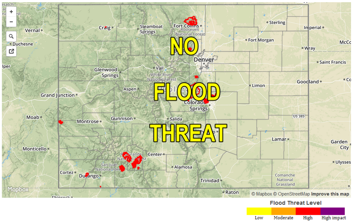
Zone Specific Forecasts
Front Range, Urban Corridor, Northeast Plains, Southeast Plains, Palmer Ridge, Raton Ridge, Southeast Mountains:
Mostly sunny skies with seasonable temperatures. Highs in the 50s in the highest terrain to the low-80s across the lower elevations. A few morning sprinkles are possible in the Northeast Plains, but everyone else will stay dry. Flooding is not expected.
Southwest Slope, San Juans, San Luis Valley, Central Mountains, Northern Mountains, Grand Valley, Northwest Slope, Southwest Slope:
Sunny skies for nearly all areas today. High temperatures will be seasonable, with readings in the 50s over the highest terrain to the mid-80s in the low elevations of the Colorado River valley. Flooding is not expected today.