Issue Date: 5/12/2016
Issue Time: 9:20 AM
NO FLOOD THREAT IS FORECAST.
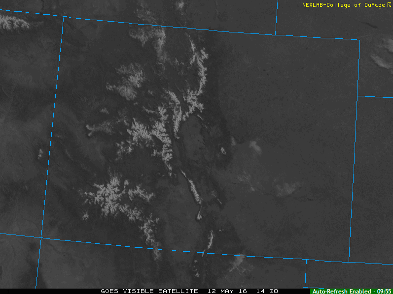
A picture is worth a thousand words, and that holds true with this morning’s visible satellite image (shown below). High pressure at the surface and a building ridge aloft will be in charge of Colorado’s weather today/tonight, allowing for sun-drenched skies and warmth to take over. Over the highest terrain, virga will be present during the afternoon/early evening as the daytime heat works on the surface/residual moisture, but no precipitation is expected to reach the surface. This “activity” will bring about some gusty winds, and that’s about it.
Otherwise, a few fair weather cumulus clouds will be noted across the lower elevations of eastern Colorado, mainly along and near the higher terrain. For tonight, the only weather highlight will be gusty winds (25-35 mph) across the Front Range and Front Range foothills.
Today’s Flood Threat Map
For more information on today’s flood threat, see the map below (hover over threat areas for more details). For Zone-Specific forecasts, jump below the map.

Zone-Specific Forecasts
Urban Corridor, Southeast Plains, Palmer Ridge, Raton Ridge, and Northeast Plains:
Sunny skies and temperatures warming back to average will be the weather story today. Some high-based, fair weather cumulus clouds will drift overhead today, mainly for locations along and near the higher terrain. High temperatures will be in the 60s and 70s.
Overnight, skies will be mostly clear with temperatures dipping to seasonal lows.
Front Range, Northwest Slope, Northern Mountains, Grand Valley, Central Mountains, Southwest Slope, San Juan Mountains, Southeast Mountains and San Luis Valley:
Mostly sunny and warmer, with high temperatures warming right up to average for this time of year. High-based clouds and virga will develop overtop of the highest terrain this afternoon/early evening, but no precipitation is expected to reach the surface; brief gusty winds will be the main result.
Overnight, the main weather highlight will be gusty winds (25-35 mph) developing over the Front Range/foothills. Otherwise, skies will be mostly clear.