Issue Date: Wednesday, July 27th, 2016
Issue Time: 10:10AM MDT
— Flooding is NOT expected today
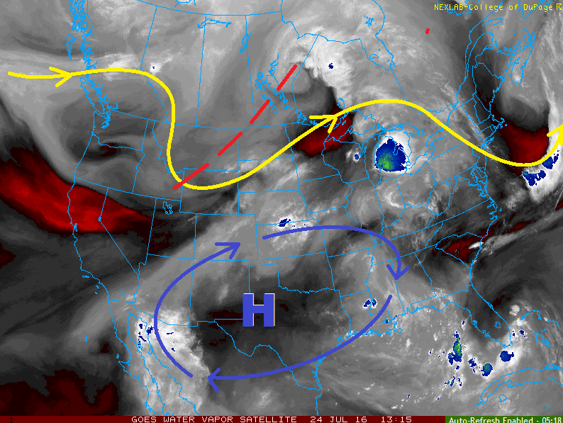
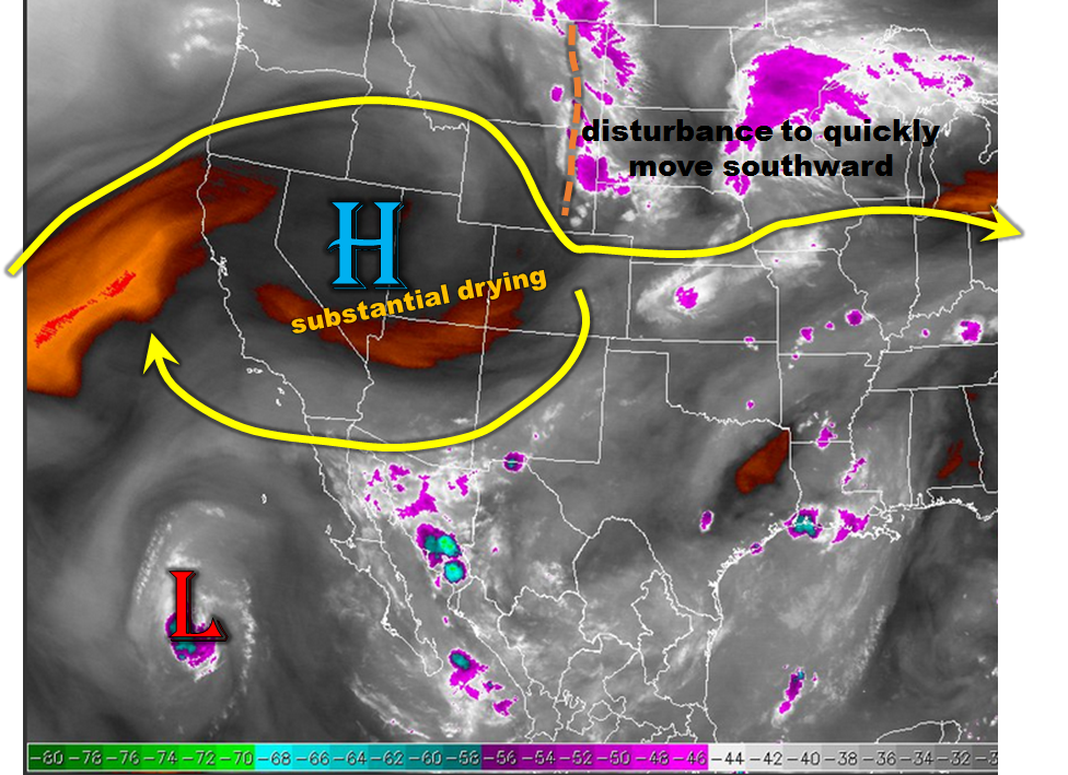
An interesting weather pattern is noted this morning across the Rocky Mountain states, as shown by the water vapor image below. The first feature of interest is the high pressure that has developed over the Great Basin. This will quickly strengthen today, and its clockwise circulation will basically shut off the northward transport of new moisture from the south (including the outflow from Tropical Storm Frank). The result will be much lower rain coverage and intensity west of the Divide. The second important feature is a rather strong disturbance, especially by summer standards, that is currently located over Wyoming and Montana. This will race south-southeastward and clip eastern areas of our state, providing favorable dynamics for enhanced upward motion. Scattered thunderstorms will be likely for far eastern areas. Counteracting this will be the rapid drying as downslope winds usher in much lower dewpoints originating off the Cheyenne ridge and then spreading south and east. The disturbance will also promote fast storm motion, up to 40 mph, which will be a negative factor for heavy rainfall in a given location.
The highest low-level moisture will be locked up mainly along the Kansas border, which is where the highest rainfall rates will occur today. However, we expect rainfall to stay just below flood thresholds. Thus, flooding is not expected today.
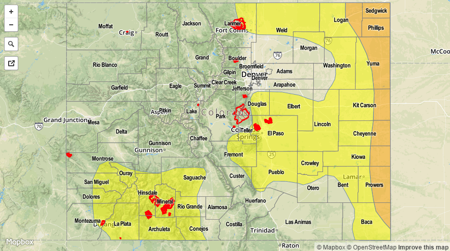
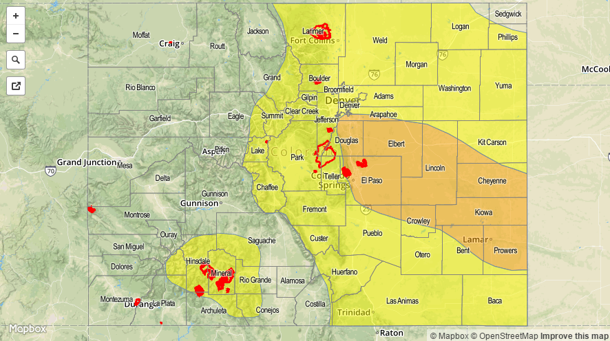
Today’s Flood Threat Map
For more information on today’s flood threat, see the map below (hover over threat areas for more details). For Zone-Specific forecasts, scroll below the map.

Zone-Specific Forecasts:
Northeast Plains, Southeast Plains:
Sunny early then partly cloudy with scattered thunderstorms developing shortly after 1PM in northern areas, then spreading south and eastward. Max 1-hr rain rates up to 1.5 inches are possible. Large hail, up to 2.25 inches and gusty winds up to 65 mph will be possible with the strongest storm cells. Most activity will quickly diminish shortly after sunset, but isolated storms will be possible into the late evening hours. Max rain rates are expected to stay just below flood thresholds, so flooding is not expected today.
Primetime: 2pm to 8:30pm for most areas, through 11pm for far eastern areas
Front Range, Urban Corridor, Palmer Ridge, Raton Ridge, Southeast Mountains:
Sunny early then turning partly cloudy and hot. An isolated storm or shower is possible, especially for eastern areas. Max 1-hour rain rates up to 0.7 inches are possible. Gusty winds up to 55mph could accompany the strongest storm. Flooding is not expected today.
Primetime: 2PM to 7PM
Northern Mountains, Grand Valley, Northwest Slope, Southwest Slope, Central Mountains, San Juan Mountains, San Luis Valley:
Sunny early then turning partly cloudy and very warm with an isolated shower or storm possible, mainly over the higher terrain. Max 1-hour rain rates up to 0.4 inches are possible. Flooding is not expected today.
Primetime: Noon to 7pm